
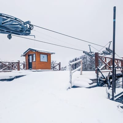
Pre-2025-Season Snowfall in Southern Hemisphere
Ski areas on three continents across the southern hemisphere have been reporting fresh snowfall ahead of the 2025 season, which is now only a month away.
Please sign in with your Snow-Forecast account details below.

Craigieburn Weather (Next 3 days): The snow forecast for Craigieburn is: Heavy rain (total 21.0mm) on Tue night. Becoming colder with heavy fall of snow, heaviest during Wed night. Freeze-thaw conditions (max 7°C on Tue night, min -2°C on Wed night). Winds increasing (calm on Tue night, fresh winds from the S by Thu morning).
Craigieburn Weather (Days 4-6): Mostly dry. Freeze-thaw conditions (max 7°C on Mon morning, min -2°C on Fri night). Wind will be generally light.
| Resort | Snow Depth | Temp. (°C) | Wind (km/h) | Weather | ||
|---|---|---|---|---|---|---|
| Top Lift: | 3 | |||||
| Middle Lift: | 4 | |||||
| Bottom Lift: | 5 |
Latest snow reports near Craigieburn:

Wednesday 30 | Thursday 1 | Friday 2 | Saturday 3 | Sunday 4 | Monday 5 | ||||||||||||||
night | AM | PM | night | AM | PM | night | AM | PM | night | AM | PM | night | AM | PM | night | AM | PM | night | |
heavy rain | light snow | mod. snow | heavy snow | mod. snow | mod. snow | light snow | cloudy | cloudy | clear | some clouds | clear | some clouds | clear | clear | clear | clear | clear | clear | |
km/h | |||||||||||||||||||
Snow map |  |  |  |  |  |  |  | ||||||||||||
— | 5 | 7 | 21 | 8 | 6 | 2.0 | — | — | — | — | — | — | — | — | — | — | — | — | |
21 | — | — | — | — | — | — | — | — | — | — | — | — | — | — | — | — | — | — | |
max°C | 7 | 2 | 1 | -2 | -2 | -2 | -2 | -1 | 0 | 0 | 3 | 2 | 1 | 4 | 4 | 4 | 7 | 7 | 5 |
min°C | 4 | 1 | 0 | -2 | -2 | -2 | -2 | -2 | -1 | -2 | 2 | 1 | 1 | 2 | 4 | 4 | 6 | 5 | 5 |
0 | -4 | -6 | -8 | -9 | -9 | -8 | -7 | -4 | -2 | 1 | -2 | -2 | 2 | 3 | 3 | 6 | 5 | 5 | |
93 | 99 | 100 | 99 | 98 | 98 | 99 | 96 | 92 | 32 | 23 | 41 | 78 | 70 | 63 | 45 | 39 | 41 | 34 | |
2900 | 2000 | 1600 | 1100 | 1100 | 1100 | 1150 | 1200 | 1350 | 2500 | 2500 | 2300 | 2350 | 2750 | 2950 | 3200 | 3400 | 3500 | 3500 | |
— | 7:20 | — | — | 7:22 | — | — | 7:22 | — | — | 7:24 | — | — | 7:26 | — | — | 7:26 | — | — | |
— | — | 5:37 | — | — | 5:37 | — | — | 5:36 | — | — | 5:34 | — | — | 5:32 | — | — | 5:31 | — | |
Heavy rain (total 21.0mm) on Tue night. Becoming colder with heavy fall of snow, heaviest during Wed night. Freeze-thaw conditions (max 7°C on Tue night, min -2°C on Wed night). Winds increasing (calm on Tue night, fresh winds from the S by Thu morning).
Mostly dry. Freeze-thaw conditions (max 7°C on Mon morning, min -2°C on Fri night). Wind will be generally light.
Latest snow reports near Craigieburn:
| Top snow depth: | — |
|---|---|
| Bottom snow depth: | — |
| Fresh snowfall depth: | — |
| Last snowfall: | 23 Apr 2025 |
| Snow Alerts | Create Alert |
0.0 | Bluebird Powder days Fresh snow, mostly sunny, light wind. |
|---|---|
0.1 | Powder days Fresh snow, limited sun, any wind. |
0.0 | Bluebird days Average snow, mostly sunny, light wind. |
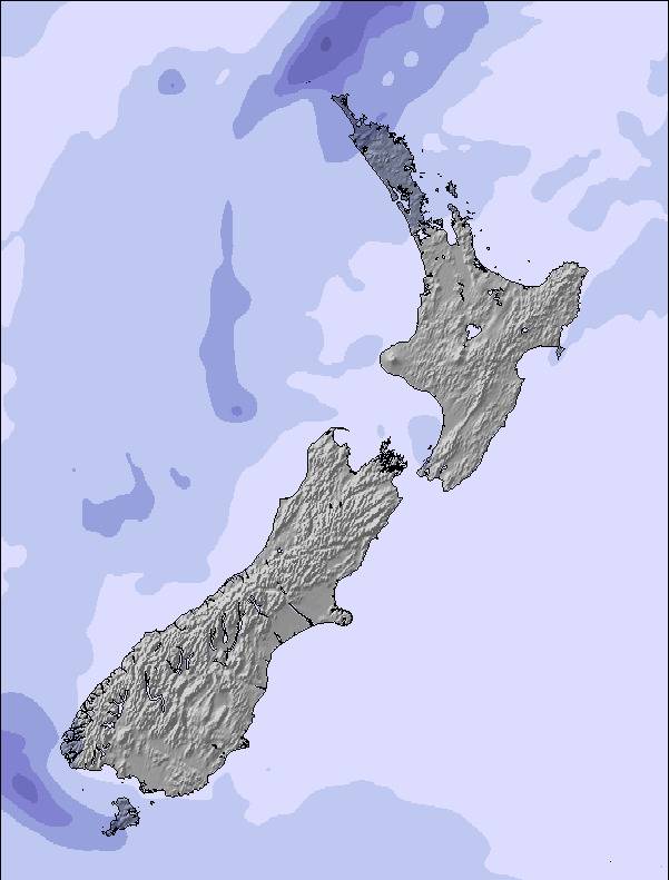
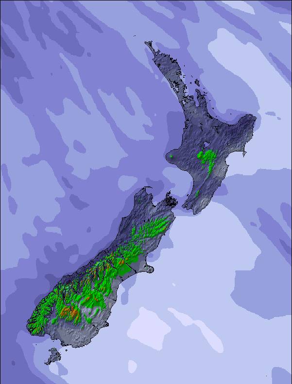
The above table gives the weather forecast for Craigieburn at the specific elevation of 1422 m. Our sophisticated weather models allow us to provide snow forecasts for the top, middle and bottom ski stations of Craigieburn. To access the weather forecasts for the other elevations, use the tab navigation above the table. For a wider view of the weather, check out the Weather Map of New Zealand.
Click here to read further information on freezing levels and how we forecast our temperatures.
Overall 3.2 Based on 8 votes and 3 reviews
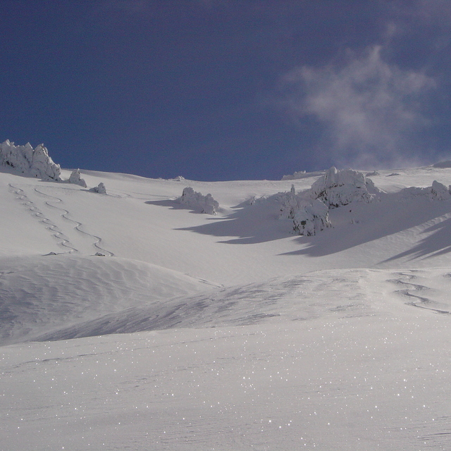
Please, if you cannot ski, if you cannot ride, if you hate powder, if you hate it steep & if you love 4+ star hotels - DO NOT COME TO THIS RESORT. Craigieburn is, to put it in simple terms, bloody 'AMAZING'. Known to the locals as steep, deep and cheap it certaintly lives up to the reputation. In 2002 I took 16 good buddies over there for the ski trip of our lives and to film a documentary. On the 2nd night it snowed 40cm's of superb light snow and we had the whole mountain (1,000's upon 1,000's or acres inbounds and easy access BC) to ourselves. Ok well maybe not entirely,we had to let the 8 staff members cut a few lines too! The peaks of the southern alps are insane! The lines you can find gnarly. Chutes (some over 55 degrees), bowls, ridges, cornices...BIG MOUNTAIN. Infact 95% of the inbound terrain is located in an avalanche start zone, path or run out. Lot's of control? Bombs go off pretty much every morning after it pukes fluff. Rustic? Yes. Accomodation is generally bunkroom style with communal bathrooms (private ensuite rooms are available but in limited supply)and a communal eating area. BUT, CV is the only NZ resort where you can walk to the ski lifts, and that takes about 4 minutes. For around 60 bucks NZ you can get fed three huge meals a day, lift tickets, lessons and accom. Oh, and there is a kick ass cosy bar upstairs in the main lodge. Last year was the completion of the panoramic day lodge located at 7000ft on a razor sharp ridgeline offering a superb place for lunch, views and kicking back on the terrace surrounded by stunning peaks with a beer. SENSATIONAL. No doubt in my mind. The best resort in the world...a place made by riders, for riders.
Ajburn from Australia writes:
Please, if you cannot ski, if you cannot ride, if you hate powder, if you hate it steep & if you love 4+ star hotels - DO NOT COME TO THIS RESORT.
Craigieburn is, to put it in simple terms, bloody 'AMAZING'. Known to the locals as steep, deep and cheap it certaintly lives up to the reputation.
In 2002 I took 16 good buddies over there for the ski trip of our lives and to film a documentary. On the 2nd night it snowed 40cm's of superb light snow and we had the whole mountain (1,000's upon 1,000's or acres inbounds and easy access BC) to ourselves. Ok well maybe not entirely,we had to let the 8 staff members cut a few lines too!
The peaks of the southern alps are insane! The lines you can find gnarly. Chutes (some over 55 degrees), bowls, ridges, cornices...BIG MOUNTAIN. Infact 95% of the inbound terrain is located in an avalanche start zone, path or run out. Lot's of control? Bombs go off pretty much every morning after it pukes fluff.
Rustic? Yes. Accomodation is generally bunkroom style with communal bathrooms (private ensuite rooms are available but in limited supply)and a communal eating area. BUT, CV is the only NZ resort where you can walk to the ski lifts, and that takes about 4 minutes.
For around 60 bucks NZ you can get fed three huge meals a day, lift tickets, lessons and accom. Oh, and there is a kick ass cosy bar upstairs in the main lodge.
Last year was the completion of the panoramic day lodge located at 7000ft on a razor sharp ridgeline offering a superb place for lunch, views and kicking back on the terrace surrounded by stunning peaks with a beer. SENSATIONAL.
No doubt in my mind. The best resort in the world...a place made by riders, for riders.
The Craigieburn skiing weather widget is available to embed on external websites free of charge. It provides a daily summary of our Craigieburn snow forecast and current weather conditions. Simply go to the feed configuration page and follow the 3 simple steps to grab the custom html code snippet and paste it into your own site. You can choose the snow forecast elevation (summit, mid-mountain or bottom lift) and metric/imperial units for the snow forecast feed to suit your own website…. Click here to get the code.
View detailed snow forecast for Craigieburn at:
snow-forecast.com

 Nearest