


North America Weekly Snow Roundup #311
Weekly Snow News for North America, updated 23 April 2026: Late-season snowfall of up to 50cm (20") hits western resorts as spring warmth accelerates thaw elsewhere.

Next 4 days weather summary:A moderate fall of snow, heaviest on Sun afternoon. Temperatures will be below freezing (max -2°C on Mon afternoon, min -12°C on Fri night). Winds decreasing (fresh winds from the NNW on Fri night, calm by Sun morning). | Days 5-7 weather summary:A dusting of new snow. Freeze-thaw conditions (max 6°C on Thu afternoon, min -5°C on Mon night). Wind will be generally light. | |||||||||||||||
Saturday 25 | Sunday 26 | Monday 27 | Tuesday 28 | Wednesday 29 | ||||||||||||
night | AM | PM | night | AM | PM | night | AM | PM | night | AM | PM | night | AM | PM | night | |
light snow | light snow | light snow | light snow | light snow | light snow | snow shwrs | light snow | light snow | snow shwrs | light snow | snow shwrs | snow shwrs | snow shwrs | light snow | snow shwrs | |
km/h | ||||||||||||||||
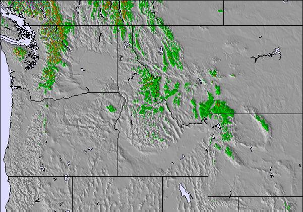
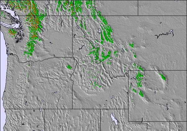
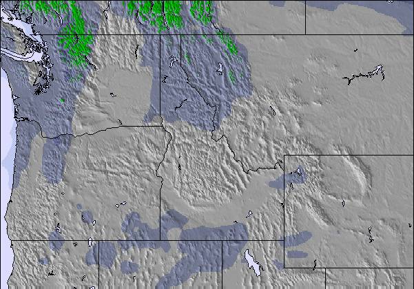
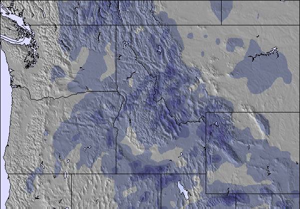
Snow map | 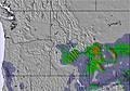 | 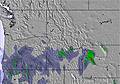 | 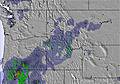 | 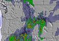 | 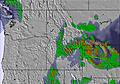 |  | ||||||||||
4 | — | 1 | 1 | 2 | 3 | — | — | 1 | — | 1 | 1 | — | — | 2 | — | |
— | — | — | — | — | — | — | — | — | — | — | — | — | — | — | — | |
max °C | -11 | -9 | -5 | -7 | -8 | -6 | -8 | -5 | -2 | -4 | -2 | 0 | -2 | 0 | 1 | -1 |
min °C | -12 | -11 | -7 | -9 | -8 | -7 | -10 | -6 | -3 | -5 | -3 | -1 | -3 | -1 | 1 | -3 |
-23 | -19 | -12 | -12 | -11 | -12 | -15 | -10 | -6 | -11 | -8 | -6 | -6 | -1 | -1 | -3 | |
94 | 85 | 81 | 92 | 93 | 93 | 88 | 77 | 90 | 81 | 81 | 88 | 90 | 72 | 79 | 88 | |
500 | 750 | 1450 | 850 | 1000 | 1450 | 300 | 1300 | 1850 | 1250 | 1950 | 2150 | 1600 | 2200 | 2400 | 1850 | |
— | 6:18 | — | — | 6:16 | — | — | 6:13 | — | — | 6:11 | — | — | 6:11 | — | — | |
— | — | 8:23 | — | — | 8:25 | — | — | 8:27 | — | — | 8:28 | — | — | 8:30 | — | |
Latest snow reports near Showdown Ski Area:
| Top snow depth: | — |
|---|---|
| Bottom snow depth: | — |
| Fresh snowfall depth: | 35 cm |
| Last snowfall: | 23 Apr 2026 |
| Snow Alerts | Create Alert |
0.6 | Bluebird Powder days Fresh snow, mostly sunny, light wind. |
|---|---|
2.0 | Powder days Fresh snow, limited sun, any wind. |
0.2 | Bluebird days Average snow, mostly sunny, light wind. |

The above table gives the weather forecast for Showdown Ski Area at the specific elevation of 2286 m. Our sophisticated weather models allow us to provide snow forecasts for the top, middle and bottom ski stations of Showdown Ski Area. To access the weather forecasts for the other elevations, use the tab navigation above the table. For a wider view of the weather, check out the Weather Map of United States.
Click here to read further information on freezing levels and how we forecast our temperatures.

 Nearest