

French Ski Areas Announce 2025 Summer Ski Plans
Three French ski areas have announced their opening plans in May, June and July after the winter season ends on May 4th.
Please sign in with your Snow-Forecast account details below.
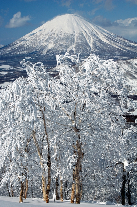

Rusutsu Resort Weather (Next 3 days): The snow forecast for Rusutsu Resort is: A moderate fall of snow, heaviest on Mon morning. Turning milder with heavy rain (total 39.0mm), heaviest during Mon afternoon. Freeze-thaw conditions (max 5°C on Sun morning, min 0°C on Tue night). Winds decreasing (gales from the SE on Sun night, calm by Tue night).
Rusutsu Resort Weather (Days 4-6): A dusting of new snow. Freeze-thaw conditions (max 8°C on Fri afternoon, min -1°C on Wed morning). Winds decreasing (strong winds from the W on Wed afternoon, calm by Fri afternoon).
| Resort | Snow Depth | Temp. (°C) | Wind (km/h) | Weather | ||
|---|---|---|---|---|---|---|
| Top Lift: | 0.0 m | 4 | ||||
| Bottom Lift: | 0.0 m | 6 |
Latest snow reports near Rusutsu Resort:
Rain and snow or hail reported from Kutchan at 179 metres elevation 6 kms NE of Niseko Grand Hirafu but it is probably falling as rain apart from near the top of the ski area from Niseko Grand Hirafu

Sunday 13 | Monday 14 | Tuesday 15 | Wednesday 16 | Thursday 17 | Friday 18 | Saturday 19 | |||||||||||||||
AM | PM | night | AM | PM | night | AM | PM | night | AM | PM | night | AM | PM | night | AM | PM | night | AM | PM | night | |
light rain | cloudy | light snow | mod. snow | heavy rain | mod. rain | cloudy | light rain | light snow | light snow | light snow | cloudy | snow shwrs | some clouds | clear | clear | some clouds | some clouds | cloudy | cloudy | light rain | |
km/h | |||||||||||||||||||||
Snow map | 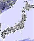 | 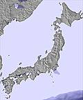 | 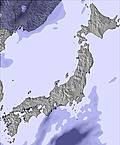 | 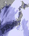 | 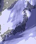 | 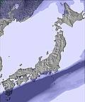 | 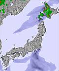 | ||||||||||||||
— | — | 3 | 6 | — | — | — | — | 4 | 2.0 | — | — | — | — | — | — | — | — | — | — | — | |
2.0 | — | — | — | 27 | 6 | — | 4 | — | — | — | — | — | — | — | — | — | — | — | — | 2.0 | |
max°C | 5 | 4 | 3 | 2 | 2 | 3 | 5 | 2 | 2 | 0 | -1 | 0 | 1 | 2 | 4 | 7 | 8 | 7 | 9 | 8 | 8 |
min°C | 4 | 3 | 1 | 2 | 2 | 2 | 5 | 2 | 0 | -1 | -1 | -1 | 0 | 1 | 2 | 5 | 7 | 6 | 7 | 8 | 8 |
-4 | -5 | -7 | -6 | -6 | -4 | 2 | -3 | -6 | -8 | -9 | -9 | -7 | -5 | -4 | 2 | 6 | 3 | 4 | 4 | 4 | |
97 | 95 | 94 | 97 | 98 | 99 | 67 | 96 | 99 | 98 | 95 | 80 | 93 | 78 | 72 | 67 | 69 | 71 | 88 | 96 | 99 | |
2100 | 1850 | 1300 | 1300 | 1350 | 1500 | 1850 | 1350 | 1200 | 800 | 900 | 950 | 1000 | 1200 | 1850 | 2300 | 2600 | 2650 | 2750 | 2800 | 2700 | |
4:58 | — | — | 4:56 | — | — | 4:56 | — | — | 4:54 | — | — | 4:52 | — | — | 4:50 | — | — | 4:48 | — | — | |
— | 6:15 | — | — | 6:15 | — | — | 6:16 | — | — | 6:17 | — | — | 6:19 | — | — | 6:21 | — | — | 6:22 | — | |
A moderate fall of snow, heaviest on Mon morning. Turning milder with heavy rain (total 39.0mm), heaviest during Mon afternoon. Freeze-thaw conditions (max 5°C on Sun morning, min 0°C on Tue night). Winds decreasing (gales from the SE on Sun night, calm by Tue night).
A dusting of new snow. Freeze-thaw conditions (max 8°C on Fri afternoon, min -1°C on Wed morning). Winds decreasing (strong winds from the W on Wed afternoon, calm by Fri afternoon).
Latest snow reports near Rusutsu Resort:
Rain and snow or hail reported from Kutchan at 179 metres elevation 6 kms NE of Niseko Grand Hirafu but it is probably falling as rain apart from near the top of the ski area from Niseko Grand Hirafu
| Top snow depth: | 0 cm |
|---|---|
| Bottom snow depth: | 0 cm |
| Fresh snowfall depth: | — |
| Last snowfall: | 3 Apr 2025 |
| Snow Alerts | Create Alert |
0.4 | Bluebird Powder days Fresh snow, mostly sunny, light wind. |
|---|---|
0.4 | Powder days Fresh snow, limited sun, any wind. |
1.7 | Bluebird days Average snow, mostly sunny, light wind. |
The above table gives the weather forecast for Rusutsu Resort at the specific elevation of 994 m. Our sophisticated weather models allow us to provide snow forecasts for the top, middle and bottom ski stations of Rusutsu Resort. To access the weather forecasts for the other elevations, use the tab navigation above the table. For a wider view of the weather, check out the Weather Map of Japan.
Click here to read further information on freezing levels and how we forecast our temperatures.
Overall 3.8 Based on 13 votes and 12 reviews
Rusutsu used to offer a great family ski environment with no apres. Over the years it has increasingly gotten busier with bus loads of rude Europeans and ugly Australians doing day trips from Niseko which was really noticeable in 2014. Where once you could get fresh tracks lasting days it is now tracked within 1/2 day. For those chasing a quieter resort their are better options. In comparison to other international resorts it still can offer an excellent trip. Everyone just needs to relax a little and take a leaf from the locals and have some respect for others.
Rueben from Australia writes:
Rusutsu used to offer a great family ski environment with no apres. Over the years it has increasingly gotten busier with bus loads of rude Europeans and ugly Australians doing day trips from Niseko which was really noticeable in 2014. Where once you could get fresh tracks lasting days it is now tracked within 1/2 day.
For those chasing a quieter resort their are better options.
In comparison to other international resorts it still can offer an excellent trip. Everyone just needs to relax a little and take a leaf from the locals and have some respect for others.
The Rusutsu Resort skiing weather widget is available to embed on external websites free of charge. It provides a daily summary of our Rusutsu Resort snow forecast and current weather conditions. Simply go to the feed configuration page and follow the 3 simple steps to grab the custom html code snippet and paste it into your own site. You can choose the snow forecast elevation (summit, mid-mountain or bottom lift) and metric/imperial units for the snow forecast feed to suit your own website…. Click here to get the code.
View detailed snow forecast for Rusutsu Resort at:
snow-forecast.com


 Nearest