The snow forecast for Peisey/Vallandry is: Moderate rain (total 11.0mm), heaviest on Sat night. Very mild (max 13°C on Sat afternoon, min 2°C on Thu morning). Wind will be generally light.
Peisey/Vallandry Weather (Next 3 days): The snow forecast for Peisey/Vallandry is: Moderate rain (total 11.0mm), heaviest on Sat night. Very mild (max 13°C on Sat afternoon, min 2°C on Thu morning). Wind will be generally light.
Peisey/Vallandry Weather (Days 4-6): Moderate rain (total 13.0mm), heaviest on Sun afternoon. Very mild (max 16°C on Tue afternoon, min 4°C on Sun night). Wind will be generally light.
Peisey/Vallandry Live Weather
Resort
Snow Depth
Temp. (°C)
Wind (km/h)
Weather
Top Lift:
-2
Middle Lift:
1
Bottom Lift:
4
Powered by Snow-Forecast.com
Peisey/Vallandry Weather
(Next 3 days):
The snow forecast for Peisey/Vallandry is: Moderate rain (total 11.0mm), heaviest on Sat night. Very mild (max 13°C on Sat afternoon, min 2°C on Thu morning). Wind will be generally light.
Peisey/Vallandry Weather (Days 4-6):
Moderate rain (total 13.0mm), heaviest on Sun afternoon. Very mild (max 16°C on Tue afternoon, min 4°C on Sun night). Wind will be generally light.
The above table gives the weather forecast for Peisey/Vallandry at the specific elevation of 1301 m. Our sophisticated weather models allow us to provide snow forecasts for the top, middle and bottom ski stations of Peisey/Vallandry. To access the weather forecasts for the other elevations, use the tab navigation above the table. For a wider view of the weather, check out the Weather Map of France.
Click here to read further information on freezing levels and how we forecast our temperatures.
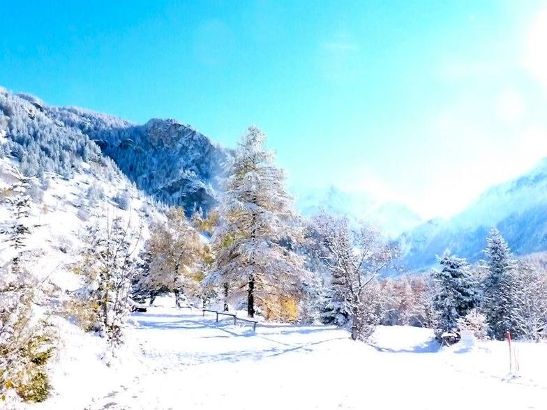
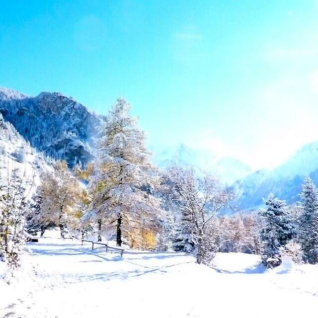
We just checked at ll'Oree ges Cimes in Vallandry for our second ski week of the year here and the third in two years. This is the place to stay if you're very serious about your skiing but have kids and have to keep them occupied so you can engage in some serious skiing. Peisey-Vallandry is basically part of the massive Les Arcs complex. Last time here, I even made it from 1600 m base, at Vallandry, to the highest part of Les Arcs (at 3200 m) and back in two hours (having to pick my toddler up from the garderie). The Garderie, "Tom Pouce", is fabulous. That and a super ESF school and great learning terrain for our seven year old makes the great skiing possible. And the skiing is great not only at Les Arcs, but also at Peisey- Vallandry itself, with long high speed lifts and super fall line skiing. In fact, my favorite lift in the whole greater complex is The Derby in Peisy-Vallandry, which is half above the tree line and half in the trees.
We just checked at ll'Oree ges Cimes in Vallandry for our second ski week of the year here and the third in two years. This is the place to stay if you're very serious about your skiing but have kids and have to keep them occupied so you can engage in some serious skiing. Peisey-Vallandry is basically part of the massive Les Arcs complex. Last time here, I even made it from 1600 m base, at Vallandry, to the highest part of Les Arcs (at 3200 m) and back in two hours (having to pick my toddler up from the garderie). The Garderie, "Tom Pouce", is fabulous. That and a super ESF school and great learning terrain for our seven year old makes the great skiing possible. And the skiing is great not only at Les Arcs, but also at Peisey- Vallandry itself, with long high speed lifts and super fall line skiing. In fact, my favorite lift in the whole greater complex is The Derby in Peisy-Vallandry, which is half above the tree line and half in the trees.
Free Snow-Forecast.com weather widget for your website
The Peisey/Vallandry skiing weather widget is available to embed on external websites free of charge. It provides a daily summary of our Peisey/Vallandry snow forecast and current weather conditions. Simply go to the feed configuration page and follow the 3 simple steps to grab the custom html code snippet and paste it into your own site. You can choose the snow forecast elevation (summit, mid-mountain or bottom lift) and metric/imperial units for the snow forecast feed to suit your own website…. Click here to get the code.


 Nearest