

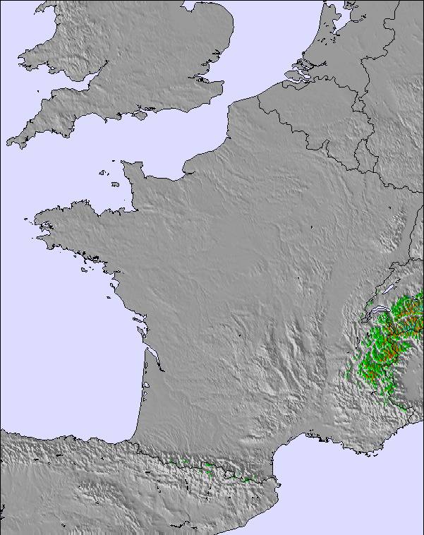
Snowstorm Hits Pyrenees as Spring Weather Arrives in Europe
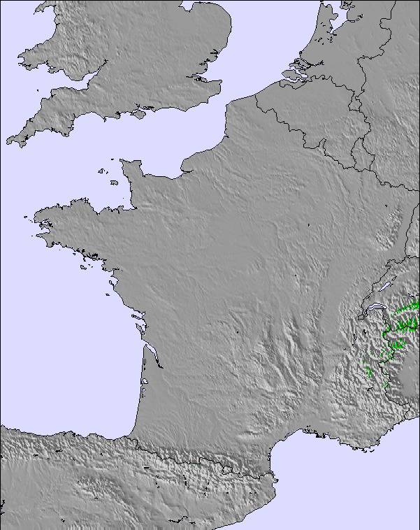
Updated March 5, 2025: Spring sunshine dominates across Europe, but heavy snow is expected in the Pyrenees. Will the Alps catch up with more snow?
Please sign in with your Snow-Forecast account details below.
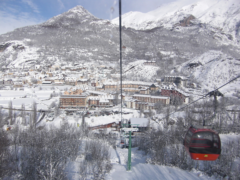

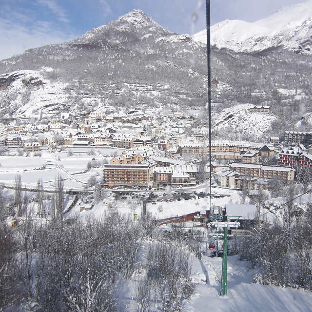
Panticosa Weather (Next 3 days): The snow forecast for Panticosa is: A heavy fall of snow, heaviest during Sat night. Temperatures will be below freezing (max 0°C on Thu afternoon, min -4°C on Sat night). Winds increasing (light winds from the SSE on Thu night, strong winds from the SSE by Sat night).
Panticosa Weather (Days 4-6): A light covering of new snow, mostly falling on Sun night. Temperatures will be below freezing (max -2°C on Mon morning, min -5°C on Mon night). Winds decreasing (fresh winds from the SSW on Sun afternoon, calm by Tue night).
| Resort | Snow Depth | Temp. (°C) | Wind (km/h) | Weather | ||
|---|---|---|---|---|---|---|
| Top Lift: | -1 | |||||
| Middle Lift: | 2 | |||||
| Bottom Lift: | 4 |
Latest snow reports near Panticosa:
Cloudless skies over Formigal. Calm. Cold. A dusting of new snow. from Formigal
Fantastic skiing on piste. Clear blue skies, all lifts open. from Grand Tourmalet-Bareges/La Mongie
It is snowing heavily in Astún. from Astún

Thursday 6 | Friday 7 | Saturday 8 | Sunday 9 | Monday 10 | Tuesday 11 | Wednesday 12 | |||||||||||||||
AM | PM | night | AM | PM | night | AM | PM | night | AM | PM | night | AM | PM | night | AM | PM | night | AM | PM | night | |
light snow | cloudy | light snow | some clouds | some clouds | light snow | light snow | heavy snow | heavy snow | snow shwrs | light snow | light snow | light snow | light snow | light snow | snow shwrs | snow shwrs | some clouds | light snow | light snow | light snow | |
km/h | |||||||||||||||||||||
Snow map |  |  |  |  |  |  |  | ||||||||||||||
— | — | — | — | — | 4 | 1.0 | 12 | 40 | 2.0 | 1.0 | 4 | — | 1.0 | 1.0 | — | — | — | — | — | — | |
— | — | — | — | — | — | — | — | — | — | — | — | — | — | — | — | — | — | — | — | — | |
max°C | -1 | 0 | -1 | 0 | 0 | 0 | 0 | 0 | 0 | -3 | -3 | -3 | -2 | -2 | -4 | -3 | -2 | -4 | -3 | -2 | -3 |
min°C | -1 | -1 | -1 | -1 | 0 | -1 | 0 | -1 | -4 | -4 | -3 | -3 | -3 | -3 | -5 | -3 | -3 | -4 | -3 | -3 | -5 |
-6 | -6 | -6 | -5 | -5 | -7 | -7 | -8 | -10 | -10 | -10 | -10 | -8 | -8 | -7 | -6 | -6 | -7 | -5 | -3 | -5 | |
94 | 78 | 90 | 92 | 82 | 98 | 96 | 98 | 98 | 61 | 98 | 99 | 87 | 98 | 86 | 81 | 83 | 85 | 87 | 89 | 91 | |
2050 | 2250 | 2000 | 2100 | 2300 | 2150 | 2200 | 2200 | 1850 | 1500 | 1700 | 1700 | 1800 | 1850 | 1500 | 1700 | 1850 | 1250 | 1750 | 1900 | 1550 | |
7:28 | — | — | 7:26 | — | — | 7:24 | — | — | 7:24 | — | — | 7:22 | — | — | 7:20 | — | — | 7:18 | — | — | |
— | 6:55 | — | — | 6:57 | — | — | 6:58 | — | — | 6:59 | — | — | 7:00 | — | — | 7:01 | — | — | 7:02 | — | |
A heavy fall of snow, heaviest during Sat night. Temperatures will be below freezing (max 0°C on Thu afternoon, min -4°C on Sat night). Winds increasing (light winds from the SSE on Thu night, strong winds from the SSE by Sat night).
A light covering of new snow, mostly falling on Sun night. Temperatures will be below freezing (max -2°C on Mon morning, min -5°C on Mon night). Winds decreasing (fresh winds from the SSW on Sun afternoon, calm by Tue night).
Latest snow reports near Panticosa:
Cloudless skies over Formigal. Calm. Cold. A dusting of new snow. from Formigal
Fantastic skiing on piste. Clear blue skies, all lifts open. from Grand Tourmalet-Bareges/La Mongie
It is snowing heavily in Astún. from Astún
| Top snow depth: | — |
|---|---|
| Bottom snow depth: | — |
| Fresh snowfall depth: | — |
| Last snowfall: | 3 Mar 2025 |
| Snow Alerts | Create Alert |
0.6 | Bluebird Powder days Fresh snow, mostly sunny, light wind. |
|---|---|
1.6 | Powder days Fresh snow, limited sun, any wind. |
0.6 | Bluebird days Average snow, mostly sunny, light wind. |
The above table gives the weather forecast for Panticosa at the specific elevation of 2221 m. Our sophisticated weather models allow us to provide snow forecasts for the top, middle and bottom ski stations of Panticosa. To access the weather forecasts for the other elevations, use the tab navigation above the table. For a wider view of the weather, check out the Weather Map of Spain.
Click here to read further information on freezing levels and how we forecast our temperatures.
Overall 3.8 Based on 34 votes and 5 reviews
Una estación pequeña pero completa,con maravillosos freeride y poco trafico en pistas.Diversidad de hoteles teniendo en cuenta la dimensión del pueblo,restaurantes familiares excelentes y entorno inmejorable.Se merece más de una visita.
Daniel from Spain writes:
Una estación pequeña pero completa,con maravillosos freeride y poco trafico en pistas.Diversidad de hoteles teniendo en cuenta la dimensión del pueblo,restaurantes familiares excelentes y entorno inmejorable.Se merece más de una visita.
The Panticosa skiing weather widget is available to embed on external websites free of charge. It provides a daily summary of our Panticosa snow forecast and current weather conditions. Simply go to the feed configuration page and follow the 3 simple steps to grab the custom html code snippet and paste it into your own site. You can choose the snow forecast elevation (summit, mid-mountain or bottom lift) and metric/imperial units for the snow forecast feed to suit your own website…. Click here to get the code.
View detailed snow forecast for Panticosa at:
snow-forecast.com


 Nearest