

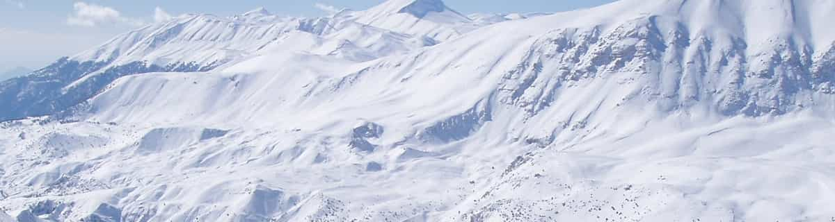
Massive Snowfall in the Alps
A huge snowfall is underway in the Alps, by far the biggest of the 24-25 season.
Please sign in with your Snow-Forecast account details below.


Notre Dame de Bellecombe Weather (Next 3 days): The snow forecast for Notre Dame de Bellecombe is: Moderate rain (total 12.0mm), heaviest on Sun afternoon. Freeze-thaw conditions (max 6°C on Sat afternoon, min -1°C on Fri morning). Wind will be generally light.
Notre Dame de Bellecombe Weather (Days 4-6): Moderate rain (total 11.0mm), heaviest on Mon morning. Mild temperatures (max 6°C on Mon afternoon, min 2°C on Mon morning). Wind will be generally light.
| Resort | Snow Depth | Temp. (°C) | Wind (km/h) | Weather | ||
|---|---|---|---|---|---|---|
| Top Lift: | -3 | |||||
| Middle Lift: | -1 | |||||
| Bottom Lift: | 1 |
Latest snow reports near Notre Dame de Bellecombe:
Light rain reported from Haute-Savoie Mont Blanc Airport/Aéroport Annecy/Meythet at 711 metres elevation only 3 kms WNW of Annecy-LeSemnoz but it is forecast cold enough for snow at the ski area from Annecy-LeSemnoz
Drizzle reported from Chambéry Aix-les-Bains Airport at 235 metres elevation 9 kms SW of Savoie Grand Revard but it is forecast cold enough for snow at the ski area from Savoie Grand Revard
Snow is falling at La Thuile. from La Thuile
Snowing at a moderate rate at La Rosière. from La Rosière
Resort is closed for the season. Heavy snow just keeps on falling. from La Giettaz en Aravis

Friday 18 | Saturday 19 | Sunday 20 | Monday 21 | Tuesday 22 | Wednesday 23 | Thursday 24 | |||||||||||||||
AM | PM | night | AM | PM | night | AM | PM | night | AM | PM | night | AM | PM | night | AM | PM | night | AM | PM | night | |
snow shwrs | some clouds | some clouds | some clouds | some clouds | some clouds | rain shwrs | light rain | light rain | rain shwrs | light rain | rain shwrs | light rain | light rain | rain shwrs | cloudy | cloudy | some clouds | cloudy | light rain | light snow | |
km/h | |||||||||||||||||||||
Snow map |  |  |  |  |  |  |  | ||||||||||||||
— | — | — | — | — | — | — | — | — | — | — | — | — | — | — | — | — | — | — | — | 4 | |
— | — | — | — | — | — | 2.0 | 5 | 5 | 1.0 | 1.0 | 3 | 2.0 | 2.0 | 2.0 | — | — | — | — | 3 | 2.0 | |
max°C | 0 | 3 | 4 | 5 | 6 | 4 | 4 | 6 | 4 | 3 | 6 | 5 | 3 | 5 | 3 | 4 | 6 | 5 | 4 | 3 | 3 |
min°C | -1 | 2 | 3 | 3 | 6 | 3 | 3 | 5 | 2 | 2 | 5 | 3 | 3 | 4 | 2 | 2 | 6 | 3 | 3 | 3 | 1 |
-1 | 2 | 2 | 0 | 4 | 1 | 1 | 3 | 0 | 0 | 5 | 3 | 3 | 3 | 2 | 2 | 5 | 3 | 3 | 1 | -2 | |
92 | 88 | 50 | 77 | 85 | 71 | 87 | 84 | 93 | 84 | 71 | 90 | 96 | 87 | 86 | 80 | 80 | 81 | 78 | 99 | 98 | |
1650 | 2650 | 3050 | 2750 | 2800 | 2550 | 2250 | 2400 | 2050 | 2150 | 2350 | 2100 | 2050 | 2300 | 2200 | 2400 | 2500 | 2550 | 2400 | 2100 | 1950 | |
6:43 | — | — | 6:41 | — | — | 6:39 | — | — | 6:39 | — | — | 6:37 | — | — | 6:35 | — | — | 6:33 | — | — | |
— | — | 8:22 | — | — | 8:24 | — | — | 8:25 | — | — | 8:27 | — | — | 8:29 | — | — | 8:30 | — | — | 8:30 | |
Moderate rain (total 12.0mm), heaviest on Sun afternoon. Freeze-thaw conditions (max 6°C on Sat afternoon, min -1°C on Fri morning). Wind will be generally light.
Moderate rain (total 11.0mm), heaviest on Mon morning. Mild temperatures (max 6°C on Mon afternoon, min 2°C on Mon morning). Wind will be generally light.
Latest snow reports near Notre Dame de Bellecombe:
Light rain reported from Haute-Savoie Mont Blanc Airport/Aéroport Annecy/Meythet at 711 metres elevation only 3 kms WNW of Annecy-LeSemnoz but it is forecast cold enough for snow at the ski area from Annecy-LeSemnoz
Drizzle reported from Chambéry Aix-les-Bains Airport at 235 metres elevation 9 kms SW of Savoie Grand Revard but it is forecast cold enough for snow at the ski area from Savoie Grand Revard
Snow is falling at La Thuile. from La Thuile
Snowing at a moderate rate at La Rosière. from La Rosière
Resort is closed for the season. Heavy snow just keeps on falling. from La Giettaz en Aravis
| Top snow depth: | — |
|---|---|
| Bottom snow depth: | — |
| Fresh snowfall depth: | 44 cm |
| Last snowfall: | 17 Apr 2025 |
| Snow Alerts | Create Alert |
0.2 | Bluebird Powder days Fresh snow, mostly sunny, light wind. |
|---|---|
0.3 | Powder days Fresh snow, limited sun, any wind. |
0.2 | Bluebird days Average snow, mostly sunny, light wind. |
The above table gives the weather forecast for Notre Dame de Bellecombe at the specific elevation of 1611 m. Our sophisticated weather models allow us to provide snow forecasts for the top, middle and bottom ski stations of Notre Dame de Bellecombe. To access the weather forecasts for the other elevations, use the tab navigation above the table. For a wider view of the weather, check out the Weather Map of France.
Click here to read further information on freezing levels and how we forecast our temperatures.
Overall 3.8 Based on 8 votes and 8 reviews
Belle statioń Sympa pour tous niveau ,environnement superbe ,enneigement très correct Au vu de l'altitude ,remontée mécaniques veillissantes Enseignement du ski à l'ESF très bien,location de matériel parfait , Pisteurs sympa ,restau rapport qualité prix bien ,hébergement correct . Bref station à tester .
Mollier from France writes:
Belle statioń
Sympa pour tous niveau ,environnement superbe ,enneigement très correct Au vu de l'altitude ,remontée mécaniques veillissantes
Enseignement du ski à l'ESF très bien,location de matériel parfait ,
Pisteurs sympa ,restau rapport qualité prix bien ,hébergement correct .
Bref station à tester .
Read 7 more reviews of Notre Dame de Bellecombe or submit your own
The Notre Dame de Bellecombe skiing weather widget is available to embed on external websites free of charge. It provides a daily summary of our Notre Dame de Bellecombe snow forecast and current weather conditions. Simply go to the feed configuration page and follow the 3 simple steps to grab the custom html code snippet and paste it into your own site. You can choose the snow forecast elevation (summit, mid-mountain or bottom lift) and metric/imperial units for the snow forecast feed to suit your own website…. Click here to get the code.
View detailed snow forecast for Notre Dame de Bellecombe at:
snow-forecast.com


 Nearest