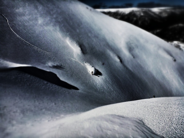


Fresh Snowfall In Australia With 2026 Season Starting This Weekend
An early-winter storm is gathering momentum in Australia ahead of the start of the 2026 ski season in the country this weekend.

Next 4 days weather summary:Mild at first with light rain (total 2.0mm) on Tue night followed by colder weather and light fall of snow, heaviest on Thu afternoon. Freeze-thaw conditions (max 3°C on Tue night, min -2°C on Wed night). Winds decreasing (strong winds from the WNW on Wed night, light winds from the SW by Fri morning). | Days 5-7 weather summary:Mostly dry. Freeze-thaw conditions (max 4°C on Mon afternoon, min 0°C on Fri night). Wind will be generally light. | |||||||||||||||
Wednesday 3 | Thursday 4 | Friday 5 | Saturday 6 | Sunday 7 | ||||||||||||
night | AM | PM | night | AM | PM | night | AM | PM | night | AM | PM | night | AM | PM | night | |
light snow | light snow | light snow | light snow | light snow | light snow | light snow | cloudy | some clouds | clear | some clouds | some clouds | clear | clear | some clouds | clear | |
km/h | ||||||||||||||||
Snow map | 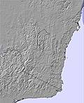 | 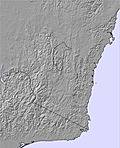 |  | 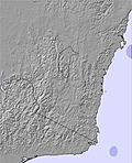 | 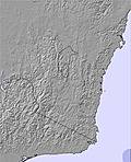 | 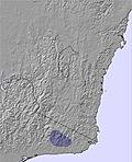 | ||||||||||
1 | 2 | 1 | 3 | 2 | 5 | 2 | — | — | — | — | — | — | — | — | — | |
2 | — | — | — | — | — | — | — | — | — | — | — | — | — | — | — | |
max °C | 3 | 1 | 0 | -1 | -2 | -1 | 0 | 0 | 0 | 3 | 3 | 3 | 3 | 3 | 3 | 3 |
min °C | 1 | 0 | -1 | -2 | -2 | -2 | 0 | -1 | 0 | 0 | 3 | 3 | 2 | 2 | 3 | 3 |
-6 | -7 | -9 | -10 | -8 | -7 | -4 | -4 | -3 | -3 | 0 | 1 | 2 | 2 | 3 | 3 | |
96 | 98 | 98 | 92 | 96 | 98 | 96 | 77 | 72 | 75 | 75 | 84 | 76 | 67 | 82 | 72 | |
2050 | 1750 | 1600 | 1350 | 1200 | 1250 | 1650 | 1400 | 1650 | 2050 | 2450 | 2450 | 2550 | 2550 | 2600 | 2550 | |
— | 7:16 | — | — | 7:16 | — | — | 7:16 | — | — | 7:18 | — | — | 7:18 | — | — | |
— | — | 5:01 | — | — | 5:01 | — | — | 5:00 | — | — | 5:00 | — | — | 5:00 | — | |
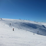
Latest snow reports near Mount Hotham:
Snow falling at Mount Hotham. from Mount Hotham
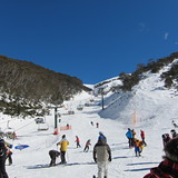
It is snowing steadily at Mount Buffalo. from Mount Buffalo
Snowing heavily in Dinner Plain. from Dinner Plain
Rain reported from MTHothamAirport at 1293 metres elevation 9 kms ESE of Dinner Plain but it is forecast cold enough for snow at the ski area from Dinner Plain
| Top snow depth: | 0 cm |
|---|---|
| Bottom snow depth: | 0 cm |
| Fresh snowfall depth: | 10 cm |
| Last snowfall: | 1 Jun 2026 |
| Snow Alerts | Create Alert |
0.1 | Bluebird Powder days Fresh snow, mostly sunny, light wind. |
|---|---|
0.4 | Powder days Fresh snow, limited sun, any wind. |
0.1 | Bluebird days Average snow, mostly sunny, light wind. |

The above table gives the weather forecast for Mount Hotham at the specific elevation of 1652 m. Our sophisticated weather models allow us to provide snow forecasts for the top, middle and bottom ski stations of Mount Hotham. To access the weather forecasts for the other elevations, use the tab navigation above the table. For a wider view of the weather, check out the Weather Map of Australia.
Click here to read further information on freezing levels and how we forecast our temperatures.
Overall 3.4 Based on 25 votes and 17 reviews
Hotham will reward if you look beyond the boundaries. Easily the pick of Vic resorts. Powder capital of Australia
Damo from Australia writes:
Hotham will reward if you look beyond the boundaries. Easily the pick of Vic resorts. Powder capital of Australia


 Nearest