

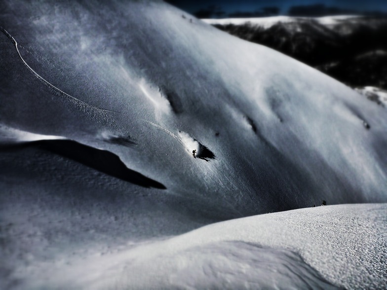
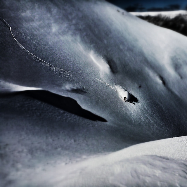
Massive Snowfall in the Alps
A huge snowfall is underway in the Alps, by far the biggest of the 24-25 season.
Please sign in with your Snow-Forecast account details below.

Mount Hotham Weather (Next 3 days): The snow forecast for Mount Hotham is: Light rain (total 5.0mm), mostly falling on Tue morning. Very mild (max 14°C on Thu morning, min 6°C on Tue morning). Winds decreasing (fresh winds from the SE on Tue afternoon, calm by Wed afternoon).
Mount Hotham Weather (Days 4-6): Moderate rain (total 12.0mm), heaviest on Sat night. Very mild (max 14°C on Fri morning, min 2°C on Sun night). Wind will be generally light.
| Resort | Snow Depth | Temp. (°C) | Wind (km/h) | Weather | ||
|---|---|---|---|---|---|---|
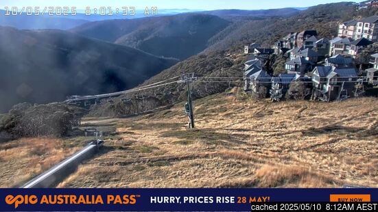
| Top Lift: | 0.0 m | 6 | ||||
| Bottom Lift: | 0.0 m | 7 |
Latest snow reports near Mount Hotham:

Tuesday 22 | Wednesday 23 | Thursday 24 | Friday 25 | Saturday 26 | Sunday 27 | Monday 28 | |||||||||||||||
AM | PM | night | AM | PM | night | AM | PM | night | AM | PM | night | AM | PM | night | AM | PM | night | AM | PM | night | |
light rain | light rain | light rain | cloudy | some clouds | clear | some clouds | clear | clear | cloudy | cloudy | light rain | light rain | light rain | light rain | some clouds | some clouds | light rain | some clouds | clear | some clouds | |
km/h | |||||||||||||||||||||
Snow map | 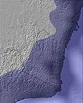 | 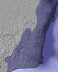 | 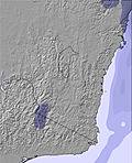 | 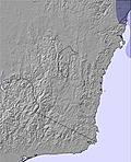 | 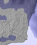 | 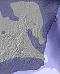 | 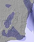 | ||||||||||||||
— | — | — | — | — | — | — | — | — | — | — | — | — | — | — | — | — | — | — | — | — | |
2.0 | 1.0 | 2.0 | — | — | — | — | — | — | — | — | 1.0 | 2.0 | 2.0 | 4 | — | — | 3 | — | — | — | |
max°C | 7 | 7 | 7 | 10 | 10 | 9 | 14 | 14 | 10 | 14 | 13 | 10 | 9 | 8 | 8 | 12 | 11 | 6 | 9 | 9 | 3 |
min°C | 6 | 7 | 6 | 9 | 8 | 8 | 12 | 10 | 8 | 12 | 10 | 7 | 9 | 8 | 5 | 7 | 7 | 2 | 3 | 4 | 1 |
1 | 3 | 2 | 7 | 8 | 6 | 11 | 8 | 4 | 10 | 8 | 5 | 8 | 8 | 5 | 7 | 5 | -1 | 2 | 4 | 1 | |
98 | 98 | 98 | 95 | 84 | 73 | 69 | 53 | 60 | 71 | 65 | 66 | 93 | 94 | 97 | 96 | 54 | 92 | 91 | 47 | 84 | |
3800 | 3600 | 3250 | 3250 | 3050 | 3150 | 3100 | 3200 | 3250 | 3300 | 3100 | 3100 | 3050 | 3000 | 2950 | 3200 | 2750 | 2350 | 2700 | 2800 | 3100 | |
6:41 | — | — | 6:43 | — | — | 6:43 | — | — | 6:45 | — | — | 6:45 | — | — | 6:46 | — | — | 6:47 | — | — | |
— | 5:37 | — | — | 5:36 | — | — | 5:34 | — | — | 5:32 | — | — | 5:31 | — | — | 5:30 | — | — | 5:30 | — | |
Light rain (total 5.0mm), mostly falling on Tue morning. Very mild (max 14°C on Thu morning, min 6°C on Tue morning). Winds decreasing (fresh winds from the SE on Tue afternoon, calm by Wed afternoon).
Moderate rain (total 12.0mm), heaviest on Sat night. Very mild (max 14°C on Fri morning, min 2°C on Sun night). Wind will be generally light.
Latest snow reports near Mount Hotham:
| Top snow depth: | 0 cm |
|---|---|
| Bottom snow depth: | 0 cm |
| Fresh snowfall depth: | — |
| Last snowfall: | 22 Dec 2024 |
| Snow Alerts | Create Alert |
0.0 | Bluebird Powder days Fresh snow, mostly sunny, light wind. |
|---|---|
0.1 | Powder days Fresh snow, limited sun, any wind. |
0.0 | Bluebird days Average snow, mostly sunny, light wind. |


The above table gives the weather forecast for Mount Hotham at the specific elevation of 1454 m. Our sophisticated weather models allow us to provide snow forecasts for the top, middle and bottom ski stations of Mount Hotham. To access the weather forecasts for the other elevations, use the tab navigation above the table. For a wider view of the weather, check out the Weather Map of Australia.
Click here to read further information on freezing levels and how we forecast our temperatures.
Overall 3.3 Based on 14 votes and 17 reviews
It's funny all the negative comments I see here. Each to their own, however, I think a lot of you have your nose out of joint because you have probably come at a time where there hasn't been particularly great snow fall. We can't predict the weather, there may be days when the resort is better than others. As for people saying its too expensive, you'll find all the other decent resorts in Aus are the same price, if not, very close! As for cost of food etc- of course it's going to be a little more pricey, it's like going to a theme park or the footy, I paid $14 for a pie and a bottle of coke at the footy! If you are planning a holiday at the snow, you need to be prepared with extra cash, just like any resort!
Rebecca from Australia writes:
It's funny all the negative comments I see here.
Each to their own, however, I think a lot of you have your nose out of joint because you have probably come at a time where there hasn't been particularly great snow fall.
We can't predict the weather, there may be days when the resort is better than others.
As for people saying its too expensive, you'll find all the other decent resorts in Aus are the same price, if not, very close!
As for cost of food etc- of course it's going to be a little more pricey, it's like going to a theme park or the footy, I paid $14 for a pie and a bottle of coke at the footy!
If you are planning a holiday at the snow, you need to be prepared with extra cash, just like any resort!
The Mount Hotham skiing weather widget is available to embed on external websites free of charge. It provides a daily summary of our Mount Hotham snow forecast and current weather conditions. Simply go to the feed configuration page and follow the 3 simple steps to grab the custom html code snippet and paste it into your own site. You can choose the snow forecast elevation (summit, mid-mountain or bottom lift) and metric/imperial units for the snow forecast feed to suit your own website…. Click here to get the code.
View detailed snow forecast for Mount Hotham at:
snow-forecast.com


 Nearest