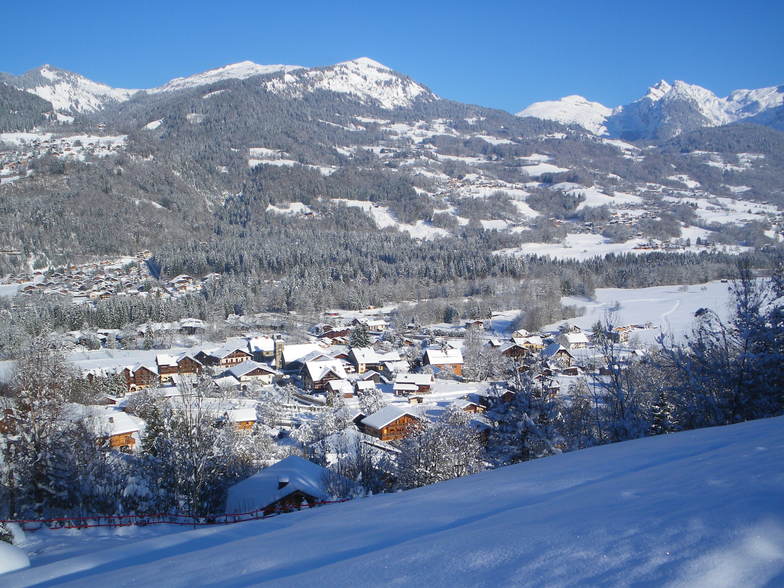
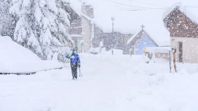
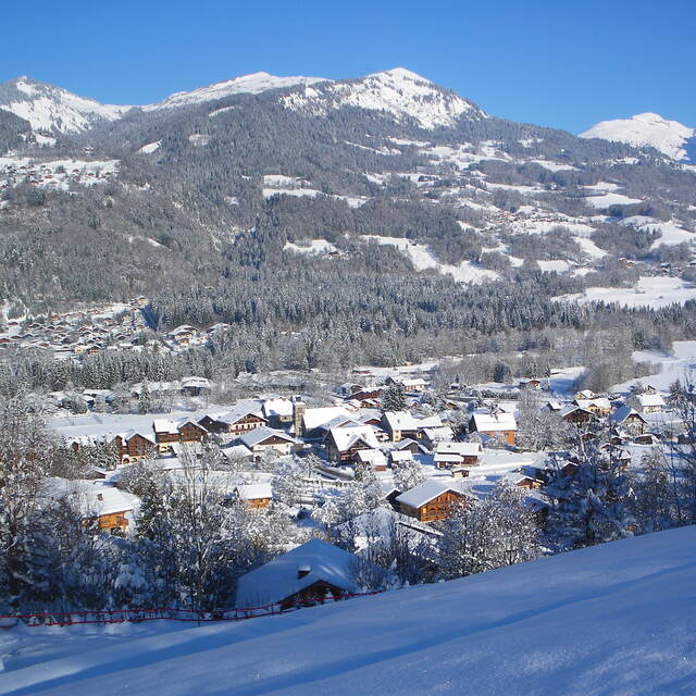
Morillon snow
Ski France

Morillon Snow Forecast

Weather Forecast for Morillon at 1900 m
Issued: 7 am  25 Apr 2025 (local time)

New snow in Morillon

6.0cm2.4in
Wed 7th
The snow forecast for Morillon is: Moderate rain (total 10.0mm), heaviest on Sun afternoon. Freeze-thaw conditions (max 7°C on Sat afternoon, min 0°C on Fri morning). Wind will be generally light.

Morillon Weather (Next 3 days): The snow forecast for Morillon is: Moderate rain (total 10.0mm), heaviest on Sun afternoon. Freeze-thaw conditions (max 7°C on Sat afternoon, min 0°C on Fri morning). Wind will be generally light.

Morillon Weather (Days 4-6): Heavy rain (total 22.0mm), heaviest during Tue night. Very mild (max 11°C on Wed afternoon, min 4°C on Mon morning). Wind will be generally light.


Morillon Live Weather

ResortSnow DepthTemp. (°C)Wind (km/h)Weather
Top Lift: 
0
5
clear
Middle Lift: 
3
5
clear
Bottom Lift: 
7
5
clear
Powered by Snow-Forecast.comSnow-Forecast.com
6 Day Forecast
Issued: 7 am 25 Apr 2025 / Updates in ::
Change Forecast Height
Choose Forecast
Last 6 daysScroll left for last 6 daysNow
Friday
25
Saturday
26
Sunday
27
Monday
28
Tuesday
29
Wednesday
30
Thursday
1
AM
PM
night
AM
PM
night
AM
PM
night
AM
PM
night
AM
PM
night
AM
PM
night
AM
PM
night
part cloud
light rain
clear
clear
part cloud
light rain
cloud
light rain
rain showers
clear
thunderstorm
rain showers
clear
thunderstorm
rain showers
clear
thunderstorm
rain showers
clear
thunderstorm
rain showers
some clouds
light rain
clear
clear
some clouds
light rain
cloudy
light rain
rain shwrs
clear
risk thun- der
rain shwrs
clear
risk thun- der
rain shwrs
clear
risk thun- der
rain shwrs
clear
risk thun- der
rain shwrs
 km/h
10
N
10
NNE
5
E
5
WSW
5
WNW
5
SE
0
SSW
5
N
5
SSE
0
WSW
5
NW
5
SSE
5
NNE
5
NW
5
SE
0
SE
5
NNW
5
SE
0
WSW
5
WNW
5
SSW
Snow map
 cm 
 mm 
1.0
3
3
3
4
4
5
6
1.0
2.0
1.0
1.0
max°C
2
3
3
5
7
5
5
6
6
7
8
7
8
9
8
9
11
10
10
12
11
min°C
0
2
2
3
6
3
3
6
4
4
8
6
6
9
7
7
11
8
9
12
10
chill°C 
-2
0
0
3
5
2
3
6
3
4
8
6
6
9
7
6
11
8
9
12
10
Humid% 
78
78
51
47
70
87
77
79
73
58
69
74
67
70
67
48
62
57
44
56
64
Freezing level (m
2150
2300
2700
2750
2700
2500
2550
2750
2650
2800
2900
2800
2900
3100
3100
3150
3250
3300
3350
3350
3500
topliftbotliftSea lvl1000m2000m3000m4000m5000m
13347446568779881191012119118111611121511141812151813162115172216
Sunrise
6:30
6:28
6:26
6:24
6:24
6:22
6:20
Sunset
8:31
8:34
8:35
8:36
8:37
8:38
8:39

Snow Radar

Submit a report Eyeball Reporter

Latest snow reports near Morillon:

  • 26 km away from Morillon

    21 hours ago
    Eyeball reporter

    Resort is closed for the season. Light clouds dotting the sky. from La Giettaz en Aravis

Morillon Snow Conditions

Top snow depth:
Bottom snow depth:
Fresh snowfall depth:
Last snowfall:17 Apr 2025
Snow AlertsCreate Alert
Other resorts in France are reporting: powder (1) / good piste (0)

Snow-Forecast Partner Offers

Snow History

Week 4 of April has on average:
0.1
Bluebird Powder days
Fresh snow, mostly sunny, light wind.
0.5
Powder days
Fresh snow, limited sun, any wind.
0.0
Bluebird days
Average snow, mostly sunny, light wind.

Morillon Resort Webcam

Live Snow webcam for Morillon
Most recent Morillon webcam image
Webcam courtesy of Morillon website
  • 2pm yesterdayMorillon webcam at 2pm yesterday
  • 2 days agoMorillon webcam 1 days ago
  • 3 days agoMorillon webcam 2 days ago
  • 4 days agoMorillon webcam 3 days ago
  • 5 days agoMorillon webcam 4 days ago