

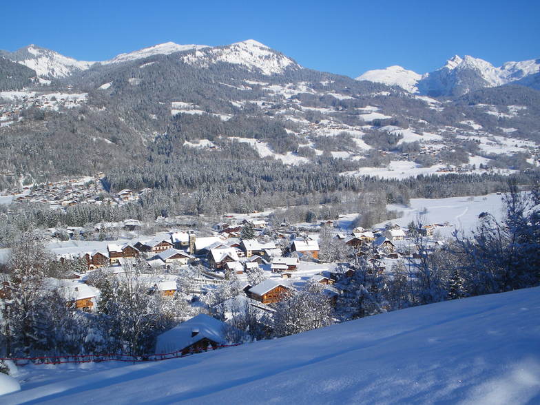
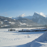
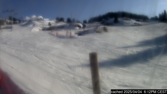
Massive Snowfall in the Alps
A huge snowfall is underway in the Alps, by far the biggest of the 24-25 season.
Please sign in with your Snow-Forecast account details below.

Morillon Weather (Next 3 days): The snow forecast for Morillon is: Moderate rain (total 18.0mm), heaviest on Sun morning. Very mild (max 11°C on Sat afternoon, min 4°C on Sun morning). Wind will be generally light.
Morillon Weather (Days 4-6): Heavy rain (total 22.0mm), heaviest during Thu night. Mild temperatures (max 9°C on Wed afternoon, min 4°C on Thu night). Wind will be generally light.
| Resort | Snow Depth | Temp. (°C) | Wind (km/h) | Weather | ||
|---|---|---|---|---|---|---|
| Top Lift: | 3 | |||||
| Middle Lift: | 5 | |||||
| Bottom Lift: | 5 |
Latest snow reports near Morillon:
Snow is falling at La Thuile. from La Thuile
Snow is falling in Verbier. from Verbier
Snowing heavily at Avoriaz. from Avoriaz
Snowing at a moderate rate at Les Contamines. from Les Contamines
Excellent on and off piste conditions. Resort closed due to heavy snowfalls. from Argentiere

Saturday 19 | Sunday 20 | Monday 21 | Tuesday 22 | Wednesday 23 | Thursday 24 | Friday 25 | |||||||||||||||
AM | PM | night | AM | PM | night | AM | PM | night | AM | PM | night | AM | PM | night | AM | PM | night | AM | PM | night | |
cloudy | some clouds | some clouds | light rain | light rain | light rain | light rain | rain shwrs | light rain | light rain | light rain | light rain | light rain | light rain | light rain | light rain | rain shwrs | rain shwrs | light rain | light rain | light rain | |
km/h | |||||||||||||||||||||
Snow map |  |  |  |  |  |  |  | ||||||||||||||
— | — | — | — | — | — | — | — | — | — | — | — | — | — | — | — | — | — | — | — | — | |
— | — | — | 3 | 3 | 5 | 2.0 | 2.0 | 3 | 1.0 | 2.0 | 4 | 2.0 | 2.0 | 2.0 | 2.0 | 2.0 | 5 | 2.0 | 2.0 | 3 | |
max°C | 10 | 11 | 8 | 5 | 7 | 6 | 6 | 9 | 7 | 7 | 7 | 7 | 6 | 9 | 8 | 7 | 9 | 6 | 5 | 7 | 5 |
min°C | 6 | 11 | 5 | 4 | 7 | 4 | 4 | 7 | 5 | 5 | 7 | 6 | 6 | 8 | 6 | 5 | 8 | 4 | 3 | 6 | 3 |
4 | 11 | 3 | 4 | 7 | 4 | 4 | 6 | 5 | 5 | 6 | 6 | 6 | 8 | 4 | 3 | 6 | 2 | 2 | 5 | 2 | |
71 | 62 | 72 | 97 | 86 | 87 | 81 | 66 | 94 | 82 | 83 | 99 | 93 | 79 | 80 | 76 | 69 | 90 | 79 | 69 | 95 | |
2850 | 2750 | 2650 | 2050 | 2300 | 2050 | 2200 | 2400 | 2150 | 2250 | 2400 | 2300 | 2350 | 2650 | 2350 | 2200 | 2350 | 1950 | 2000 | 2200 | 1900 | |
6:41 | — | — | 6:39 | — | — | 6:37 | — | — | 6:35 | — | — | 6:33 | — | — | 6:31 | — | — | 6:30 | — | — | |
— | — | 8:23 | — | — | 8:25 | — | — | 8:27 | — | — | 8:28 | — | — | 8:30 | — | — | 8:30 | — | — | 8:31 | |
Moderate rain (total 18.0mm), heaviest on Sun morning. Very mild (max 11°C on Sat afternoon, min 4°C on Sun morning). Wind will be generally light.
Heavy rain (total 22.0mm), heaviest during Thu night. Mild temperatures (max 9°C on Wed afternoon, min 4°C on Thu night). Wind will be generally light.
Latest snow reports near Morillon:
Snow is falling at La Thuile. from La Thuile
Snow is falling in Verbier. from Verbier
Snowing heavily at Avoriaz. from Avoriaz
Snowing at a moderate rate at Les Contamines. from Les Contamines
Excellent on and off piste conditions. Resort closed due to heavy snowfalls. from Argentiere
| Top snow depth: | — |
|---|---|
| Bottom snow depth: | — |
| Fresh snowfall depth: | 22 cm |
| Last snowfall: | 17 Apr 2025 |
| Snow Alerts | Create Alert |
0.0 | Bluebird Powder days Fresh snow, mostly sunny, light wind. |
|---|---|
0.2 | Powder days Fresh snow, limited sun, any wind. |
0.2 | Bluebird days Average snow, mostly sunny, light wind. |


The above table gives the weather forecast for Morillon at the specific elevation of 1294 m. Our sophisticated weather models allow us to provide snow forecasts for the top, middle and bottom ski stations of Morillon. To access the weather forecasts for the other elevations, use the tab navigation above the table. For a wider view of the weather, check out the Weather Map of France.
Click here to read further information on freezing levels and how we forecast our temperatures.
Overall 4.3 Based on 19 votes and 26 reviews
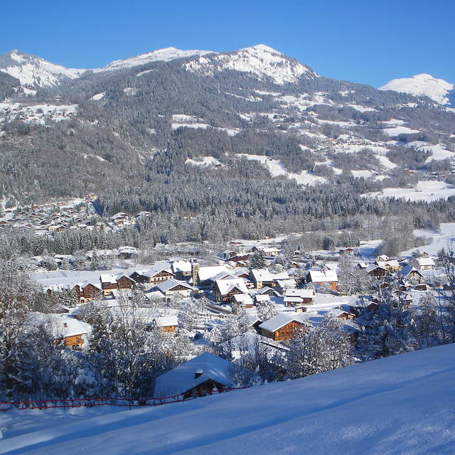
Lifts have improved so much from early days and it is a fabulous area to ski. No steps anywhere as completely equipped for the disabled skiers. Pistes very well looked after and there is something for everyone. .The Grand Massif has black off-piste bowls and runs, to lovely long green ones. There are also open slopes and tree runs so when the weather is bad you can usually ski. February does get busy but so does everywhere.
Crioutwo from United Kingdom writes:
Lifts have improved so much from early days and it is a fabulous area to ski. No steps anywhere as completely equipped for the disabled skiers. Pistes very well looked after and there is something for everyone. .The Grand Massif has black off-piste bowls and runs, to lovely long green ones. There are also open slopes and tree runs so when the weather is bad you can usually ski.
February does get busy but so does everywhere.
The Morillon skiing weather widget is available to embed on external websites free of charge. It provides a daily summary of our Morillon snow forecast and current weather conditions. Simply go to the feed configuration page and follow the 3 simple steps to grab the custom html code snippet and paste it into your own site. You can choose the snow forecast elevation (summit, mid-mountain or bottom lift) and metric/imperial units for the snow forecast feed to suit your own website…. Click here to get the code.
View detailed snow forecast for Morillon at:
snow-forecast.com


 Nearest