

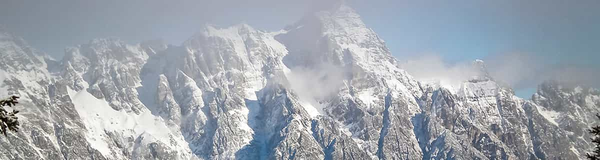
Massive Snowfall in the Alps
A huge snowfall is underway in the Alps, by far the biggest of the 24-25 season.
Please sign in with your Snow-Forecast account details below.

Mont Ste Marie Weather (Next 3 days): The snow forecast for Mont Ste Marie is: Moderate rain (total 17.0mm), heaviest on Fri night. Freeze-thaw conditions (max 15°C on Sat morning, min -3°C on Sat night). Winds decreasing (strong winds from the WSW on Sat morning, calm by Sun night).
Mont Ste Marie Weather (Days 4-6): Moderate rain (total 17.0mm), heaviest on Mon night. Freeze-thaw conditions (max 8°C on Mon night, min 0°C on Tue night). Winds decreasing (fresh winds from the SSW on Mon night, light winds from the NNW by Wed night).
| Resort | Snow Depth | Temp. (°C) | Wind (km/h) | Weather | ||
|---|---|---|---|---|---|---|
| Top Lift: | 8 | |||||
| Bottom Lift: | 8 |
Latest snow reports near Mont Ste Marie:

Fri 18 | Saturday 19 | Sunday 20 | Monday 21 | Tuesday 22 | Wednesday 23 | Thursday 24 | ||||||||||||||
PM | night | AM | PM | night | AM | PM | night | AM | PM | night | AM | PM | night | AM | PM | night | AM | PM | night | |
light rain | mod. rain | light rain | light rain | rain shwrs | clear | clear | some clouds | cloudy | light rain | mod. rain | light rain | cloudy | light snow | cloudy | light rain | cloudy | clear | some clouds | some clouds | |
km/h | ||||||||||||||||||||
Snow map |  |  |  |  |  |  |  | |||||||||||||
— | — | — | — | — | — | — | — | — | — | — | — | — | — | — | — | — | — | — | — | |
2.0 | 8 | 4 | 2.0 | 1.0 | — | — | — | — | 2.0 | 10 | 3 | — | 1.0 | — | 1.0 | — | — | — | — | |
max°C | 8 | 11 | 15 | 12 | 5 | 0 | 5 | 3 | 6 | 6 | 8 | 5 | 4 | 2 | 1 | 3 | 2 | 6 | 10 | 8 |
min°C | 7 | 8 | 13 | 9 | -3 | -3 | 4 | 0 | 2 | 4 | 5 | 5 | 3 | 0 | 0 | 2 | 2 | 3 | 8 | 6 |
2 | 5 | 10 | 5 | -10 | -10 | -1 | 0 | 0 | -1 | 0 | 0 | -2 | -5 | -5 | -2 | -2 | 0 | 8 | 5 | |
91 | 97 | 91 | 87 | 73 | 39 | 29 | 49 | 27 | 88 | 97 | 95 | 95 | 93 | 89 | 79 | 75 | 41 | 44 | 55 | |
3200 | 3150 | 3250 | 2450 | 400 | 550 | 1100 | 0 | 2550 | 2750 | 2700 | 1600 | 1350 | 750 | 700 | 1000 | 950 | 2050 | 1850 | 2500 | |
— | — | 6:11 | — | — | 6:09 | — | — | 6:07 | — | — | 6:05 | — | — | 6:03 | — | — | 6:01 | — | — | |
7:53 | — | — | 7:54 | — | — | 7:55 | — | — | 7:58 | — | — | 7:59 | — | — | — | 8:00 | — | — | 8:00 | |
Moderate rain (total 17.0mm), heaviest on Fri night. Freeze-thaw conditions (max 15°C on Sat morning, min -3°C on Sat night). Winds decreasing (strong winds from the WSW on Sat morning, calm by Sun night).
Moderate rain (total 17.0mm), heaviest on Mon night. Freeze-thaw conditions (max 8°C on Mon night, min 0°C on Tue night). Winds decreasing (fresh winds from the SSW on Mon night, light winds from the NNW by Wed night).
Latest snow reports near Mont Ste Marie:
| Top snow depth: | — |
|---|---|
| Bottom snow depth: | — |
| Fresh snowfall depth: | — |
| Last snowfall: | 15 Apr 2025 |
| Snow Alerts | Create Alert |
0.1 | Bluebird Powder days Fresh snow, mostly sunny, light wind. |
|---|---|
0.3 | Powder days Fresh snow, limited sun, any wind. |
0.6 | Bluebird days Average snow, mostly sunny, light wind. |
The above table gives the weather forecast for Mont Ste Marie at the specific elevation of 582 m. Our sophisticated weather models allow us to provide snow forecasts for the top, middle and bottom ski stations of Mont Ste Marie. To access the weather forecasts for the other elevations, use the tab navigation above the table. For a wider view of the weather, check out the Weather Map of Canada.
Click here to read further information on freezing levels and how we forecast our temperatures.
Overall 2.7 Based on 2 votes and 4 reviews
Mont Ste-Marie is the only real mountain skiing in the Ottawa area. It has almost twice the vertical as the next highest area resort but it's only half an hour beyond Edelweiss and Vorlage. Lift lines are modest or non-existent. Both Mont Ste-Marie's mountains have detachable quads and snowmaking. Black runs on the Vanier side (Carol Ann, Exhibition, Tornade) are reasonably challenging, but the real challenges are to be found on the Cheval Blanc side. Vanier, however, has a couple of blue runs (Serenade and Bellevue) that low intermediate skiers will really enjoy. Grooming is both regular and pretty good. Quite frankly, I love the place. (Though I just wish it was easier to get to the Cheval Blanc side from the main lodge. The little bus is a pain.) The lodge has individual padded chairs upstairs (!), a great view of the hill, a small cafeteria with very good prices and a bar with frequent live music evenings. Staff are great and always helpful. Mont Ste-Marie has a very flexible season's pass structure that caters to just about every skier. For example, you could get a 2013/2014 weekday pass for $149 - if you bought it in March 2013. Thumbs up for this great resort!
Gary MacDonald from Canada writes:
Mont Ste-Marie is the only real mountain skiing in the Ottawa area. It has almost twice the vertical as the next highest area resort but it's only half an hour beyond Edelweiss and Vorlage.
Lift lines are modest or non-existent. Both Mont Ste-Marie's mountains have detachable quads and snowmaking.
Black runs on the Vanier side (Carol Ann, Exhibition, Tornade) are reasonably challenging, but the real challenges are to be found on the Cheval Blanc side. Vanier, however, has a couple of blue runs (Serenade and Bellevue) that low intermediate skiers will really enjoy. Grooming is both regular and pretty good. Quite frankly, I love the place.
(Though I just wish it was easier to get to the Cheval Blanc side from the main lodge. The little bus is a pain.)
The lodge has individual padded chairs upstairs (!), a great view of the hill, a small cafeteria with very good prices and a bar with frequent live music evenings. Staff are great and always helpful.
Mont Ste-Marie has a very flexible season's pass structure that caters to just about every skier. For example, you could get a 2013/2014 weekday pass for $149 - if you bought it in March 2013.
Thumbs up for this great resort!
The Mont Ste Marie skiing weather widget is available to embed on external websites free of charge. It provides a daily summary of our Mont Ste Marie snow forecast and current weather conditions. Simply go to the feed configuration page and follow the 3 simple steps to grab the custom html code snippet and paste it into your own site. You can choose the snow forecast elevation (summit, mid-mountain or bottom lift) and metric/imperial units for the snow forecast feed to suit your own website…. Click here to get the code.
View detailed snow forecast for Mont Ste Marie at:
snow-forecast.com


 Nearest