

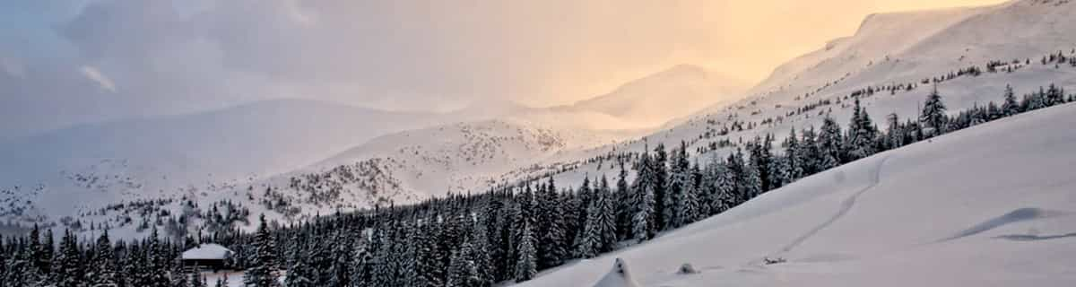
Massive Snowfall in the Alps
A huge snowfall is underway in the Alps, by far the biggest of the 24-25 season.
Please sign in with your Snow-Forecast account details below.


Mont Saint Sauveur Weather (Next 3 days): The snow forecast for Mont Saint Sauveur is: Moderate rain (total 14.0mm), heaviest on Mon night. Freeze-thaw conditions (max 8°C on Mon afternoon, min 0°C on Sun night). Wind will be generally light.
Mont Saint Sauveur Weather (Days 4-6): Heavy rain (total 32.0mm), heaviest during Fri night. Very mild (max 13°C on Fri afternoon, min 3°C on Thu night). Wind will be generally light.
| Resort | Snow Depth | Temp. (°C) | Wind (km/h) | Weather | ||
|---|---|---|---|---|---|---|
| Top Lift: | 0.5 m | 6 | ||||
| Bottom Lift: | 0.1 m | 8 |
Latest snow reports near Mont Saint Sauveur:

Sun 20 | Monday 21 | Tuesday 22 | Wednesday 23 | Thursday 24 | Friday 25 | Saturday 26 | ||||||||||||||
PM | night | AM | PM | night | AM | PM | night | AM | PM | night | AM | PM | night | AM | PM | night | AM | PM | night | |
clear | some clouds | some clouds | light rain | heavy rain | light rain | light rain | cloudy | cloudy | cloudy | cloudy | cloudy | cloudy | some clouds | cloudy | cloudy | heavy rain | light rain | light rain | some clouds | |
km/h | ||||||||||||||||||||
Snow map |  |  |  |  |  |  |  | |||||||||||||
— | — | — | — | — | — | — | — | — | — | — | — | — | — | — | — | — | — | — | — | |
— | — | — | 1.0 | 11 | 1.0 | 1.0 | — | — | — | — | — | — | — | — | — | 29 | 3 | 1.0 | — | |
max°C | 7 | 3 | 6 | 8 | 7 | 6 | 4 | 3 | 3 | 6 | 5 | 9 | 11 | 7 | 9 | 13 | 13 | 11 | 6 | 5 |
min°C | 5 | 0 | 2 | 6 | 5 | 5 | 4 | 2 | 3 | 6 | 4 | 5 | 10 | 3 | 5 | 12 | 10 | 5 | 5 | 0 |
1 | -2 | 0 | 3 | 2 | 1 | 0 | -2 | 0 | 4 | 3 | 5 | 9 | 0 | 2 | 10 | 7 | 0 | 1 | -6 | |
37 | 63 | 41 | 68 | 99 | 91 | 96 | 91 | 86 | 74 | 79 | 65 | 59 | 76 | 54 | 66 | 98 | 77 | 75 | 77 | |
1000 | 450 | 2600 | 2800 | 2700 | 1000 | 950 | 850 | 1150 | 1200 | 1550 | 1400 | 1450 | 2300 | 2700 | 2700 | 2950 | 1500 | 1000 | 500 | |
— | — | 6:01 | — | — | 5:58 | — | — | 5:56 | — | — | 5:54 | — | — | 5:54 | — | — | 5:52 | — | — | |
7:49 | — | — | 7:50 | — | — | 7:52 | — | — | 7:52 | — | — | 7:53 | — | — | 7:55 | — | — | 7:57 | — | |
Moderate rain (total 14.0mm), heaviest on Mon night. Freeze-thaw conditions (max 8°C on Mon afternoon, min 0°C on Sun night). Wind will be generally light.
Heavy rain (total 32.0mm), heaviest during Fri night. Very mild (max 13°C on Fri afternoon, min 3°C on Thu night). Wind will be generally light.
Latest snow reports near Mont Saint Sauveur:
| Top snow depth: | 50 cm |
|---|---|
| Bottom snow depth: | 10 cm |
| Fresh snowfall depth: | — |
| Last snowfall: | 11 Apr 2025 |
| Snow Alerts | Create Alert |
0.1 | Bluebird Powder days Fresh snow, mostly sunny, light wind. |
|---|---|
0.1 | Powder days Fresh snow, limited sun, any wind. |
0.2 | Bluebird days Average snow, mostly sunny, light wind. |
The above table gives the weather forecast for Mont Saint Sauveur at the specific elevation of 310 m. Our sophisticated weather models allow us to provide snow forecasts for the top, middle and bottom ski stations of Mont Saint Sauveur. To access the weather forecasts for the other elevations, use the tab navigation above the table. For a wider view of the weather, check out the Weather Map of Canada.
Click here to read further information on freezing levels and how we forecast our temperatures.
Saint SAUVEUR des Monts est la PERLE des LAURENTIDES. Au Printemps, tout est en feuilles & fleurs, en été les biches et chevreuil sont en liberté devant vos yeux, l'Autome l'Erable rougit et s'effeuille. Et l'Hiver, la neige & le ski Alpin ou de fond est partout pratiqué. Ne manquez pas la Rue Principale (très animée l'été) et l'hiver une multitude de boutiques colorées vous acceuillent dans leur interieur chaud et achalandé. Un Français des montagnes de Haute SAVOIE . BRAVO Saint SAUVEUR.
Paul MONATERI from France writes:
Saint SAUVEUR des Monts est la PERLE des LAURENTIDES.
Au Printemps, tout est en feuilles & fleurs, en été les biches et chevreuil sont en liberté devant vos yeux, l'Autome l'Erable rougit et s'effeuille. Et l'Hiver, la neige & le ski Alpin ou de fond est partout pratiqué. Ne manquez pas la Rue Principale (très animée l'été) et l'hiver une multitude de boutiques colorées vous acceuillent dans leur interieur chaud et achalandé.
Un Français des montagnes de Haute SAVOIE .
BRAVO Saint SAUVEUR.
Read 2 more reviews of Mont Saint Sauveur or submit your own
The Mont Saint Sauveur skiing weather widget is available to embed on external websites free of charge. It provides a daily summary of our Mont Saint Sauveur snow forecast and current weather conditions. Simply go to the feed configuration page and follow the 3 simple steps to grab the custom html code snippet and paste it into your own site. You can choose the snow forecast elevation (summit, mid-mountain or bottom lift) and metric/imperial units for the snow forecast feed to suit your own website…. Click here to get the code.
View detailed snow forecast for Mont Saint Sauveur at:
snow-forecast.com


 Nearest