

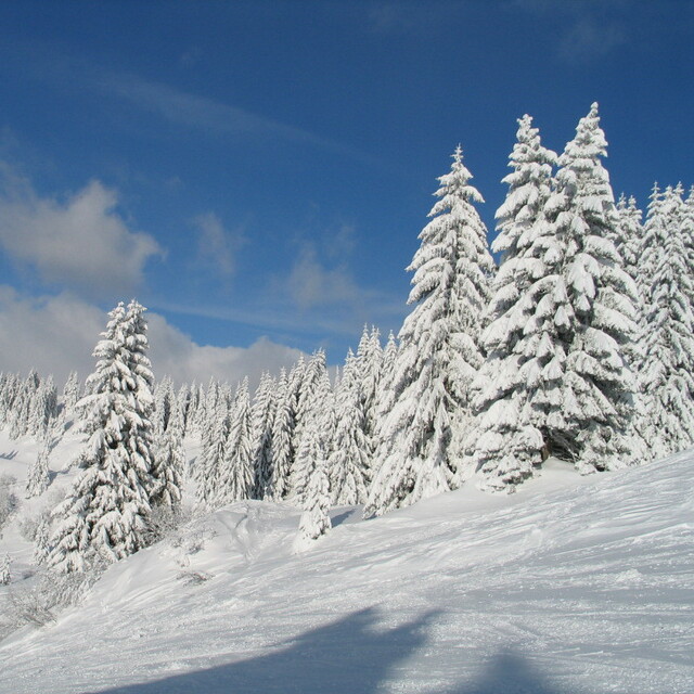
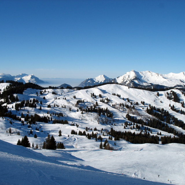
Massive Snowfall in the Alps
A huge snowfall is underway in the Alps, by far the biggest of the 24-25 season.
Please sign in with your Snow-Forecast account details below.


Les Gets Weather (Next 3 days): The snow forecast for Les Gets is: Moderate rain (total 13.0mm), heaviest on Sun morning. Very mild (max 13°C on Sat afternoon, min 3°C on Fri night). Wind will be generally light.
Les Gets Weather (Days 4-6): Heavy rain (total 25.0mm), heaviest during Wed night. Very mild (max 12°C on Wed afternoon, min 3°C on Thu morning). Wind will be generally light.
| Resort | Snow Depth | Temp. (°C) | Wind (km/h) | Weather | ||
|---|---|---|---|---|---|---|
| Top Lift: | 3 | |||||
| Middle Lift: | 5 | |||||
| Bottom Lift: | 4 |
Latest snow reports near Les Gets:
Snow is falling in Verbier. from Verbier
Snowing heavily at Avoriaz. from Avoriaz
Snowing at a moderate rate at Les Contamines. from Les Contamines
Excellent on and off piste conditions. Resort closed due to heavy snowfalls. from Argentiere
It is snowing heavily in Argentiere. from Argentiere

Saturday 19 | Sunday 20 | Monday 21 | Tuesday 22 | Wednesday 23 | Thursday 24 | ||||||||||||||
night | AM | PM | night | AM | PM | night | AM | PM | night | AM | PM | night | AM | PM | night | AM | PM | night | |
clear | some clouds | cloudy | some clouds | light rain | light rain | light rain | cloudy | cloudy | light rain | light rain | light rain | light rain | cloudy | light rain | rain shwrs | light rain | light rain | mod. snow | |
km/h | |||||||||||||||||||
Snow map |  |  |  |  |  |  |  | ||||||||||||
— | — | — | — | — | — | — | — | — | — | — | — | — | — | — | — | — | — | 6 | |
— | — | — | — | 5 | 4 | 4 | — | — | 2.0 | 1.0 | 2.0 | 4 | — | 1.0 | 8 | 3 | 4 | 8 | |
max°C | 6 | 11 | 13 | 8 | 5 | 7 | 6 | 8 | 10 | 7 | 8 | 8 | 7 | 9 | 12 | 7 | 4 | 6 | 4 |
min°C | 3 | 5 | 13 | 4 | 4 | 6 | 4 | 5 | 9 | 6 | 6 | 8 | 6 | 6 | 11 | 4 | 3 | 6 | 1 |
1 | 3 | 13 | 3 | 4 | 6 | 4 | 3 | 8 | 6 | 6 | 7 | 5 | 6 | 10 | 1 | 0 | 4 | -1 | |
57 | 63 | 58 | 71 | 95 | 93 | 85 | 71 | 71 | 94 | 87 | 88 | 98 | 84 | 65 | 86 | 96 | 73 | 99 | |
3000 | 2850 | 2750 | 2700 | 2000 | 2200 | 2050 | 2300 | 2400 | 2150 | 2250 | 2350 | 2250 | 2600 | 2650 | 2100 | 1700 | 1950 | 1450 | |
— | 6:39 | — | — | 6:39 | — | — | 6:37 | — | — | 6:35 | — | — | 6:33 | — | — | 6:31 | — | — | |
— | — | — | 8:24 | — | — | 8:25 | — | — | 8:27 | — | — | 8:29 | — | — | 8:30 | — | — | 8:30 | |
Moderate rain (total 13.0mm), heaviest on Sun morning. Very mild (max 13°C on Sat afternoon, min 3°C on Fri night). Wind will be generally light.
Heavy rain (total 25.0mm), heaviest during Wed night. Very mild (max 12°C on Wed afternoon, min 3°C on Thu morning). Wind will be generally light.
Latest snow reports near Les Gets:
Snow is falling in Verbier. from Verbier
Snowing heavily at Avoriaz. from Avoriaz
Snowing at a moderate rate at Les Contamines. from Les Contamines
Excellent on and off piste conditions. Resort closed due to heavy snowfalls. from Argentiere
It is snowing heavily in Argentiere. from Argentiere
| Top snow depth: | — |
|---|---|
| Bottom snow depth: | — |
| Fresh snowfall depth: | 34 cm |
| Last snowfall: | 17 Apr 2025 |
| Snow Alerts | Create Alert |
0.0 | Bluebird Powder days Fresh snow, mostly sunny, light wind. |
|---|---|
0.2 | Powder days Fresh snow, limited sun, any wind. |
0.0 | Bluebird days Average snow, mostly sunny, light wind. |
The above table gives the weather forecast for Les Gets at the specific elevation of 1172 m. Our sophisticated weather models allow us to provide snow forecasts for the top, middle and bottom ski stations of Les Gets. To access the weather forecasts for the other elevations, use the tab navigation above the table. For a wider view of the weather, check out the Weather Map of France.
Click here to read further information on freezing levels and how we forecast our temperatures.
Overall 4.3 Based on 61 votes and 36 reviews
I have been driving clients to and from Les Gets for over 10 years. This family ski resort never fails to deliver unbeatable surprises, short transfer time, fantastic slopes for all standards and fun place to sample off-piste fun. Plenty of English speaking French, all willing to help you have the ski holiday of a lifetime.
Summit Transfers from France writes:
I have been driving clients to and from Les Gets for over 10 years. This family ski resort never fails to deliver unbeatable surprises, short transfer time, fantastic slopes for all standards and fun place to sample off-piste fun. Plenty of English speaking French, all willing to help you have the ski holiday of a lifetime.
The Les Gets skiing weather widget is available to embed on external websites free of charge. It provides a daily summary of our Les Gets snow forecast and current weather conditions. Simply go to the feed configuration page and follow the 3 simple steps to grab the custom html code snippet and paste it into your own site. You can choose the snow forecast elevation (summit, mid-mountain or bottom lift) and metric/imperial units for the snow forecast feed to suit your own website…. Click here to get the code.
View detailed snow forecast for Les Gets at:
snow-forecast.com


 Nearest