

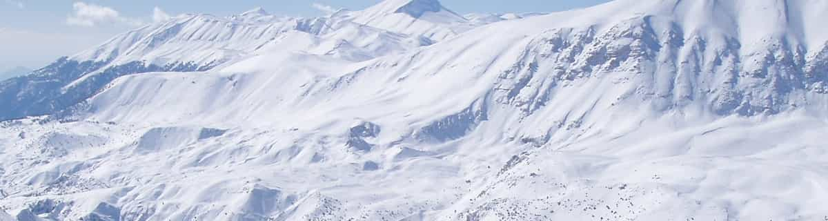
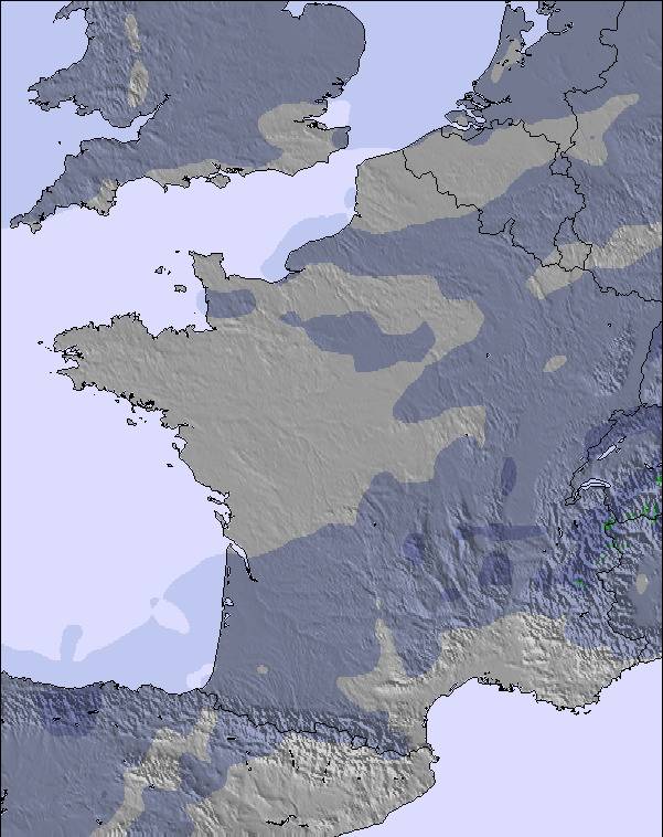
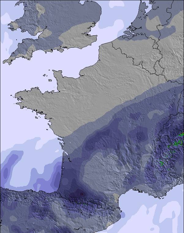
Massive Snowfall in the Alps
A huge snowfall is underway in the Alps, by far the biggest of the 24-25 season.
Please sign in with your Snow-Forecast account details below.

Le Mont-Dore Weather (Next 3 days): The snow forecast for Le Mont-Dore is: Mild with light rain (total 5.0mm) on Sat night Becoming colder with a light covering of snow, mostly falling on Sat night. Freeze-thaw conditions (max 9°C on Fri night, min -1°C on Sat night). Winds increasing (light winds from the SSW on Fri night, near gales from the SSE by Sat afternoon).
Le Mont-Dore Weather (Days 4-6): Light rain (total 8.0mm) at first, then becoming colder with a dusting of snow on Wed night. Freeze-thaw conditions (max 4°C on Tue afternoon, min 0°C on Mon night). Winds increasing (calm on Tue night, gales from the WSW by Wed night).
| Resort | Snow Depth | Temp. (°C) | Wind (km/h) | Weather | ||
|---|---|---|---|---|---|---|
| Top Lift: | 0.0 m | 6 | ||||
| Middle Lift: | 8 | |||||
| Bottom Lift: | 0.0 m | 7 |
Latest snow reports near Le Mont-Dore:

Saturday 19 | Sunday 20 | Monday 21 | Tuesday 22 | Wednesday 23 | Thursday 24 | ||||||||||||||
night | AM | PM | night | AM | PM | night | AM | PM | night | AM | PM | night | AM | PM | night | AM | PM | night | |
some clouds | cloudy | cloudy | light snow | cloudy | rain shwrs | light snow | light snow | light rain | light snow | cloudy | light rain | some clouds | cloudy | light snow | light snow | light snow | light rain | light snow | |
km/h | |||||||||||||||||||
Snow map |  |  |  |  |  | 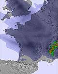 |  | ||||||||||||
— | — | — | 5 | — | — | 3 | 1.0 | — | — | — | — | — | — | — | 2.0 | 1.0 | — | 1.0 | |
— | — | — | 1.0 | — | 1.0 | 1.0 | — | 2.0 | — | — | 1.0 | — | — | 3 | 2.0 | — | 2.0 | — | |
max°C | 9 | 5 | 7 | 5 | 1 | 5 | 3 | 2 | 2 | 2 | 0 | 4 | 4 | 3 | 3 | 3 | 1 | 3 | 1 |
min°C | 4 | 5 | 5 | -1 | 0 | 4 | 0 | 1 | 2 | 0 | 0 | 3 | 2 | 2 | 2 | 1 | 1 | 2 | -2 |
-1 | 0 | -1 | -8 | -8 | -2 | -8 | -6 | -4 | -5 | -4 | 0 | -1 | -4 | -5 | -8 | -6 | -4 | -9 | |
63 | 95 | 65 | 97 | 79 | 68 | 98 | 93 | 97 | 88 | 95 | 68 | 87 | 77 | 99 | 99 | 96 | 85 | 97 | |
2750 | 2550 | 2700 | 1300 | 1750 | 2100 | 1650 | 1800 | 1900 | 1700 | 1600 | 2050 | 1950 | 2200 | 2100 | 1750 | 1700 | 1900 | 1400 | |
— | 6:56 | — | — | 6:54 | — | — | 6:52 | — | — | 6:52 | — | — | 6:50 | — | — | 6:48 | — | — | |
— | — | — | 8:38 | — | — | 8:39 | — | — | 8:42 | — | — | 8:43 | — | — | 8:44 | — | — | 8:45 | |
Mild with light rain (total 5.0mm) on Sat night Becoming colder with a light covering of snow, mostly falling on Sat night. Freeze-thaw conditions (max 9°C on Fri night, min -1°C on Sat night). Winds increasing (light winds from the SSW on Fri night, near gales from the SSE by Sat afternoon).
Light rain (total 8.0mm) at first, then becoming colder with a dusting of snow on Wed night. Freeze-thaw conditions (max 4°C on Tue afternoon, min 0°C on Mon night). Winds increasing (calm on Tue night, gales from the WSW by Wed night).
Latest snow reports near Le Mont-Dore:
| Top snow depth: | 0 cm |
|---|---|
| Bottom snow depth: | 0 cm |
| Fresh snowfall depth: | 16 cm |
| Last snowfall: | 16 Apr 2025 |
| Snow Alerts | Create Alert |
0.1 | Bluebird Powder days Fresh snow, mostly sunny, light wind. |
|---|---|
0.4 | Powder days Fresh snow, limited sun, any wind. |
0.4 | Bluebird days Average snow, mostly sunny, light wind. |
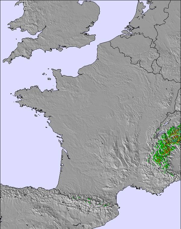
The above table gives the weather forecast for Le Mont-Dore at the specific elevation of 1526 m. Our sophisticated weather models allow us to provide snow forecasts for the top, middle and bottom ski stations of Le Mont-Dore. To access the weather forecasts for the other elevations, use the tab navigation above the table. For a wider view of the weather, check out the Weather Map of France.
Click here to read further information on freezing levels and how we forecast our temperatures.
Overall 3.9 Based on 7 votes and 3 reviews
My wife and I are both retired but enjoy our skiing. We have skied in Le Mont Dore for the past few years and have found it perfect for our needs. The people are really friendly and the ski staff are very helpful. Lift passes are very reasonable and flexible. The town, itself, is very good for shopping and, again, the people are very friendly. We have a property near Bellac so travelling to the resort takes around two hours using mostly motorways. If you need other Brits around you, you will be disappointed. This is mostly a French ski resort but we have found everyone friendly on and off the piste. As a retired ski coach, I can recommend Mont Dore to all levels but it is especially good for beginners and intermediates. Alan Bainbridge
alan bainbridge from United Kingdom writes:
My wife and I are both retired but enjoy our skiing. We have skied in Le Mont Dore for the past few years and have found it perfect for our needs. The people are really friendly and the ski staff are very helpful. Lift passes are very reasonable and flexible. The town, itself, is very good for shopping and, again, the people are very friendly.
We have a property near Bellac so travelling to the resort takes around two hours using mostly motorways. If you need other Brits around you, you will be disappointed. This is mostly a French ski resort but we have found everyone friendly on and off the piste.
As a retired ski coach, I can recommend Mont Dore to all levels but it is especially good for beginners and intermediates.
Alan Bainbridge
The Le Mont-Dore skiing weather widget is available to embed on external websites free of charge. It provides a daily summary of our Le Mont-Dore snow forecast and current weather conditions. Simply go to the feed configuration page and follow the 3 simple steps to grab the custom html code snippet and paste it into your own site. You can choose the snow forecast elevation (summit, mid-mountain or bottom lift) and metric/imperial units for the snow forecast feed to suit your own website…. Click here to get the code.
View detailed snow forecast for Le Mont-Dore at:
snow-forecast.com


 Nearest