

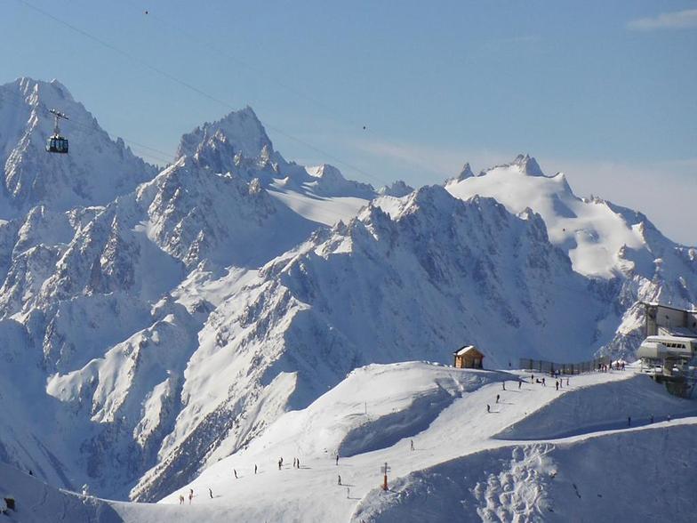
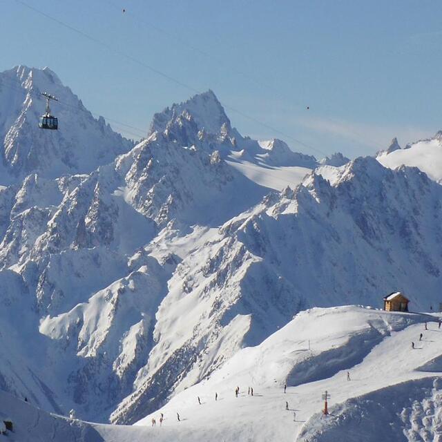
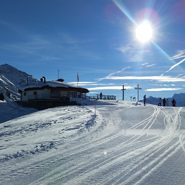
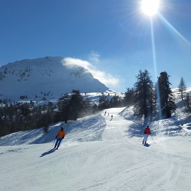
Massive Snowfall in the Alps
A huge snowfall is underway in the Alps, by far the biggest of the 24-25 season.
Please sign in with your Snow-Forecast account details below.

La Tzoumaz Weather (Next 3 days): The snow forecast for La Tzoumaz is: A dusting of new snow. Freeze-thaw conditions (max 2°C on Sat morning, min -2°C on Sun night). Wind will be generally light.
La Tzoumaz Weather (Days 4-6): Drizzle at first, then turning colder with dusting of snow on Tue night. Freeze-thaw conditions (max 3°C on Tue afternoon, min -1°C on Thu night). Wind will be generally light.
| Resort | Snow Depth | Temp. (°C) | Wind (km/h) | Weather | ||
|---|---|---|---|---|---|---|
| Top Lift: | 1.5 m | 1 | ||||
| Middle Lift: | 2 | |||||
| Bottom Lift: | 0.7 m | 2 |
Latest snow reports near La Tzoumaz:
Snowing in St-Luc. from St-Luc
Snow is falling in Verbier. from Verbier
Snowing heavily at Avoriaz. from Avoriaz
Excellent on and off piste conditions. Resort closed due to heavy snowfalls. from Argentiere
It is snowing heavily in Argentiere. from Argentiere

Saturday 19 | Sunday 20 | Monday 21 | Tuesday 22 | Wednesday 23 | Thursday 24 | Friday 25 | |||||||||||||||
AM | PM | night | AM | PM | night | AM | PM | night | AM | PM | night | AM | PM | night | AM | PM | night | AM | PM | night | |
some clouds | some clouds | snow shwrs | light snow | light snow | light snow | some clouds | snow shwrs | snow shwrs | some clouds | rain shwrs | light snow | snow shwrs | snow shwrs | snow shwrs | some clouds | some clouds | snow shwrs | cloudy | light snow | some clouds | |
km/h | |||||||||||||||||||||
Snow map |  |  |  |  |  |  |  | ||||||||||||||
— | — | — | — | 1.0 | — | — | — | — | — | — | — | — | — | — | — | — | — | — | — | — | |
— | — | — | — | — | — | — | — | — | — | 1.0 | — | — | — | — | — | — | — | — | — | — | |
max°C | 2 | 2 | 1 | 0 | 0 | -1 | 0 | 1 | 0 | 2 | 3 | 2 | 1 | 2 | 1 | 0 | 2 | 0 | 0 | 1 | 1 |
min°C | 1 | 2 | -1 | -1 | 0 | -2 | -2 | 1 | -1 | 0 | 3 | 0 | 0 | 2 | 0 | 0 | 2 | -1 | -1 | 1 | 0 |
-2 | -2 | -6 | -5 | -3 | -5 | -5 | 1 | -1 | 0 | 3 | 0 | 0 | 2 | -2 | -3 | -1 | -4 | -4 | -1 | 0 | |
67 | 82 | 76 | 93 | 96 | 92 | 79 | 85 | 89 | 62 | 79 | 90 | 85 | 87 | 77 | 70 | 71 | 77 | 81 | 82 | 56 | |
2750 | 2650 | 2200 | 2300 | 2300 | 2050 | 2300 | 2500 | 2250 | 2650 | 2700 | 2450 | 2450 | 2600 | 2500 | 2350 | 2600 | 2200 | 2350 | 2500 | 2450 | |
6:37 | — | — | 6:35 | — | — | 6:35 | — | — | 6:33 | — | — | 6:31 | — | — | 6:30 | — | — | 6:28 | — | — | |
— | — | 8:22 | — | — | 8:23 | — | — | 8:24 | — | — | 8:25 | — | — | 8:28 | — | — | 8:29 | — | — | 8:30 | |
A dusting of new snow. Freeze-thaw conditions (max 2°C on Sat morning, min -2°C on Sun night). Wind will be generally light.
Drizzle at first, then turning colder with dusting of snow on Tue night. Freeze-thaw conditions (max 3°C on Tue afternoon, min -1°C on Thu night). Wind will be generally light.
Latest snow reports near La Tzoumaz:
Snowing in St-Luc. from St-Luc
Snow is falling in Verbier. from Verbier
Snowing heavily at Avoriaz. from Avoriaz
Excellent on and off piste conditions. Resort closed due to heavy snowfalls. from Argentiere
It is snowing heavily in Argentiere. from Argentiere
| Top snow depth: | 150 cm |
|---|---|
| Bottom snow depth: | 65 cm |
| Fresh snowfall depth: | 54 cm |
| Last snowfall: | 17 Apr 2025 |
| Snow Alerts | Create Alert |
0.6 | Bluebird Powder days Fresh snow, mostly sunny, light wind. |
|---|---|
2.4 | Powder days Fresh snow, limited sun, any wind. |
0.3 | Bluebird days Average snow, mostly sunny, light wind. |
The above table gives the weather forecast for La Tzoumaz at the specific elevation of 2354 m. Our sophisticated weather models allow us to provide snow forecasts for the top, middle and bottom ski stations of La Tzoumaz. To access the weather forecasts for the other elevations, use the tab navigation above the table. For a wider view of the weather, check out the Weather Map of Switzerland.
Click here to read further information on freezing levels and how we forecast our temperatures.
Overall 4.0 Based on 15 votes and 11 reviews
Just back from two weeks spent over Christmas and New Year and can honestly say that I managed to do some of the best skiing in my life. We are a family of seasoned skiers, having done most Europe famous resorts in France, Switzerland and Austria over the years so have something to compare with. So, why do we love La Tzoumaz? Amazingly easy access to Verbier ski area (fast modern 6-seater chair lift to Savolyers), no queues (in stark contrast to Verbier or Nendaz on either side), superb tree lined runs, amazing off-piste, better ski cover vs. southern facing Verbier, friendly locals, picture perfect views to opposite Iserables (much better than car congested Verbier). Easy drive from Geneva - just 1.5 hours or 2 hour train ride from Geneva airport to Riddes and just 15 mins drive up to the village. Or 8 hour drive from Calais. Well worth it if going on a self-catering basis so you can get all supplies from close by Conthey (30 mins drive). Nice that the village arranged events such as Father Christmas meets kids and gives free presents, free ice skating rink, NY party with live band, fireworks, etc. Mostly Dutch, Swiss and British tourists.
MVS from United Kingdom writes:
Just back from two weeks spent over Christmas and New Year and can honestly say that I managed to do some of the best skiing in my life. We are a family of seasoned skiers, having done most Europe famous resorts in France, Switzerland and Austria over the years so have something to compare with. So, why do we love La Tzoumaz? Amazingly easy access to Verbier ski area (fast modern 6-seater chair lift to Savolyers), no queues (in stark contrast to Verbier or Nendaz on either side), superb tree lined runs, amazing off-piste, better ski cover vs. southern facing Verbier, friendly locals, picture perfect views to opposite Iserables (much better than car congested Verbier). Easy drive from Geneva - just 1.5 hours or 2 hour train ride from Geneva airport to Riddes and just 15 mins drive up to the village. Or 8 hour drive from Calais. Well worth it if going on a self-catering basis so you can get all supplies from close by Conthey (30 mins drive). Nice that the village arranged events such as Father Christmas meets kids and gives free presents, free ice skating rink, NY party with live band, fireworks, etc. Mostly Dutch, Swiss and British tourists.
The La Tzoumaz skiing weather widget is available to embed on external websites free of charge. It provides a daily summary of our La Tzoumaz snow forecast and current weather conditions. Simply go to the feed configuration page and follow the 3 simple steps to grab the custom html code snippet and paste it into your own site. You can choose the snow forecast elevation (summit, mid-mountain or bottom lift) and metric/imperial units for the snow forecast feed to suit your own website…. Click here to get the code.
View detailed snow forecast for La Tzoumaz at:
snow-forecast.com


 Nearest