
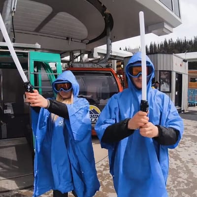
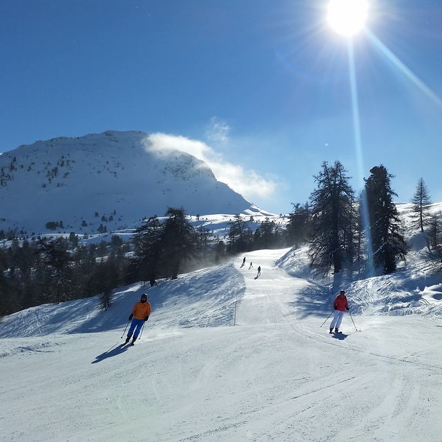
Ski Areas Ready for Star Wars Day
Several North American ski areas that are still open plan to celebrate the unofficial Star Wars Day tomorrow, May the Fourth (be with you).
Please sign in with your Snow-Forecast account details below.

La Tzoumaz Weather (Next 3 days): The snow forecast for La Tzoumaz is: A light covering of new snow, mostly falling on Mon afternoon. Becoming milder with light rain (total 7.0mm) on Tue night. Freeze-thaw conditions (max 5°C on Tue afternoon, min 0°C on Wed night). Wind will be generally light.
La Tzoumaz Weather (Days 4-6): Heavy rain (total 23.0mm), heaviest during Fri afternoon. Mild temperatures (max 7°C on Sat afternoon, min 1°C on Thu night). Wind will be generally light.
| Resort | Snow Depth | Temp. (°F) | Wind (mph) | Weather | ||
|---|---|---|---|---|---|---|
| Top Lift: | 0 ft | 32 | ||||
| Middle Lift: | 36 | |||||
| Bottom Lift: | 0 ft | 39 |
Latest snow reports near La Tzoumaz:
Light rain reported from Sion at 339 metres elevation only 2 kms NW of Veysonnaz-Printse but it is forecast cold enough for snow at higher elevations in the ski area from Veysonnaz-Printse

Mon 5 | Tuesday 6 | Wednesday 7 | Thursday 8 | Friday 9 | Saturday 10 | Sunday 11 | ||||||||||||||
PM | night | AM | PM | night | AM | PM | night | AM | PM | night | AM | PM | night | AM | PM | night | AM | PM | night | |
light snow | light snow | some clouds | light rain | light snow | light snow | light snow | light snow | cloudy | light rain | light rain | some clouds | light rain | rain shwrs | clear | risk thun- der | rain shwrs | light rain | risk thun- der | rain shwrs | |
mph | ||||||||||||||||||||
Snow map |  |  |  |  |  |  |  | |||||||||||||
1 | — | — | — | — | 0.4 | 1 | — | — | — | — | — | — | — | — | — | — | — | — | — | |
— | — | — | 0.08 | 0.2 | — | — | — | — | 0.08 | 0.1 | — | 0.2 | 0.1 | — | 0.2 | 0.2 | 0.04 | 0.2 | 0.2 | |
max°F | 36 | 34 | 39 | 41 | 37 | 36 | 36 | 34 | 37 | 39 | 37 | 39 | 41 | 41 | 41 | 45 | 41 | 41 | 45 | 43 |
min°F | 36 | 34 | 34 | 39 | 36 | 36 | 34 | 32 | 34 | 39 | 34 | 36 | 41 | 36 | 37 | 43 | 37 | 39 | 45 | 39 |
34 | 32 | 34 | 39 | 36 | 36 | 32 | 32 | 34 | 39 | 34 | 36 | 41 | 32 | 37 | 41 | 37 | 39 | 45 | 39 | |
98 | 96 | 83 | 91 | 96 | 98 | 99 | 93 | 81 | 91 | 89 | 76 | 74 | 80 | 67 | 78 | 91 | 79 | 78 | 83 | |
7400 | 6700 | 8200 | 8400 | 7700 | 7400 | 6900 | 6600 | 7500 | 8000 | 7200 | 7900 | 8500 | 7900 | 8500 | 9000 | 8400 | 8500 | 9200 | 8500 | |
— | — | 6:11 | — | — | 6:09 | — | — | 6:07 | — | — | 6:05 | — | — | 6:05 | — | — | 6:03 | — | — | |
— | 8:43 | — | — | 8:45 | — | — | 8:45 | — | — | 8:46 | — | — | 8:47 | — | — | 8:50 | — | — | 8:51 | |
A light covering of new snow, mostly falling on Mon afternoon. Becoming milder with light rain (total 7.0mm) on Tue night. Freeze-thaw conditions (max 5°C on Tue afternoon, min 0°C on Wed night). Wind will be generally light.
Heavy rain (total 23.0mm), heaviest during Fri afternoon. Mild temperatures (max 7°C on Sat afternoon, min 1°C on Thu night). Wind will be generally light.
Latest snow reports near La Tzoumaz:
Light rain reported from Sion at 339 metres elevation only 2 kms NW of Veysonnaz-Printse but it is forecast cold enough for snow at higher elevations in the ski area from Veysonnaz-Printse
| Top snow depth: | 0 in |
|---|---|
| Bottom snow depth: | 0 in |
| Fresh snowfall depth: | 1 in |
| Last snowfall: | 4 May 2025 |
| Snow Alerts | Create Alert |
0.3 | Bluebird Powder days Fresh snow, mostly sunny, light wind. |
|---|---|
0.4 | Powder days Fresh snow, limited sun, any wind. |
0.1 | Bluebird days Average snow, mostly sunny, light wind. |
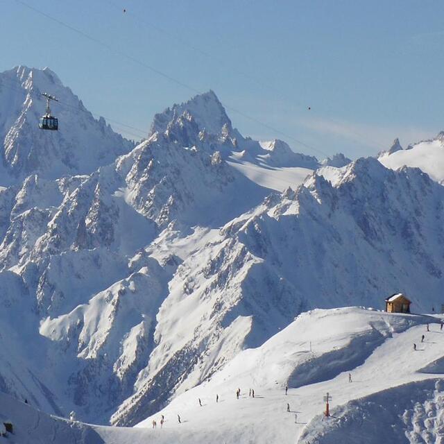
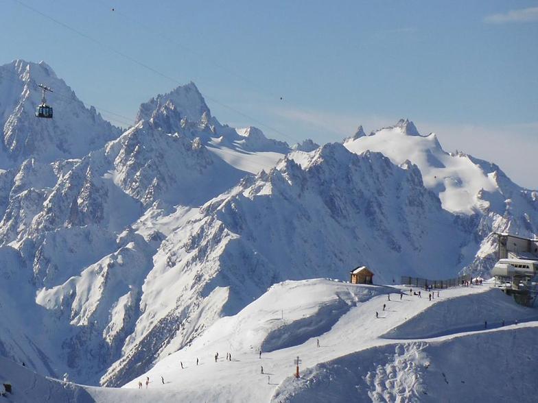
The above table gives the weather forecast for La Tzoumaz at the specific elevation of 1927 m. Our sophisticated weather models allow us to provide snow forecasts for the top, middle and bottom ski stations of La Tzoumaz. To access the weather forecasts for the other elevations, use the tab navigation above the table. For a wider view of the weather, check out the Weather Map of Switzerland.
Click here to read further information on freezing levels and how we forecast our temperatures.
Overall 4.0 Based on 15 votes and 11 reviews
I bought an apartment here a couple of years ago and have spent quite a lot of time in the resort as I live in Switzerland. Overall, amazing skiing. You can get to the Verbier snow faster than the people who are staying in Verbier itself. As the other reviewers say, mainly set up for families in self-catering accommodation. A great little place, nice atmosphere, no need to wear a fur coat like you need to do in Verbier. The guys are chilled out and very open. Mainly Brits, Dutch and Belgians. Skiing on the La Tzoumaz side is great as there a some nice runs to the village (but nothing like the amazing Verbier routes). There are a few bars. On the piste there is the bar Etablons at the roundabout on the way back home, there is a bar/nightclub Vitho that can get busy. Best food to be had at Hotel de la Poste; you will get to know the boss Pascal and the staff well! There is also a bar for food/drinks that the locals use (Les Trappeurs) that is a nice sun-trap in the morning. Getting there: Best by car as the transport links there are a little patchy at best. Train to Riddes, then you can get a cab or hitch-hike to the village. You can take the cable car to the little village Iserables and then get the bus but connections are terrible and you risk getting stranded. You can get a taxi from Riddes oR you can phone your hotel and they can send someone down to pick you up. Another option is to take the train up towards Verbier and then use the ski lifts to get you there (but this will cost a 1/2 day ski pass). Do not get stranded in Verbier as the last lift up is at about 1600 (ish). If there are a few of you, you should rent a car, depending where you fly into. The snow/connections: The village has a free bus that you can use to get around. Otherwise, you can just drive past the ski lift and there is a large, free parking at the very top of the road. There is a fast, modern ski lift to take you up to the top (there is really only one way up) and you can either drop into the Verbier bowl or cruise around the reds and blues and the off-piste runs between them (snow permitting). You can read endless reviews on the yellow-marked trails on other websites (one line of posts, not 2) that you follow down the mountain. Some of the runs are simply stunning and are up there with the best in the world when the snow is good. As normal, the recommendation is not to do this by yourself (think about wearing an avalanche transceiver), but then again if dad can take his 8 year old down here it is not the most extreme. Best time of year: If the snow is there, anytime... but there is a real buzz to the place over Christmas, snow permitting (Verbier itself is rammed.... terrible queues at the lifts on the other side of the mountain). Best snow is normally reserved for Feb but March can be amazing if the snow is there; the sun tends to do some damage to the end of the month. Summer is great also but the lift is normally open from mid July to mid August (but you can hike up the vallon D'Arby for free!) Recommendations: Buy food, in the valley, before getting up the mountain. The little market, in the village, is open 7 days a week, but you pay a premium. If there are enough of you rent a car if you fly to Geneva, it will work out cheaper. Make sure that it has snow tires. If the snow is not perfect, there is a small swimming pool in the village, however, there is an amazing swimming pool at Sion (car drive away). You can walk down to Iserables through the Foret Vert if the snow is gone from May onwards; a nice place but the transport connections are bad (the bus only stops if you call the driver in the summer.) Changes: There has been talk of a new chairlift from Verbier to the top of the mountain (the way back, for those not taking the Vallon d'Arby run). This is held up as there are some hold-outs on the Verbier side. I hope it stays that way, then La Tzoumaz stays much quieter. There are also some people talking about a new cable-car connection from Riddes (new the DIY store) to La Tzoumaz. This would be nice for Televerbier, but would cost a fortune; don't hold your breath.
Gareth Wilson from Switzerland writes:
I bought an apartment here a couple of years ago and have spent quite a lot of time in the resort as I live in Switzerland.
Overall, amazing skiing. You can get to the Verbier snow faster than the people who are staying in Verbier itself. As the other reviewers say, mainly set up for families in self-catering accommodation. A great little place, nice atmosphere, no need to wear a fur coat like you need to do in Verbier. The guys are chilled out and very open. Mainly Brits, Dutch and Belgians. Skiing on the La Tzoumaz side is great as there a some nice runs to the village (but nothing like the amazing Verbier routes).
There are a few bars. On the piste there is the bar Etablons at the roundabout on the way back home, there is a bar/nightclub Vitho that can get busy. Best food to be had at Hotel de la Poste; you will get to know the boss Pascal and the staff well! There is also a bar for food/drinks that the locals use (Les Trappeurs) that is a nice sun-trap in the morning.
Getting there:
Best by car as the transport links there are a little patchy at best. Train to Riddes, then you can get a cab or hitch-hike to the village. You can take the cable car to the little village Iserables and then get the bus but connections are terrible and you risk getting stranded. You can get a taxi from Riddes oR you can phone your hotel and they can send someone down to pick you up.
Another option is to take the train up towards Verbier and then use the ski lifts to get you there (but this will cost a 1/2 day ski pass). Do not get stranded in Verbier as the last lift up is at about 1600 (ish). If there are a few of you, you should rent a car, depending where you fly into.
The snow/connections:
The village has a free bus that you can use to get around. Otherwise, you can just drive past the ski lift and there is a large, free parking at the very top of the road. There is a fast, modern ski lift to take you up to the top (there is really only one way up) and you can either drop into the Verbier bowl or cruise around the reds and blues and the off-piste runs between them (snow permitting). You can read endless reviews on the yellow-marked trails on other websites (one line of posts, not 2) that you follow down the mountain. Some of the runs are simply stunning and are up there with the best in the world when the snow is good. As normal, the recommendation is not to do this by yourself (think about wearing an avalanche transceiver), but then again if dad can take his 8 year old down here it is not the most extreme.
Best time of year:
If the snow is there, anytime... but there is a real buzz to the place over Christmas, snow permitting (Verbier itself is rammed.... terrible queues at the lifts on the other side of the mountain). Best snow is normally reserved for Feb but March can be amazing if the snow is there; the sun tends to do some damage to the end of the month. Summer is great also but the lift is normally open from mid July to mid August (but you can hike up the vallon D'Arby for free!)
Recommendations:
Buy food, in the valley, before getting up the mountain. The little market, in the village, is open 7 days a week, but you pay a premium.
If there are enough of you rent a car if you fly to Geneva, it will work out cheaper. Make sure that it has snow tires.
If the snow is not perfect, there is a small swimming pool in the village, however, there is an amazing swimming pool at Sion (car drive away).
You can walk down to Iserables through the Foret Vert if the snow is gone from May onwards; a nice place but the transport connections are bad (the bus only stops if you call the driver in the summer.)
Changes:
There has been talk of a new chairlift from Verbier to the top of the mountain (the way back, for those not taking the Vallon d'Arby run). This is held up as there are some hold-outs on the Verbier side. I hope it stays that way, then La Tzoumaz stays much quieter.
There are also some people talking about a new cable-car connection from Riddes (new the DIY store) to La Tzoumaz. This would be nice for Televerbier, but would cost a fortune; don't hold your breath.
The La Tzoumaz skiing weather widget is available to embed on external websites free of charge. It provides a daily summary of our La Tzoumaz snow forecast and current weather conditions. Simply go to the feed configuration page and follow the 3 simple steps to grab the custom html code snippet and paste it into your own site. You can choose the snow forecast elevation (summit, mid-mountain or bottom lift) and metric/imperial units for the snow forecast feed to suit your own website…. Click here to get the code.
View detailed snow forecast for La Tzoumaz at:
snow-forecast.com


 Nearest