

French Ski Areas Announce 2025 Summer Ski Plans
Three French ski areas have announced their opening plans in May, June and July after the winter season ends on May 4th.
Please sign in with your Snow-Forecast account details below.


Kaprun Weather (Next 3 days): The snow forecast for Kaprun is: Light rain (total 4.0mm), mostly falling on Thu night. Mild temperatures (max 8°C on Wed morning, min 3°C on Thu night). Wind will be generally light.
Kaprun Weather (Days 4-6): Mild with light rain (total 5.0mm) on Fri morning Becoming colder with a light covering of snow, mostly falling on Sun afternoon. Freeze-thaw conditions (max 8°C on Fri afternoon, min -1°C on Sun morning). Wind will be generally light.
| Resort | Snow Depth | Temp. (°C) | Wind (km/h) | Weather | ||
|---|---|---|---|---|---|---|
| Top Lift: | 2.3 m | 0 | ||||
| Middle Lift: | 4 | |||||
| Bottom Lift: | 8 |
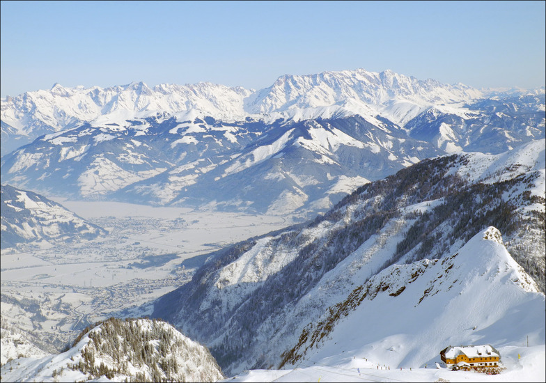
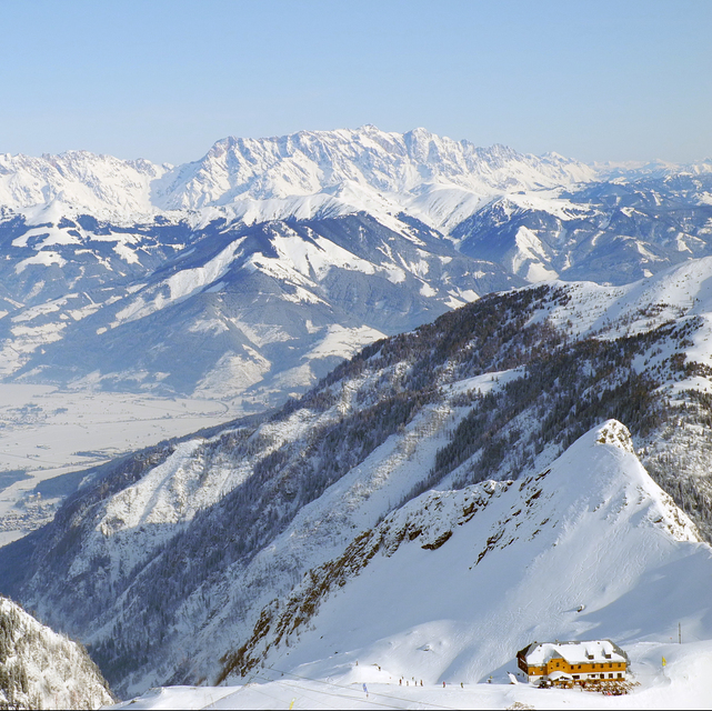
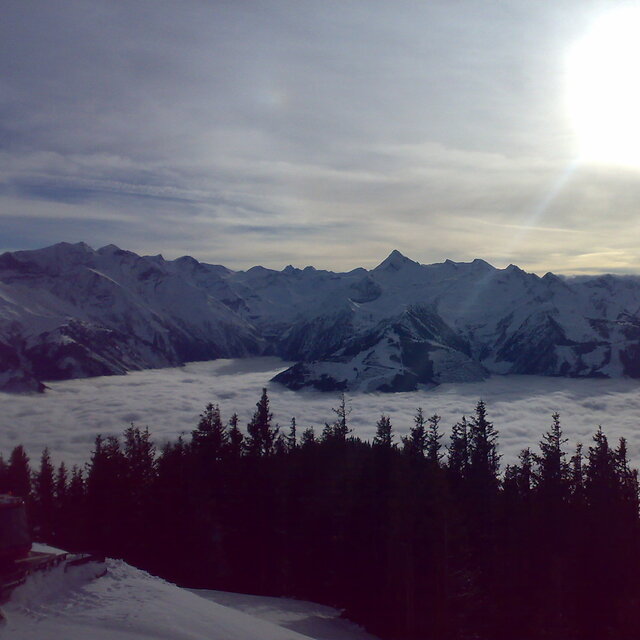
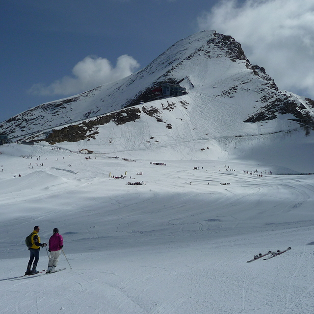
Latest snow reports near Kaprun:
For Ellmau: All lifts are closed. No pistes are open. from Ellmau

Tuesday 15 | Wednesday 16 | Thursday 17 | Friday 18 | Saturday 19 | Sunday 20 | Monday 21 | |||||||||||||||
AM | PM | night | AM | PM | night | AM | PM | night | AM | PM | night | AM | PM | night | AM | PM | night | AM | PM | night | |
some clouds | some clouds | some clouds | some clouds | some clouds | some clouds | some clouds | light rain | rain shwrs | light rain | cloudy | some clouds | clear | cloudy | light snow | light snow | light snow | cloudy | some clouds | cloudy | cloudy | |
km/h | |||||||||||||||||||||
Snow map |  |  |  |  |  |  |  | ||||||||||||||
— | — | — | — | — | — | — | — | — | — | — | — | — | — | — | 2.0 | 3 | — | — | — | — | |
— | — | — | — | — | — | — | 1.0 | 3 | 5 | — | — | — | — | — | — | — | — | — | — | — | |
max°C | 5 | 6 | 5 | 8 | 8 | 5 | 7 | 8 | 5 | 5 | 8 | 5 | 7 | 8 | 5 | -1 | 0 | 0 | 3 | 5 | 2 |
min°C | 4 | 5 | 4 | 5 | 8 | 4 | 5 | 7 | 3 | 3 | 7 | 3 | 4 | 8 | 0 | -1 | -1 | -1 | 1 | 4 | 0 |
0 | 2 | 1 | 2 | 5 | 0 | 2 | 5 | 1 | 1 | 5 | 1 | 2 | 6 | 0 | -1 | -1 | -4 | -2 | 2 | -3 | |
81 | 82 | 64 | 49 | 53 | 78 | 76 | 77 | 83 | 79 | 56 | 78 | 55 | 56 | 93 | 99 | 99 | 95 | 67 | 74 | 83 | |
2800 | 2900 | 3200 | 3200 | 3100 | 2900 | 3000 | 2900 | 2750 | 2700 | 2900 | 2850 | 2950 | 2950 | 2200 | 1800 | 1900 | 1950 | 2350 | 2500 | 2100 | |
6:22 | — | — | 6:20 | — | — | 6:18 | — | — | 6:16 | — | — | 6:13 | — | — | 6:11 | — | — | 6:09 | — | — | |
— | 7:57 | — | — | 7:58 | — | — | 7:59 | — | — | — | 8:00 | — | — | 8:01 | — | — | 8:04 | — | — | 8:05 | |
Light rain (total 4.0mm), mostly falling on Thu night. Mild temperatures (max 8°C on Wed morning, min 3°C on Thu night). Wind will be generally light.
Mild with light rain (total 5.0mm) on Fri morning Becoming colder with a light covering of snow, mostly falling on Sun afternoon. Freeze-thaw conditions (max 8°C on Fri afternoon, min -1°C on Sun morning). Wind will be generally light.
Latest snow reports near Kaprun:
For Ellmau: All lifts are closed. No pistes are open. from Ellmau
| Top snow depth: | 230 cm |
|---|---|
| Bottom snow depth: | — |
| Fresh snowfall depth: | — |
| Last snowfall: | 5 Apr 2025 |
| Snow Alerts | Create Alert |
0.5 | Bluebird Powder days Fresh snow, mostly sunny, light wind. |
|---|---|
1.3 | Powder days Fresh snow, limited sun, any wind. |
0.6 | Bluebird days Average snow, mostly sunny, light wind. |
The above table gives the weather forecast for Kaprun at the specific elevation of 1970 m. Our sophisticated weather models allow us to provide snow forecasts for the top, middle and bottom ski stations of Kaprun. To access the weather forecasts for the other elevations, use the tab navigation above the table. For a wider view of the weather, check out the Weather Map of Austria.
Click here to read further information on freezing levels and how we forecast our temperatures.
Overall 4.1 Based on 18 votes and 29 reviews
There is extensive skiing at Kaprun with excellent slopes for all skill levels. My only concern was the very high speeds that many people were skiing at. It was frankly dangerous. There is no way this would be permitted in North America. Something needs to be done about it. We are aware of one fatality that occurred 2 weeks before we holidayed there.
Jonathan Mann from United Kingdom writes:
There is extensive skiing at Kaprun with excellent slopes for all skill levels. My only concern was the very high speeds that many people were skiing at. It was frankly dangerous. There is no way this would be permitted in North America. Something needs to be done about it. We are aware of one fatality that occurred 2 weeks before we holidayed there.
The Kaprun skiing weather widget is available to embed on external websites free of charge. It provides a daily summary of our Kaprun snow forecast and current weather conditions. Simply go to the feed configuration page and follow the 3 simple steps to grab the custom html code snippet and paste it into your own site. You can choose the snow forecast elevation (summit, mid-mountain or bottom lift) and metric/imperial units for the snow forecast feed to suit your own website…. Click here to get the code.
View detailed snow forecast for Kaprun at:
snow-forecast.com


 Nearest