

French Ski Areas Announce 2025 Summer Ski Plans
Three French ski areas have announced their opening plans in May, June and July after the winter season ends on May 4th.
Please sign in with your Snow-Forecast account details below.

Grainau Weather (Next 3 days): The snow forecast for Grainau is: Mostly dry. Freeze-thaw conditions (max 2°C on Mon night, min -2°C on Sun night). Wind will be generally light.
Grainau Weather (Days 4-6): A dusting of new snow. Temperatures will be below freezing (max -1°C on Wed night, min -5°C on Thu night). Wind will be generally light.
| Resort | Snow Depth | Temp. (°C) | Wind (km/h) | Weather | ||
|---|---|---|---|---|---|---|
| Top Lift: | -1 | |||||
| Middle Lift: | 3 | |||||
| Bottom Lift: | 6 |
Latest snow reports near Grainau:

Monday 14 | Tuesday 15 | Wednesday 16 | Thursday 17 | Friday 18 | Saturday 19 | ||||||||||||||
night | AM | PM | night | AM | PM | night | AM | PM | night | AM | PM | night | AM | PM | night | AM | PM | night | |
light snow | cloudy | cloudy | cloudy | cloudy | snow shwrs | clear | some clouds | snow shwrs | light snow | light snow | light snow | light snow | light snow | cloudy | some clouds | some clouds | light snow | light snow | |
km/h | |||||||||||||||||||
Snow map |  |  |  |  |  |  |  | ||||||||||||
— | — | — | — | — | — | — | — | — | — | 1.0 | — | — | — | — | — | — | — | 2.0 | |
— | — | — | — | — | — | — | — | — | — | — | — | — | — | — | — | — | — | — | |
max°C | -1 | -1 | -1 | 2 | 0 | -1 | 2 | 0 | 0 | -1 | -2 | -2 | -4 | -4 | -3 | -1 | -2 | -2 | -2 |
min°C | -2 | -2 | -1 | 1 | -1 | -1 | 0 | 0 | 0 | -2 | -2 | -3 | -5 | -5 | -3 | -2 | -2 | -2 | -4 |
-4 | -4 | -4 | -3 | -4 | -4 | -4 | -4 | -4 | -7 | -7 | -7 | -5 | -9 | -8 | -4 | -8 | -5 | -8 | |
96 | 75 | 90 | 60 | 89 | 94 | 37 | 64 | 80 | 99 | 100 | 100 | 99 | 99 | 98 | 80 | 50 | 95 | 68 | |
2500 | 2650 | 2750 | 3150 | 2700 | 2750 | 3200 | 2850 | 2900 | 2250 | 1650 | 1550 | 1450 | 1550 | 2000 | 2400 | 2550 | 2600 | 2400 | |
— | 6:30 | — | — | 6:28 | — | — | 6:26 | — | — | 6:24 | — | — | 6:22 | — | — | 6:20 | — | — | |
— | — | — | 8:02 | — | — | 8:04 | — | — | 8:05 | — | — | 8:07 | — | — | 8:07 | — | — | 8:09 | |
Mostly dry. Freeze-thaw conditions (max 2°C on Mon night, min -2°C on Sun night). Wind will be generally light.
A dusting of new snow. Temperatures will be below freezing (max -1°C on Wed night, min -5°C on Thu night). Wind will be generally light.
Latest snow reports near Grainau:
| Top snow depth: | — |
|---|---|
| Bottom snow depth: | — |
| Fresh snowfall depth: | — |
| Last snowfall: | 1 Apr 2025 |
| Snow Alerts | Create Alert |
0.7 | Bluebird Powder days Fresh snow, mostly sunny, light wind. |
|---|---|
1.8 | Powder days Fresh snow, limited sun, any wind. |
1.6 | Bluebird days Average snow, mostly sunny, light wind. |
The above table gives the weather forecast for Grainau at the specific elevation of 2831 m. Our sophisticated weather models allow us to provide snow forecasts for the top, middle and bottom ski stations of Grainau. To access the weather forecasts for the other elevations, use the tab navigation above the table. For a wider view of the weather, check out the Weather Map of Germany.
Click here to read further information on freezing levels and how we forecast our temperatures.
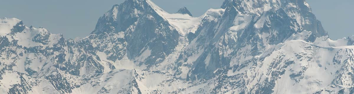
I have been to Grainau every year for the last 6 years and the prices never change. There's never a price rise. We pay around 70 euros a night for 4 people and if you try and find a cheaper room so close to a major ski area you're going to have a problem. Grainau is a small sleepy village 5 mins up the road from Garmisch and it's only a train ride away from the Zugspitze, the highest mountain in Germany. The skiing up there is amazing with crisp snow and the feeling of a true French Alpine resort. But you better get used to T-bars as that's pretty much all there is up there. The classic area is much more German with tree lined slopes, loud Euro pop coming out of Garmisher Hause and the millions spent on the lifts cable cars and snow makeing has made it all the better. Access to Grainau is suprisingly easy with Munich being only an hour drive and with it being right on the edge of the Alps there aren't any mountain passes to deal with.
frazer attrill from United Kingdom writes:
I have been to Grainau every year for the last 6 years and the prices never change. There's never a price rise. We pay around 70 euros a night for 4 people and if you try and find a cheaper room so close to a major ski area you're going to have a problem. Grainau is a small sleepy village 5 mins up the road from Garmisch and it's only a train ride away from the Zugspitze, the highest mountain in Germany. The skiing up there is amazing with crisp snow and the feeling of a true French Alpine resort. But you better get used to T-bars as that's pretty much all there is up there. The classic area is much more German with tree lined slopes, loud Euro pop coming out of Garmisher Hause and the millions spent on the lifts cable cars and snow makeing has made it all the better. Access to Grainau is suprisingly easy with Munich being only an hour drive and with it being right on the edge of the Alps there aren't any mountain passes to deal with.
The Grainau skiing weather widget is available to embed on external websites free of charge. It provides a daily summary of our Grainau snow forecast and current weather conditions. Simply go to the feed configuration page and follow the 3 simple steps to grab the custom html code snippet and paste it into your own site. You can choose the snow forecast elevation (summit, mid-mountain or bottom lift) and metric/imperial units for the snow forecast feed to suit your own website…. Click here to get the code.
View detailed snow forecast for Grainau at:
snow-forecast.com


 Nearest