The above table gives the weather forecast for Aussois at the specific elevation of 2750 m. Our sophisticated weather models allow us to provide snow forecasts for the top, middle and bottom ski stations of Aussois. To access the weather forecasts for the other elevations, use the tab navigation above the table. For a wider view of the weather, check out the Weather Map of France.
Click here to read further information on freezing levels and how we forecast our temperatures.
Been to Aussois twice, just came back (Jan 2012). The only other resort I've been to is Garmisch-Partenkirchen (also twice).
I am a beginner skier. The ski instruction was excellent (private lessons from ESF guy named Denis; taught me well)! You can have English instruction as I did.
Some have already commented it is great for families - I would have to agree very much. I have a 6 y/o and 4 y/o that enrolled in the ski school there - it is amazing to see my 6 y/o skiing now (she has attended the school on three occasions).
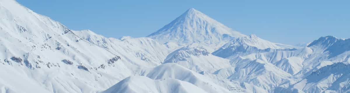
The atmosphere is small town for sure! If you appreciate a place off the beaten path for a genuine Alps feel, while also having everything you need well within reach, this is great! The views are breath-taking. Fantastic - and not bustling, fast-paced, dodgy. Really, you can bring the kids and feel at ease!
I reference my brochure now (I just returned from Aussois) - there are 5 "very difficult", 7 "difficult", 6 "intermediate level", and 6 "easy" pistes at this resort.
At welcome center for skiing, English help avail, but with any vacation in France don't expect everyone to speak English (like Germany or NL). During my visit there were mostly Italian and Dutch tourists, so language should not be a hang up. I encountered less than five native English speakers in the whole week - that may be a plus for some wanting a "get away."
We stayed in a caravan camping area "La Bouidonerre" - anyway look up info if you have a caravan to travel and love skiing and family it is great! Can't speak for hotels but clearly there are plenty places to stay there judging on what I saw traveling by the bus. The bus is great - but it can get packed - not to worry the bus drivers know what they are doing - but it can get crammed some.
Been to Aussois twice, just came back (Jan 2012). The only other resort I've been to is Garmisch-Partenkirchen (also twice).
I am a beginner skier. The ski instruction was excellent (private lessons from ESF guy named Denis; taught me well)! You can have English instruction as I did.
Some have already commented it is great for families - I would have to agree very much. I have a 6 y/o and 4 y/o that enrolled in the ski school there - it is amazing to see my 6 y/o skiing now (she has attended the school on three occasions).
The atmosphere is small town for sure! If you appreciate a place off the beaten path for a genuine Alps feel, while also having everything you need well within reach, this is great! The views are breath-taking. Fantastic - and not bustling, fast-paced, dodgy. Really, you can bring the kids and feel at ease!
I reference my brochure now (I just returned from Aussois) - there are 5 "very difficult", 7 "difficult", 6 "intermediate level", and 6 "easy" pistes at this resort.
At welcome center for skiing, English help avail, but with any vacation in France don't expect everyone to speak English (like Germany or NL). During my visit there were mostly Italian and Dutch tourists, so language should not be a hang up. I encountered less than five native English speakers in the whole week - that may be a plus for some wanting a "get away."
We stayed in a caravan camping area "La Bouidonerre" - anyway look up info if you have a caravan to travel and love skiing and family it is great! Can't speak for hotels but clearly there are plenty places to stay there judging on what I saw traveling by the bus. The bus is great - but it can get packed - not to worry the bus drivers know what they are doing - but it can get crammed some.
Free Snow-Forecast.com weather widget for your website
Embed the Aussois weather widget on your site for free. It provides a weekly snapshot of snow and rain conditions across all elevations. Follow the two quick steps to grab your custom code and paste it into your site. Choose between metric or imperial units. Click here to get the code.


 Nearest