

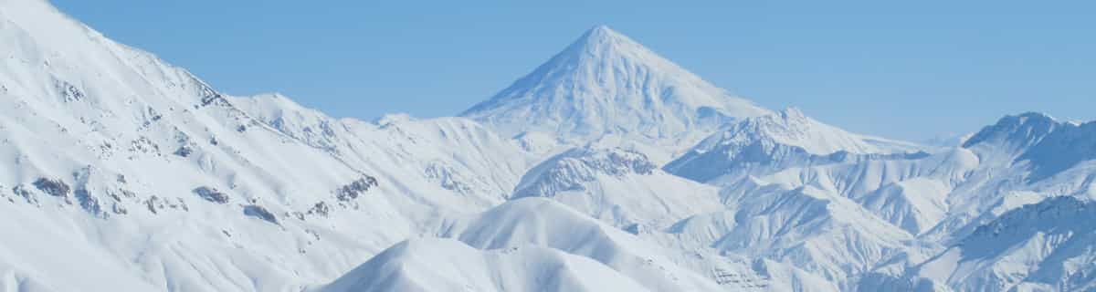
Massive Snowfall in the Alps
A huge snowfall is underway in the Alps, by far the biggest of the 24-25 season.
Please sign in with your Snow-Forecast account details below.

Aussois Weather (Next 3 days): The snow forecast for Aussois is: Drizzle at first, then turning colder with dusting of snow on Sat night. Freeze-thaw conditions (max 3°C on Fri afternoon, min -1°C on Sun night). Wind will be generally light.
Aussois Weather (Days 4-6): Mild with moderate rain (total 14.0mm) on Wed night, Becoming colder with a light covering of snow, mostly falling on Thu morning. Freeze-thaw conditions (max 6°C on Wed afternoon, min -1°C on Thu morning). Wind will be generally light.
| Resort | Snow Depth | Temp. (°C) | Wind (km/h) | Weather | ||
|---|---|---|---|---|---|---|
| Top Lift: | 0.0 m | -1 | ||||
| Middle Lift: | 3 | |||||
| Bottom Lift: | 0.0 m | 5 |
Latest snow reports near Aussois:
Powder day!. Another glorious day. from Val Thorens
Snowing at a moderate rate at La Rosière. from La Rosière
It is snowing steadily at Val Thorens. from Val Thorens
Snow is falling in Val Thorens. from Val Thorens

Fri 18 | Saturday 19 | Sunday 20 | Monday 21 | Tuesday 22 | Wednesday 23 | Thursday 24 | ||||||||||||||
PM | night | AM | PM | night | AM | PM | night | AM | PM | night | AM | PM | night | AM | PM | night | AM | PM | night | |
cloudy | some clouds | cloudy | light snow | light snow | light snow | cloudy | light snow | cloudy | light rain | light snow | light snow | light rain | light rain | some clouds | light rain | light snow | mod. snow | light snow | light snow | |
km/h | ||||||||||||||||||||
Snow map |  |  |  |  |  |  |  | |||||||||||||
— | — | — | — | 2.0 | 1.0 | — | — | — | — | 1.0 | 1.0 | — | — | — | — | 1.0 | 7 | — | 1.0 | |
— | — | — | 1.0 | — | — | — | — | — | 2.0 | 1.0 | — | 2.0 | 1.0 | — | 3 | 5 | — | — | — | |
max°C | 3 | 2 | 2 | 2 | 1 | 0 | 1 | 0 | 1 | 3 | 2 | 2 | 3 | 2 | 4 | 6 | 4 | -1 | 0 | -1 |
min°C | 3 | 0 | 1 | 2 | 0 | 0 | 1 | -1 | 0 | 3 | 1 | 2 | 3 | 2 | 2 | 6 | 1 | -1 | 0 | -1 |
1 | -3 | -2 | -1 | -4 | -3 | -2 | -3 | 0 | 3 | 0 | 1 | 3 | 2 | 2 | 5 | -2 | -4 | -3 | -5 | |
66 | 71 | 90 | 94 | 93 | 76 | 76 | 94 | 89 | 94 | 99 | 96 | 97 | 93 | 78 | 67 | 93 | 94 | 90 | 95 | |
2850 | 2550 | 2400 | 2400 | 2250 | 2200 | 2300 | 2000 | 2300 | 2550 | 2400 | 2400 | 2550 | 2450 | 2600 | 2850 | 2400 | 2000 | 2100 | 2000 | |
— | — | 6:41 | — | — | 6:39 | — | — | 6:37 | — | — | 6:37 | — | — | 6:35 | — | — | 6:33 | — | — | |
— | 8:21 | — | — | 8:22 | — | — | 8:23 | — | — | 8:24 | — | — | 8:25 | — | — | 8:28 | — | — | 8:29 | |
Drizzle at first, then turning colder with dusting of snow on Sat night. Freeze-thaw conditions (max 3°C on Fri afternoon, min -1°C on Sun night). Wind will be generally light.
Mild with moderate rain (total 14.0mm) on Wed night, Becoming colder with a light covering of snow, mostly falling on Thu morning. Freeze-thaw conditions (max 6°C on Wed afternoon, min -1°C on Thu morning). Wind will be generally light.
Latest snow reports near Aussois:
Powder day!. Another glorious day. from Val Thorens
Snowing at a moderate rate at La Rosière. from La Rosière
It is snowing steadily at Val Thorens. from Val Thorens
Snow is falling in Val Thorens. from Val Thorens
| Top snow depth: | 0 cm |
|---|---|
| Bottom snow depth: | 0 cm |
| Fresh snowfall depth: | 93 cm |
| Last snowfall: | 17 Apr 2025 |
| Snow Alerts | Create Alert |
0.3 | Bluebird Powder days Fresh snow, mostly sunny, light wind. |
|---|---|
0.8 | Powder days Fresh snow, limited sun, any wind. |
0.6 | Bluebird days Average snow, mostly sunny, light wind. |
The above table gives the weather forecast for Aussois at the specific elevation of 2125 m. Our sophisticated weather models allow us to provide snow forecasts for the top, middle and bottom ski stations of Aussois. To access the weather forecasts for the other elevations, use the tab navigation above the table. For a wider view of the weather, check out the Weather Map of France.
Click here to read further information on freezing levels and how we forecast our temperatures.
Overall 4.0 Based on 8 votes and 4 reviews
Just got back from Aussois for a 5 day mini holiday with very young family. My 2 boys loved the nursery in the morning while my wife and I skied. Then had great family time in the afternoon. Great value, lovely people. The only thing a little odd was the pizzeria and creperie next to the mainlift didn't sell pizzas or crepes. Would definitely go back.
Jon Partridge from United Kingdom writes:
Just got back from Aussois for a 5 day mini holiday with very young family. My 2 boys loved the nursery in the morning while my wife and I skied. Then had great family time in the afternoon. Great value, lovely people. The only thing a little odd was the pizzeria and creperie next to the mainlift didn't sell pizzas or crepes.
Would definitely go back.
The Aussois skiing weather widget is available to embed on external websites free of charge. It provides a daily summary of our Aussois snow forecast and current weather conditions. Simply go to the feed configuration page and follow the 3 simple steps to grab the custom html code snippet and paste it into your own site. You can choose the snow forecast elevation (summit, mid-mountain or bottom lift) and metric/imperial units for the snow forecast feed to suit your own website…. Click here to get the code.
View detailed snow forecast for Aussois at:
snow-forecast.com


 Nearest