

Tignes Unlimited Festival Into May
Tignes, one of the few French ski areas staying open into May, will round off the 2025–26 winter season with the return of the Tignes Unlimited electronic music festival, running from 25 April to 3 May 2026.

Next 3 days weather summary:Mostly dry. Freeze-thaw conditions (max 3°C on Thu afternoon, min -5°C on Tue night). Wind will be generally light. | Days 4-6 weather summary:Some drizzle, heaviest during Sun night. Mild temperatures (max 7°C on Sun afternoon, min 2°C on Sat night). Wind will be generally light. | |||||||||||||||||
Tuesday 21 | Wednesday 22 | Thursday 23 | Friday 24 | Saturday 25 | Sunday 26 | |||||||||||||
AM | PM | night | AM | PM | night | AM | PM | night | AM | PM | night | AM | PM | night | AM | PM | night | |
clear | snow shwrs | snow shwrs | clear | some clouds | snow shwrs | clear | clear | clear | clear | clear | clear | clear | some clouds | clear | clear | some clouds | rain shwrs | |
km/h | ||||||||||||||||||
Snow map |  |  |  |  |  |  | ||||||||||||
— | — | — | — | — | — | — | — | — | — | — | — | — | — | — | — | — | — | |
— | — | — | — | — | — | — | — | — | — | — | — | — | — | — | — | — | 1 | |
max °C | -3 | -1 | -3 | -3 | -1 | -2 | 0 | 3 | 2 | 4 | 6 | 4 | 5 | 6 | 4 | 5 | 7 | 4 |
min °C | -4 | -2 | -5 | -5 | -1 | -3 | -1 | 3 | 1 | 3 | 6 | 4 | 4 | 6 | 2 | 3 | 7 | 2 |
-7 | -5 | -5 | -5 | -3 | -5 | -4 | 1 | -2 | 1 | 6 | 2 | 3 | 6 | 0 | 1 | 7 | 1 | |
66 | 42 | 62 | 41 | 45 | 41 | 18 | 26 | 13 | 11 | 25 | 20 | 17 | 32 | 41 | 28 | 41 | 79 | |
2200 | 2450 | 1550 | 2200 | 2500 | 2000 | 2650 | 2950 | 2900 | 3150 | 3400 | 3350 | 3250 | 3400 | 3100 | 3150 | 3450 | 2950 | |
6:18 | — | — | 6:16 | — | — | 6:15 | — | — | 6:13 | — | — | 6:11 | — | — | 6:09 | — | — | |
— | — | 8:10 | — | — | 8:13 | — | — | 8:14 | — | — | 8:15 | — | — | 8:16 | — | — | 8:17 | |
Latest snow reports near Val Senales (Schnalstal):
| Top snow depth: | 140 cm |
|---|---|
| Bottom snow depth: | 20 cm |
| Fresh snowfall depth: | 3 cm |
| Last snowfall: | 19 Apr 2026 |
| Snow Alerts | Create Alert |
1.2 | Bluebird Powder days Fresh snow, mostly sunny, light wind. |
|---|---|
1.7 | Powder days Fresh snow, limited sun, any wind. |
1.7 | Bluebird days Average snow, mostly sunny, light wind. |
The above table gives the weather forecast for Val Senales (Schnalstal) at the specific elevation of 2600 m. Our sophisticated weather models allow us to provide snow forecasts for the top, middle and bottom ski stations of Val Senales (Schnalstal). To access the weather forecasts for the other elevations, use the tab navigation above the table. For a wider view of the weather, check out the Weather Map of Italy.
Click here to read further information on freezing levels and how we forecast our temperatures.
Resort name is also written as Val Senales.
Overall 4.4 Based on 15 votes and 2 reviews
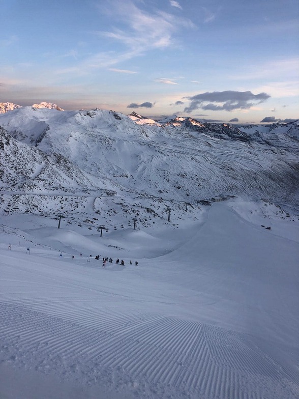
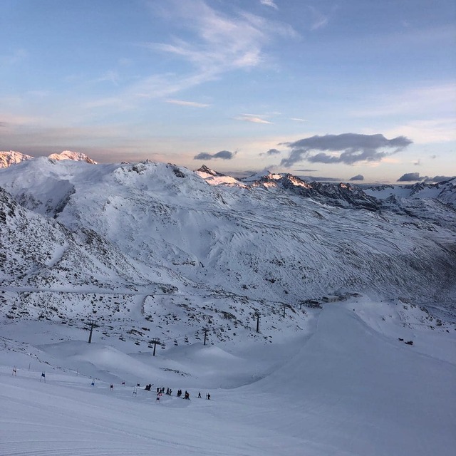
Fantastic location with good weather. I come to Val Senales to ski every season and it's an absolute pleasure to ski down without stopping from 3200 to 2100 m, one of my favourite slopes. I remember skiing there in the late 70's. The glacier was much bigger but still today you ski within unique scenery. Avoid Val Senales with bad weather, wind can be very strong and lift could be closed. As well you will find top conditions until end of season beginning of May.
Massimo Anselmi from Italy writes:
Fantastic location with good weather. I come to Val Senales to ski every season and it's an absolute pleasure to ski down without stopping from 3200 to 2100 m, one of my favourite slopes. I remember skiing there in the late 70's. The glacier was much bigger but still today you ski within unique scenery. Avoid Val Senales with bad weather, wind can be very strong and lift could be closed. As well you will find top conditions until end of season beginning of May.
Read 1 more reviews of Val Senales (Schnalstal) or submit your own


 Nearest