
Ski Hire by Skiset
extra 5% off


Thollon les Mémises Weather (Next 3 days): The snow forecast for Thollon les Mémises is: A light fall of snow, heaviest on Thu afternoon. Turning milder with light rain (total 7.0mm) on Sat night. Freeze-thaw conditions (max 5°C on Sun morning, min -2°C on Thu afternoon). Wind will be generally light.
Thollon les Mémises Weather (Days 4-6): Mild with heavy rain (total 26.0mm), heaviest during Mon afternoon. Becoming colder with a moderate fall of snow heaviest on Mon afternoon. Freeze-thaw conditions (max 6°C on Sun afternoon, min -1°C on Tue morning). Wind will be generally light.
| Resort | Snow Depth | Temp. (°C) | Wind (km/h) | Weather | ||
|---|---|---|---|---|---|---|
| Top Lift: | 0.0 m | -1 | ||||
| Middle Lift: | 1 | |||||
| Bottom Lift: | 0.0 m | 4 |
Latest snow reports near Thollon les Mémises:
Continuous moderate rain reported from Aigle at 479 metres elevation 7 kms WSW of Leysin but it is forecast cold enough for snow at higher elevations in the ski area from Leysin
Continuous light rain reported from Aigle at 479 metres elevation 7 kms WSW of Leysin but it is forecast cold enough for snow at higher elevations in the ski area from Leysin

Thu 2 | Friday 3 | Saturday 4 | Sunday 5 | Monday 6 | Tuesday 7 | Wednesday 8 | ||||||||||||||
PM | night | AM | PM | night | AM | PM | night | AM | PM | night | AM | PM | night | AM | PM | night | AM | PM | night | |
mod. snow | mod. snow | light snow | light snow | light snow | cloudy | light rain | mod. rain | cloudy | light rain | light rain | mod. rain | light snow | light snow | snow shwrs | snow shwrs | snow shwrs | some clouds | some clouds | clear | |
km/h | ||||||||||||||||||||
Snow map |  |  |  |  |  |  |  | |||||||||||||
7 | 5 | — | — | — | — | — | — | — | — | — | — | 3 | 5 | 2.0 | 1.0 | — | — | — | — | |
— | — | — | — | — | — | 1.0 | 6 | — | 4 | 5 | 7 | 10 | — | — | — | — | — | — | — | |
max°C | -1 | -2 | -2 | 0 | 0 | 1 | 3 | 3 | 5 | 6 | 5 | 4 | 2 | 2 | -1 | 0 | 1 | 3 | 4 | 4 |
min°C | -2 | -2 | -2 | -1 | -1 | 0 | 2 | 2 | 3 | 5 | 4 | 3 | 1 | 0 | -1 | 0 | 0 | 1 | 4 | 4 |
-7 | -7 | -4 | -1 | -1 | -4 | -3 | -3 | -2 | 0 | 1 | 0 | -4 | -4 | -5 | -3 | -5 | -4 | 0 | 1 | |
99 | 98 | 93 | 81 | 77 | 69 | 84 | 93 | 81 | 91 | 86 | 98 | 95 | 97 | 94 | 86 | 82 | 76 | 74 | 65 | |
1600 | 1550 | 1650 | 1950 | 1900 | 2250 | 2550 | 2450 | 2700 | 2800 | 2800 | 2650 | 2300 | 2200 | 1900 | 2050 | 2100 | 2600 | 2700 | 3200 | |
— | — | 6:15 | — | — | 6:13 | — | — | 6:11 | — | — | 6:11 | — | — | 6:09 | — | — | 6:07 | — | — | |
— | 8:43 | — | — | 8:45 | — | — | 8:45 | — | — | 8:46 | — | — | 8:49 | — | — | 8:50 | — | — | 8:51 | |
A light fall of snow, heaviest on Thu afternoon. Turning milder with light rain (total 7.0mm) on Sat night. Freeze-thaw conditions (max 5°C on Sun morning, min -2°C on Thu afternoon). Wind will be generally light.
Mild with heavy rain (total 26.0mm), heaviest during Mon afternoon. Becoming colder with a moderate fall of snow heaviest on Mon afternoon. Freeze-thaw conditions (max 6°C on Sun afternoon, min -1°C on Tue morning). Wind will be generally light.
Latest snow reports near Thollon les Mémises:
Continuous moderate rain reported from Aigle at 479 metres elevation 7 kms WSW of Leysin but it is forecast cold enough for snow at higher elevations in the ski area from Leysin
Continuous light rain reported from Aigle at 479 metres elevation 7 kms WSW of Leysin but it is forecast cold enough for snow at higher elevations in the ski area from Leysin
| Top snow depth: | 0 cm |
|---|---|
| Bottom snow depth: | 0 cm |
| Fresh snowfall depth: | — |
| Last snowfall: | 24 Apr 2024 |
| Snow Alerts | Create Alert |
0.3 | Bluebird Powder days Fresh snow, mostly sunny, light wind. |
|---|---|
0.6 | Powder days Fresh snow, limited sun, any wind. |
0.3 | Bluebird days Average snow, mostly sunny, light wind. |
The above table gives the weather forecast for Thollon les Mémises at the specific elevation of 1999 m. Our sophisticated weather models allow us to provide snow forecasts for the top, middle and bottom ski stations of Thollon les Mémises. To access the weather forecasts for the other elevations, use the tab navigation above the table. For a wider view of the weather, check out the Weather Map of France.
Click here to read further information on freezing levels and how we forecast our temperatures.
Resort name is also written as Thollon les Memises.
Overall 3.9 Based on 28 votes and 24 reviews
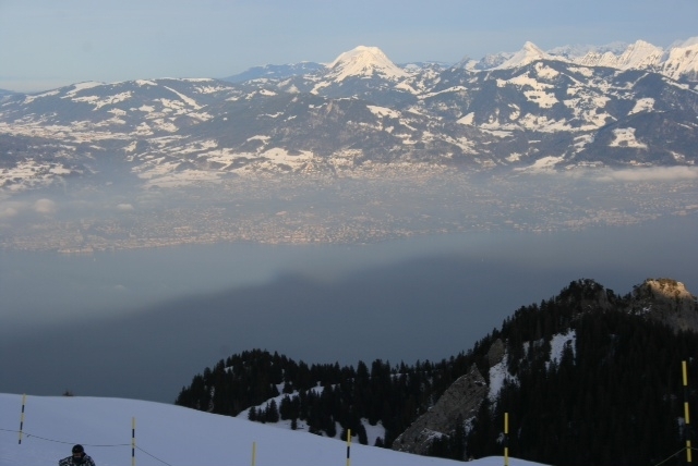
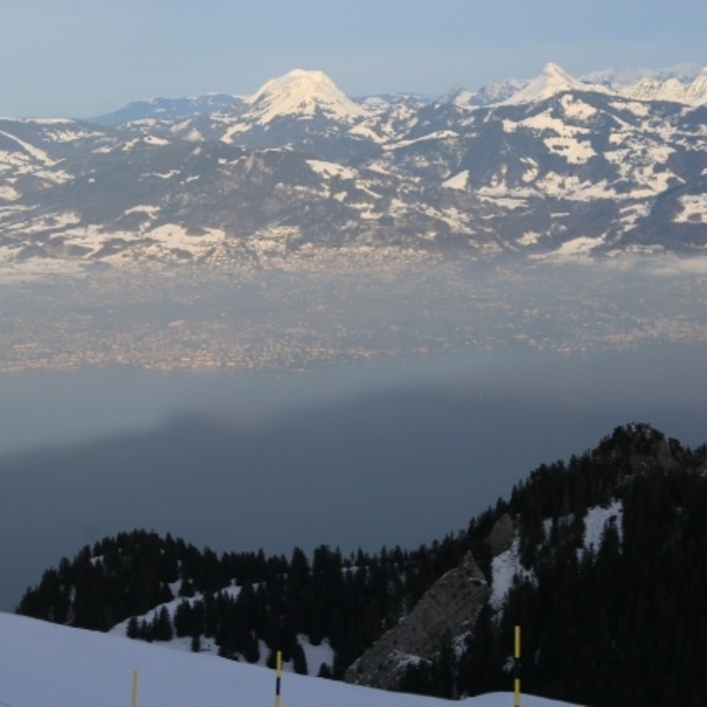
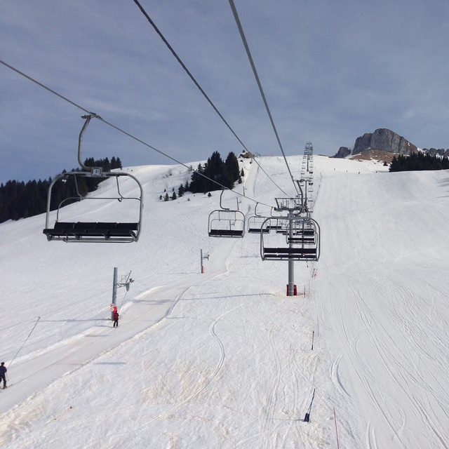
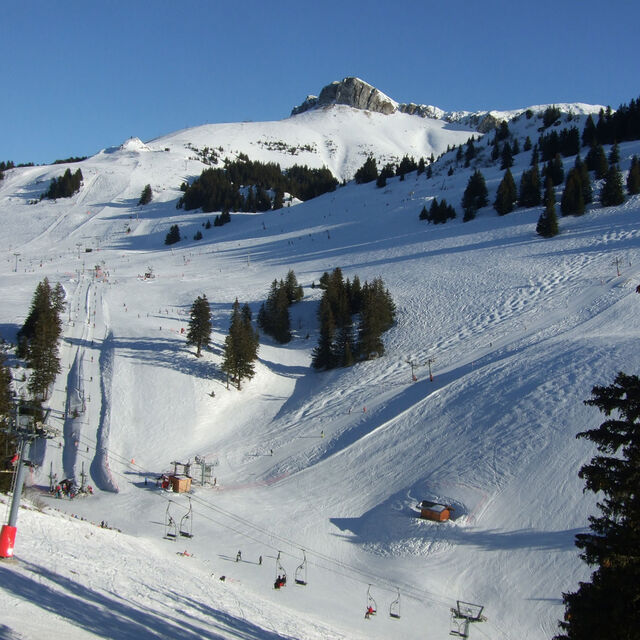
Owned an apartment in Thollon since 1989 and have had wonderful holidays in all seasons. One of the closest resorts to Geneva, it is spectacularly situated overlooking the lake with Bernese Alps and the Jura in the background. The new list systems have made a difference as has the investment in snow making facilities. It has a great ski school and my children started skiing at 4. The views of the lake including Montreaux and Lausanne are really breathtaking from the upper slopes. The runs are generally shortish but the back run is quite magical and the black run down to the village enjoyable for moderate skiers. The village is friendly with some great restaurants especially l’Outa. The artisan bakery is renowned locally. Alternative resorts include Berne's and Chapella d'Abondance some half hour away, Violate (in Switzerland) 50 mins and Avoriaz about 1 hour. We mix and match and enjoy the variety of resorts. Being low down means the roads are always clear to these resorts. Summer is superb as it’s only ten minutes down to the lake. Wonderful walking country as you’re on an off-shoot to the GNR5 long distance footpath.
Gareth Thomas from United Kingdom writes:
Owned an apartment in Thollon since 1989 and have had wonderful holidays in all seasons. One of the closest resorts to Geneva, it is spectacularly situated overlooking the lake with Bernese Alps and the Jura in the background. The new list systems have made a difference as has the investment in snow making facilities. It has a great ski school and my children started skiing at 4. The views of the lake including Montreaux and Lausanne are really breathtaking from the upper slopes. The runs are generally shortish but the back run is quite magical and the black run down to the village enjoyable for moderate skiers. The village is friendly with some great restaurants especially l’Outa. The artisan bakery is renowned locally. Alternative resorts include Berne's and Chapella d'Abondance some half hour away, Violate (in Switzerland) 50 mins and Avoriaz about 1 hour. We mix and match and enjoy the variety of resorts. Being low down means the roads are always clear to these resorts. Summer is superb as it’s only ten minutes down to the lake. Wonderful walking country as you’re on an off-shoot to the GNR5 long distance footpath.
Read 23 more reviews of Thollon les Mémises or submit your own
The Thollon les Mémises skiing weather widget is available to embed on external websites free of charge. It provides a daily summary of our Thollon les Mémises snow forecast and current weather conditions. Simply go to the feed configuration page and follow the 3 simple steps to grab the custom html code snippet and paste it into your own site. You can choose the snow forecast elevation (summit, mid-mountain or bottom lift) and metric/imperial units for the snow forecast feed to suit your own website…. Click here to get the code.
View detailed snow forecast for Thollon les Mémises at:
snow-forecast.com


 Nearest