
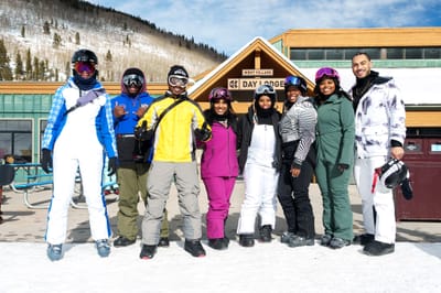
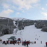
National Brotherhood of Skiers Gather in Colorado
The largest gathering of Black skiers, snowboarders and snowsports enthusiasts in the USA is getting underway in Keystone, Colorado this coming week.
Please sign in with your Snow-Forecast account details below.
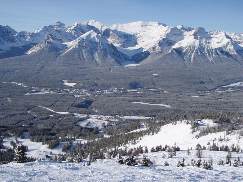

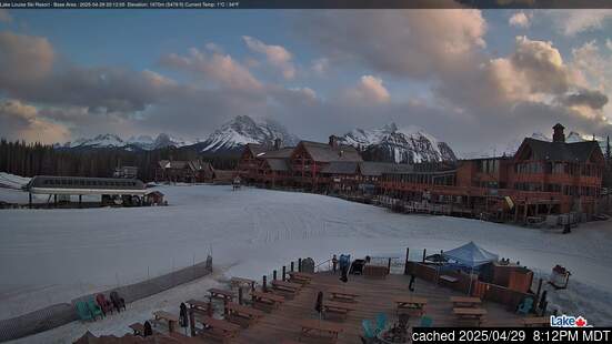
Lake Louise Weather (Next 3 days): The snow forecast for Lake Louise is: A light covering of new snow, mostly falling on Sat night. Temperatures will be below freezing (max -3°C on Sun afternoon, min -9°C on Fri morning). Wind will be generally light.
Lake Louise Weather (Days 4-6): A light covering of new snow, mostly falling on Sun night. Temperatures will be below freezing (max -3°C on Sun night, min -11°C on Tue night). Winds decreasing (fresh winds from the WSW on Sun night, light winds from the WSW by Tue night).
| Resort | Snow Depth | Temp. (°C) | Wind (km/h) | Weather | ||
|---|---|---|---|---|---|---|
| Top Lift: | 1.4 m | -10 | ||||
| Middle Lift: | -9 | |||||
| Bottom Lift: | 0.8 m | -10 |
Latest snow reports near Lake Louise:

Friday 21 | Saturday 22 | Sunday 23 | Monday 24 | Tuesday 25 | Wednesday 26 | ||||||||||||||
night | AM | PM | night | AM | PM | night | AM | PM | night | AM | PM | night | AM | PM | night | AM | PM | night | |
light snow | light snow | light snow | light snow | light snow | light snow | light snow | light snow | light snow | light snow | light snow | light snow | light snow | light snow | snow shwrs | light snow | light snow | light snow | light snow | |
km/h | |||||||||||||||||||
Snow map | 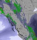 |  | 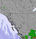 | 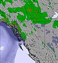 | 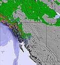 | 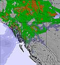 | 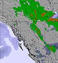 | ||||||||||||
— | — | — | 1.0 | — | — | 3 | — | — | 3 | — | — | 1.0 | — | — | 1.0 | — | — | — | |
— | — | — | — | — | — | — | — | — | — | — | — | — | — | — | — | — | — | — | |
max°C | -6 | -6 | -5 | -6 | -4 | -4 | -4 | -4 | -3 | -3 | -4 | -4 | -6 | -6 | -5 | -9 | -6 | -3 | -3 |
min°C | -7 | -9 | -5 | -8 | -6 | -4 | -6 | -6 | -3 | -5 | -5 | -5 | -8 | -9 | -5 | -11 | -10 | -4 | -6 |
-11 | -14 | -10 | -13 | -14 | -10 | -12 | -12 | -8 | -13 | -12 | -10 | -15 | -15 | -11 | -17 | -15 | -8 | -10 | |
83 | 89 | 92 | 93 | 85 | 93 | 96 | 83 | 93 | 93 | 83 | 93 | 95 | 84 | 83 | 96 | 87 | 81 | 81 | |
850 | 1000 | 1300 | 750 | 1200 | 1450 | 800 | 1450 | 1700 | 1400 | 1450 | 1500 | 800 | 1250 | 1450 | 400 | 1050 | 1450 | 950 | |
— | 7:46 | — | — | 7:43 | — | — | 7:41 | — | — | 7:39 | — | — | 7:37 | — | — | 7:35 | — | — | |
— | — | 6:09 | — | — | 6:12 | — | — | 6:13 | — | — | 6:15 | — | — | 6:16 | — | — | 6:19 | — | |
A light covering of new snow, mostly falling on Sat night. Temperatures will be below freezing (max -3°C on Sun afternoon, min -9°C on Fri morning). Wind will be generally light.
A light covering of new snow, mostly falling on Sun night. Temperatures will be below freezing (max -3°C on Sun night, min -11°C on Tue night). Winds decreasing (fresh winds from the WSW on Sun night, light winds from the WSW by Tue night).
Latest snow reports near Lake Louise:
| Top snow depth: | 137 cm |
|---|---|
| Bottom snow depth: | 84 cm |
| Fresh snowfall depth: | — |
| Last snowfall: | 17 Feb 2025 |
| Snow Alerts | Create Alert |
0.6 | Bluebird Powder days Fresh snow, mostly sunny, light wind. |
|---|---|
1.3 | Powder days Fresh snow, limited sun, any wind. |
2.2 | Bluebird days Average snow, mostly sunny, light wind. |


The above table gives the weather forecast for Lake Louise at the specific elevation of 2141 m. Our sophisticated weather models allow us to provide snow forecasts for the top, middle and bottom ski stations of Lake Louise. To access the weather forecasts for the other elevations, use the tab navigation above the table. For a wider view of the weather, check out the Weather Map of Canada.
Click here to read further information on freezing levels and how we forecast our temperatures.
Overall 3.8 Based on 36 votes and 40 reviews
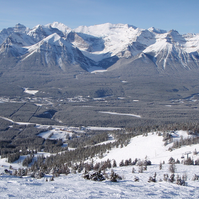
Amazing ski hill! Lots of amazing runs for every level of expertise. Also, the view from the top of the new Summit chair is a must see. Staff are very friendly. Just an approximate 5 min drive from Fairmont Chateau Lake Louise. An absolute must experience.
Esmonde Holowaty from Canada writes:
Amazing ski hill! Lots of amazing runs for every level of expertise. Also, the view from the top of the new Summit chair is a must see. Staff are very friendly. Just an approximate 5 min drive from Fairmont Chateau Lake Louise. An absolute must experience.
The Lake Louise skiing weather widget is available to embed on external websites free of charge. It provides a daily summary of our Lake Louise snow forecast and current weather conditions. Simply go to the feed configuration page and follow the 3 simple steps to grab the custom html code snippet and paste it into your own site. You can choose the snow forecast elevation (summit, mid-mountain or bottom lift) and metric/imperial units for the snow forecast feed to suit your own website…. Click here to get the code.
View detailed snow forecast for Lake Louise at:
snow-forecast.com

 Nearest