

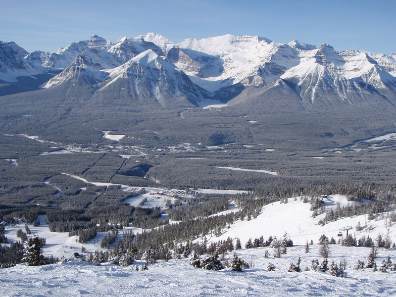
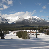
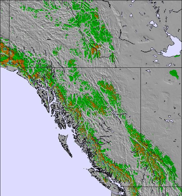
Massive Snowfall in the Alps
A huge snowfall is underway in the Alps, by far the biggest of the 24-25 season.
Please sign in with your Snow-Forecast account details below.

Lake Louise Weather (Next 3 days): The snow forecast for Lake Louise is: Mild with light rain (total 6.0mm) on Sat afternoon Becoming colder with a light covering of snow, mostly falling on Sat night. Freeze-thaw conditions (max 7°C on Fri afternoon, min -3°C on Sun night). Wind will be generally light.
Lake Louise Weather (Days 4-6): A light covering of new snow, mostly falling on Mon night. Becoming milder with light rain (total 4.0mm) on Tue afternoon. Freeze-thaw conditions (max 5°C on Wed afternoon, min -5°C on Tue night). Wind will be generally light.
| Resort | Snow Depth | Temp. (°C) | Wind (km/h) | Weather | ||
|---|---|---|---|---|---|---|
| Top Lift: | 1.8 m | -4 | ||||
| Middle Lift: | -2 | |||||
| Bottom Lift: | 1.0 m | -1 |
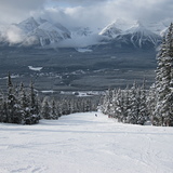
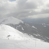
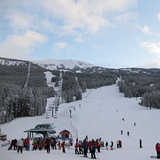
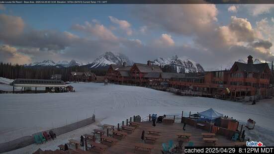
Latest snow reports near Lake Louise:

Friday 18 | Saturday 19 | Sunday 20 | Monday 21 | Tuesday 22 | Wednesday 23 | Thursday 24 | |||||||||||||||
AM | PM | night | AM | PM | night | AM | PM | night | AM | PM | night | AM | PM | night | AM | PM | night | AM | PM | night | |
clear | clear | some clouds | light snow | rain shwrs | light snow | light snow | light snow | light snow | light snow | light snow | mod. snow | light snow | light snow | some clouds | rain shwrs | light rain | some clouds | some clouds | rain shwrs | rain shwrs | |
km/h | |||||||||||||||||||||
Snow map |  |  |  | 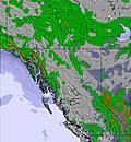 | 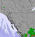 | 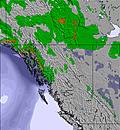 | 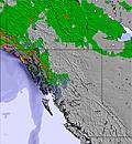 | ||||||||||||||
— | — | — | — | — | 3 | 1.0 | 2.0 | 3 | 1.0 | 2.0 | 6 | — | — | — | — | — | — | — | — | — | |
— | — | — | 1.0 | 3 | 2.0 | — | — | — | — | — | — | — | 1.0 | — | 1.0 | 2.0 | — | — | 1.0 | 1.0 | |
max°C | 3 | 7 | 1 | 4 | 6 | 2 | 0 | 1 | -1 | 1 | 2 | 0 | 1 | 3 | -2 | 3 | 5 | 0 | 5 | 7 | 2 |
min°C | -1 | 6 | -1 | 1 | 5 | -2 | -1 | 0 | -3 | -2 | 2 | -3 | -1 | 2 | -5 | 0 | 5 | -3 | 2 | 7 | -1 |
-3 | 5 | -3 | -1 | 3 | -4 | -3 | 0 | -5 | -2 | 1 | -6 | -1 | 1 | -5 | 0 | 5 | -3 | 2 | 6 | -3 | |
64 | 52 | 75 | 94 | 65 | 95 | 86 | 86 | 94 | 89 | 75 | 91 | 76 | 55 | 80 | 72 | 47 | 76 | 68 | 49 | 85 | |
1700 | 2450 | 2250 | 1950 | 2250 | 1800 | 1400 | 1650 | 1250 | 1350 | 1800 | 1400 | 1400 | 1800 | 1150 | 1650 | 2100 | 1600 | 1900 | 2350 | 1850 | |
6:43 | — | — | 6:39 | — | — | 6:37 | — | — | 6:35 | — | — | 6:33 | — | — | 6:31 | — | — | 6:30 | — | — | |
— | 8:45 | — | — | 8:46 | — | — | 8:47 | — | — | 8:50 | — | — | 8:52 | — | — | 8:52 | — | — | 8:54 | — | |
Mild with light rain (total 6.0mm) on Sat afternoon Becoming colder with a light covering of snow, mostly falling on Sat night. Freeze-thaw conditions (max 7°C on Fri afternoon, min -3°C on Sun night). Wind will be generally light.
A light covering of new snow, mostly falling on Mon night. Becoming milder with light rain (total 4.0mm) on Tue afternoon. Freeze-thaw conditions (max 5°C on Wed afternoon, min -5°C on Tue night). Wind will be generally light.
Latest snow reports near Lake Louise:
| Top snow depth: | 181 cm |
|---|---|
| Bottom snow depth: | 95 cm |
| Fresh snowfall depth: | 3.0 cm |
| Last snowfall: | 16 Apr 2025 |
| Snow Alerts | Create Alert |
0.6 | Bluebird Powder days Fresh snow, mostly sunny, light wind. |
|---|---|
0.9 | Powder days Fresh snow, limited sun, any wind. |
0.4 | Bluebird days Average snow, mostly sunny, light wind. |


The above table gives the weather forecast for Lake Louise at the specific elevation of 1646 m. Our sophisticated weather models allow us to provide snow forecasts for the top, middle and bottom ski stations of Lake Louise. To access the weather forecasts for the other elevations, use the tab navigation above the table. For a wider view of the weather, check out the Weather Map of Canada.
Click here to read further information on freezing levels and how we forecast our temperatures.
Overall 3.8 Based on 36 votes and 40 reviews
I had purchased 3 Lake Louise Plus Cards for me and my 2 daughters. You pay $99 and it gets you 1st, 4th & 7th lift tickets free. I was looking at taking the Lake Louis ski bus from Calgary. It's advertised on the Lake Louise web page. I had used our plus cards once already, which was our 1st free pass. When I contacted the bus company they informed me that they have a deal with the lift tickets. If you purchase a lift ticket from the bus company your bus fare is included round trip from Calgary. Good deal I thought. So I phone Lake Louise Information to ask if I purchase the lift ticket from the bus company will it count as my second lift pass on my plus card. The person working had to ask a manager about it. He came back and informed me that, yes, it would go towards my plus card. I'm thinking great. Two days later I phone back and talk to a different person and ask same question because I'm not sure where I go to get my lift ticket put on my plus card. The person tells me to go to customer service and produce the lift ticket and they will put it towards my second lift pass on my plus card. Today we go to Lake Louise by bus and show up at customer service only to be told no that does not happen. I ask for the manager only to be told I am mistaken (twice) and don't know where I heard this, loud enough to be heard in front of lots of people. Basically the manager is trying to make me look stupid. She had no intention of trying to resolve this. She just wanted me to go away. I don't know how Lake Louise trains their management but I can attest that it is done poorly. Well Lake Louise management I will not go away and this will not be the last time you heard from me.
Lifeincabo from Canada writes:
I had purchased 3 Lake Louise Plus Cards for me and my 2 daughters. You pay $99 and it gets you 1st, 4th & 7th lift tickets free. I was looking at taking the Lake Louis ski bus from Calgary. It's advertised on the Lake Louise web page. I had used our plus cards once already, which was our 1st free pass. When I contacted the bus company they informed me that they have a deal with the lift tickets. If you purchase a lift ticket from the bus company your bus fare is included round trip from Calgary. Good deal I thought. So I phone Lake Louise Information to ask if I purchase the lift ticket from the bus company will it count as my second lift pass on my plus card. The person working had to ask a manager about it. He came back and informed me that, yes, it would go towards my plus card. I'm thinking great. Two days later I phone back and talk to a different person and ask same question because I'm not sure where I go to get my lift ticket put on my plus card. The person tells me to go to customer service and produce the lift ticket and they will put it towards my second lift pass on my plus card.
Today we go to Lake Louise by bus and show up at customer service only to be told no that does not happen. I ask for the manager only to be told I am mistaken (twice) and don't know where I heard this, loud enough to be heard in front of lots of people. Basically the manager is trying to make me look stupid. She had no intention of trying to resolve this. She just wanted me to go away. I don't know how Lake Louise trains their management but I can attest that it is done poorly. Well Lake Louise management I will not go away and this will not be the last time you heard from me.
The Lake Louise skiing weather widget is available to embed on external websites free of charge. It provides a daily summary of our Lake Louise snow forecast and current weather conditions. Simply go to the feed configuration page and follow the 3 simple steps to grab the custom html code snippet and paste it into your own site. You can choose the snow forecast elevation (summit, mid-mountain or bottom lift) and metric/imperial units for the snow forecast feed to suit your own website…. Click here to get the code.
View detailed snow forecast for Lake Louise at:
snow-forecast.com

 Nearest