
Ski Lessons by SkiBro
BOOK NOW
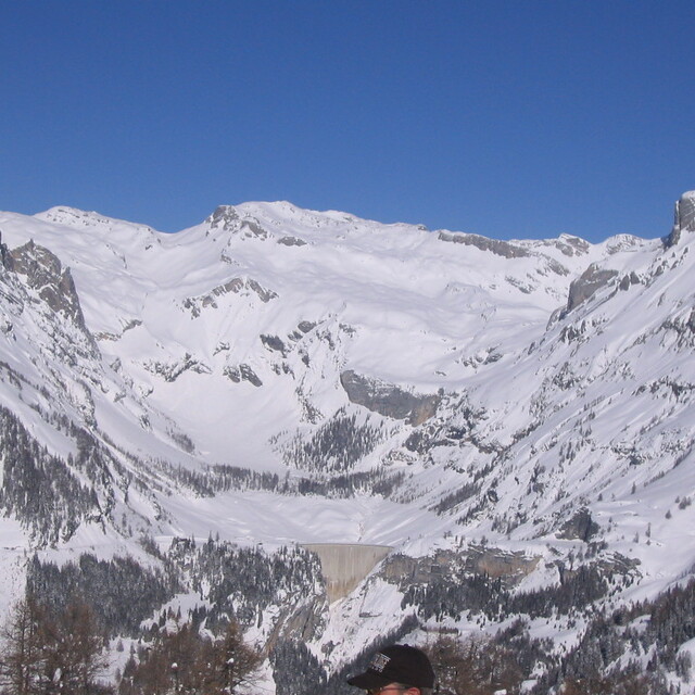
Ski lessons in Crans Montana
Book now

Crans Montana Weather (Next 3 days): The snow forecast for Crans Montana is: A heavy fall of snow, heaviest during Mon afternoon. Temperatures will be below freezing (max 0°C on Sun night, min -6°C on Tue morning). Wind will be generally light.
Crans Montana Weather (Days 4-6): Mostly dry. Freeze-thaw conditions (max 2°C on Fri morning, min -4°C on Wed night). Wind will be generally light.
| Resort | Snow Depth | Temp. (°C) | Wind (km/h) | Weather | ||
|---|---|---|---|---|---|---|
| Top Lift: | 0.0 m | 0 | ||||
| Middle Lift: | 4 | |||||
| Bottom Lift: | 0.0 m | 7 |
Latest snow reports near Crans Montana:
Snowing at a moderate rate at altitude in Zermatt. from Zermatt
Light rain reported from Sion at 339 metres elevation 5 kms WNW of Thyon-Printze but it is forecast cold enough for snow at higher elevations in the ski area from Thyon-Printze
Intermittent light snow reported from Jungfrau Mountain at 3576 metres elevation 7 kms E of Mürren but it is probably falling as rain apart from near the top of the ski area from Mürren

Monday 6 | Tuesday 7 | Wednesday 8 | Thursday 9 | Friday 10 | Saturday 11 | ||||||||||||||
night | AM | PM | night | AM | PM | night | AM | PM | night | AM | PM | night | AM | PM | night | AM | PM | night | |
light snow | light snow | mod. snow | light snow | mod. snow | mod. snow | light snow | light snow | light snow | snow shwrs | clear | some clouds | some clouds | clear | some clouds | snow shwrs | some clouds | light snow | snow shwrs | |
km/h | |||||||||||||||||||
Snow map |  |  |  |  |  |  |  | ||||||||||||
1.0 | — | 8 | 1.0 | 5 | 6 | 2.0 | — | — | — | — | — | — | — | — | — | — | — | — | |
— | — | — | — | — | — | — | — | — | — | — | — | — | — | — | — | — | — | — | |
max°C | 0 | -1 | -3 | -3 | -5 | -5 | -5 | -5 | -4 | -1 | 0 | 0 | 1 | 2 | 2 | 2 | 2 | 2 | 1 |
min°C | -1 | -2 | -3 | -5 | -6 | -6 | -5 | -5 | -5 | -4 | -1 | -1 | 0 | 1 | 1 | 1 | 1 | 1 | 1 |
-4 | -5 | -7 | -7 | -10 | -10 | -11 | -10 | -9 | -8 | -1 | -1 | 0 | 0 | 1 | 0 | -1 | -1 | -1 | |
84 | 99 | 99 | 100 | 97 | 97 | 95 | 92 | 93 | 57 | 46 | 90 | 41 | 27 | 89 | 51 | 37 | 84 | 68 | |
2850 | 2750 | 2350 | 2250 | 2000 | 2000 | 2100 | 2150 | 2450 | 2350 | 2950 | 3000 | 3200 | 3250 | 3250 | 3250 | 3250 | 3200 | 3200 | |
— | 6:07 | — | — | 6:07 | — | — | 6:05 | — | — | 6:03 | — | — | 6:03 | — | — | 6:01 | — | — | |
— | — | — | 8:45 | — | — | 8:46 | — | — | 8:47 | — | — | 8:49 | — | — | 8:51 | — | — | 8:52 | |
A heavy fall of snow, heaviest during Mon afternoon. Temperatures will be below freezing (max 0°C on Sun night, min -6°C on Tue morning). Wind will be generally light.
Mostly dry. Freeze-thaw conditions (max 2°C on Fri morning, min -4°C on Wed night). Wind will be generally light.
Latest snow reports near Crans Montana:
Snowing at a moderate rate at altitude in Zermatt. from Zermatt
Light rain reported from Sion at 339 metres elevation 5 kms WNW of Thyon-Printze but it is forecast cold enough for snow at higher elevations in the ski area from Thyon-Printze
Intermittent light snow reported from Jungfrau Mountain at 3576 metres elevation 7 kms E of Mürren but it is probably falling as rain apart from near the top of the ski area from Mürren
| Top snow depth: | 0 cm |
|---|---|
| Bottom snow depth: | 0 cm |
| Fresh snowfall depth: | 1 cm |
| Last snowfall: | 3 May 2024 |
| Snow Alerts | Create Alert |
1.2 | Bluebird Powder days Fresh snow, mostly sunny, light wind. |
|---|---|
1.4 | Powder days Fresh snow, limited sun, any wind. |
1.8 | Bluebird days Average snow, mostly sunny, light wind. |
The above table gives the weather forecast for Crans Montana at the specific elevation of 3000 m. Our sophisticated weather models allow us to provide snow forecasts for the top, middle and bottom ski stations of Crans Montana. To access the weather forecasts for the other elevations, use the tab navigation above the table. For a wider view of the weather, check out the Weather Map of Switzerland.
Click here to read further information on freezing levels and how we forecast our temperatures.
Overall 3.9 Based on 23 votes and 16 reviews
We have owned an apartment here for the past 6 years and been coming a few times every year since. My son learned to ski here and is now 12 and very proficient. The resort has everything; great runs, great restaurants and cool bars like Amadeus and Zero Dix. That said the apres-ski and night life is not like some of the Austrian resorts and is much more reserved. The views and a beer at Amadeus overlooking the valley is something to look forward to every year. We enjoy this resort and it is improving each year with new faster lifts and restaurants. There are also no queues like France and most of the other more popular resorts. It is a great place!
dave liddle from United Kingdom writes:
We have owned an apartment here for the past 6 years and been coming a few times every year since. My son learned to ski here and is now 12 and very proficient. The resort has everything; great runs, great restaurants and cool bars like Amadeus and Zero Dix. That said the apres-ski and night life is not like some of the Austrian resorts and is much more reserved. The views and a beer at Amadeus overlooking the valley is something to look forward to every year. We enjoy this resort and it is improving each year with new faster lifts and restaurants. There are also no queues like France and most of the other more popular resorts. It is a great place!
The Crans Montana skiing weather widget is available to embed on external websites free of charge. It provides a daily summary of our Crans Montana snow forecast and current weather conditions. Simply go to the feed configuration page and follow the 3 simple steps to grab the custom html code snippet and paste it into your own site. You can choose the snow forecast elevation (summit, mid-mountain or bottom lift) and metric/imperial units for the snow forecast feed to suit your own website…. Click here to get the code.
View detailed snow forecast for Crans Montana at:
snow-forecast.com


 Nearest