

French Ski Areas Announce 2025 Summer Ski Plans
Three French ski areas have announced their opening plans in May, June and July after the winter season ends on May 4th.
Please sign in with your Snow-Forecast account details below.
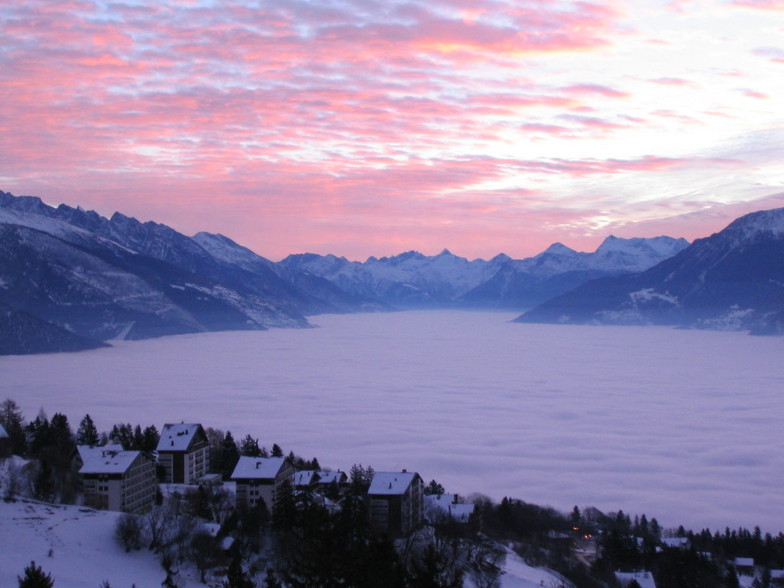

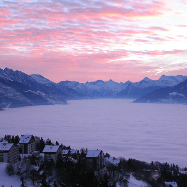
Crans Montana Weather (Next 3 days): The snow forecast for Crans Montana is: A heavy fall of snow, heaviest during Wed night. Becoming milder with heavy rain (total 29.0mm) on Thu afternoon. Freeze-thaw conditions (max 11°C on Tue afternoon, min 0°C on Wed night). Wind will be generally light.
Crans Montana Weather (Days 4-6): Mild at first with light rain (total 9.0mm) on Sat afternoon followed by colder weather and light fall of snow, heaviest on Sat night. Freeze-thaw conditions (max 5°C on Sat afternoon, min -2°C on Sat night). Wind will be generally light.
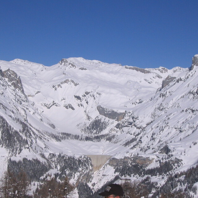
| Resort | Snow Depth | Temp. (°C) | Wind (km/h) | Weather | ||
|---|---|---|---|---|---|---|
| Top Lift: | 0.9 m | -3 | ||||
| Middle Lift: | 2 | |||||
| Bottom Lift: | 7 |
Latest snow reports near Crans Montana:
Snowing at altitude in Breuil-Cervinia Valtournenche. from Breuil-Cervinia Valtournenche
Snow crystals reported from Jungfrau Mountain at 3576 metres elevation 7 kms E of Mürren but it is probably falling as rain apart from near the top of the ski area from Mürren

Tuesday 15 | Wednesday 16 | Thursday 17 | Friday 18 | Saturday 19 | Sunday 20 | Monday 21 | |||||||||||||||
AM | PM | night | AM | PM | night | AM | PM | night | AM | PM | night | AM | PM | night | AM | PM | night | AM | PM | night | |
light rain | risk thun- der | rain shwrs | light rain | mod. rain | heavy snow | mod. snow | heavy rain | light snow | light snow | cloudy | some clouds | cloudy | mod. rain | mod. snow | cloudy | light rain | mod. snow | light snow | light snow | light snow | |
km/h | |||||||||||||||||||||
Snow map |  |  |  |  |  |  |  | ||||||||||||||
— | — | — | — | — | 19 | 7 | — | 2.0 | — | — | — | — | — | 9 | — | — | 7 | 3 | 1.0 | — | |
1.0 | 2.0 | 4 | 4 | 7 | — | — | 11 | — | — | — | — | — | 7 | — | — | 2.0 | — | — | — | — | |
max°C | 7 | 11 | 6 | 5 | 5 | 1 | 1 | 2 | 1 | 2 | 4 | 2 | 4 | 5 | 0 | 1 | 3 | 1 | 0 | 1 | -1 |
min°C | 5 | 10 | 4 | 4 | 3 | 0 | 0 | 2 | 0 | 1 | 4 | 0 | 2 | 2 | -2 | -2 | 3 | 0 | -1 | 1 | -5 |
5 | 10 | 2 | 3 | 3 | 0 | 0 | 2 | 0 | 1 | 4 | -2 | 0 | 1 | -2 | -2 | 3 | -2 | -4 | 0 | -5 | |
85 | 66 | 89 | 90 | 99 | 100 | 100 | 100 | 100 | 99 | 97 | 85 | 95 | 100 | 98 | 94 | 91 | 99 | 95 | 86 | 92 | |
2550 | 2800 | 2500 | 2400 | 2200 | 1900 | 1950 | 2200 | 1950 | 2300 | 2750 | 2900 | 2450 | 2000 | 1450 | 1700 | 1950 | 1550 | 1500 | 1700 | 800 | |
6:45 | — | — | 6:43 | — | — | 6:41 | — | — | 6:39 | — | — | 6:37 | — | — | 6:35 | — | — | 6:33 | — | — | |
— | — | 8:15 | — | — | 8:17 | — | — | 8:19 | — | — | 8:20 | — | — | 8:22 | — | — | 8:22 | — | — | 8:23 | |
A heavy fall of snow, heaviest during Wed night. Becoming milder with heavy rain (total 29.0mm) on Thu afternoon. Freeze-thaw conditions (max 11°C on Tue afternoon, min 0°C on Wed night). Wind will be generally light.
Mild at first with light rain (total 9.0mm) on Sat afternoon followed by colder weather and light fall of snow, heaviest on Sat night. Freeze-thaw conditions (max 5°C on Sat afternoon, min -2°C on Sat night). Wind will be generally light.
Latest snow reports near Crans Montana:
Snowing at altitude in Breuil-Cervinia Valtournenche. from Breuil-Cervinia Valtournenche
Snow crystals reported from Jungfrau Mountain at 3576 metres elevation 7 kms E of Mürren but it is probably falling as rain apart from near the top of the ski area from Mürren
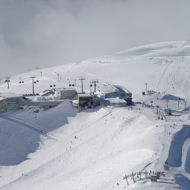
| Top snow depth: | 90 cm |
|---|---|
| Bottom snow depth: | — |
| Fresh snowfall depth: | — |
| Last snowfall: | 1 Apr 2025 |
| Snow Alerts | Create Alert |
0.1 | Bluebird Powder days Fresh snow, mostly sunny, light wind. |
|---|---|
0.3 | Powder days Fresh snow, limited sun, any wind. |
0.0 | Bluebird days Average snow, mostly sunny, light wind. |
The above table gives the weather forecast for Crans Montana at the specific elevation of 1500 m. Our sophisticated weather models allow us to provide snow forecasts for the top, middle and bottom ski stations of Crans Montana. To access the weather forecasts for the other elevations, use the tab navigation above the table. For a wider view of the weather, check out the Weather Map of Switzerland.
Click here to read further information on freezing levels and how we forecast our temperatures.
Overall 3.9 Based on 23 votes and 16 reviews
Some mixed reviews on this resort. I confess I have not actually been there myself but I am planning to go with my family at the end of February 2015 with Simon Butler Skiing. If any of you skied with Simon in Megeve you will know the high level of his professional standards for everything including accommodation, food and ski tuition. Frankly, he would not chose to offer another option in Crans-Montana if he didn't think it would tick all the boxes for his loyal clientele. I personally can't wait to go but I will post another review on my actual findings when I return.
Mark Betteridge from United Kingdom writes:
Some mixed reviews on this resort.
I confess I have not actually been there myself but I am planning to go with my family at the end of February 2015 with Simon Butler Skiing. If any of you skied with Simon in Megeve you will know the high level of his professional standards for everything including accommodation, food and ski tuition. Frankly, he would not chose to offer another option in Crans-Montana if he didn't think it would tick all the boxes for his loyal clientele.
I personally can't wait to go but I will post another review on my actual findings when I return.
The Crans Montana skiing weather widget is available to embed on external websites free of charge. It provides a daily summary of our Crans Montana snow forecast and current weather conditions. Simply go to the feed configuration page and follow the 3 simple steps to grab the custom html code snippet and paste it into your own site. You can choose the snow forecast elevation (summit, mid-mountain or bottom lift) and metric/imperial units for the snow forecast feed to suit your own website…. Click here to get the code.
View detailed snow forecast for Crans Montana at:
snow-forecast.com


 Nearest