

Massive Snowfall in the Alps
A huge snowfall is underway in the Alps, by far the biggest of the 24-25 season.
Please sign in with your Snow-Forecast account details below.

Villard-Reculas Weather (Next 3 days): The snow forecast for Villard-Reculas is: Moderate rain (total 13.0mm), heaviest on Sun morning. Freeze-thaw conditions (max 8°C on Mon afternoon, min 0°C on Sun night). Wind will be generally light.
Villard-Reculas Weather (Days 4-6): Heavy rain (total 26.0mm), heaviest during Wed afternoon. Mild temperatures (max 6°C on Tue night, min 2°C on Fri morning). Wind will be generally light.
| Resort | Snow Depth | Temp. (°C) | Wind (km/h) | Weather | ||
|---|---|---|---|---|---|---|
| Top Lift: | -5 | |||||
| Middle Lift: | 1 | |||||
| Bottom Lift: | 5 |
Latest snow reports near Villard-Reculas:
Great conditions for this time of year. Light clouds dotting the sky. from Val Thorens

Sunday 20 | Monday 21 | Tuesday 22 | Wednesday 23 | Thursday 24 | Friday 25 | ||||||||||||||
night | AM | PM | night | AM | PM | night | AM | PM | night | AM | PM | night | AM | PM | night | AM | PM | night | |
rain shwrs | mod. rain | some clouds | rain shwrs | clear | some clouds | light rain | cloudy | light rain | light rain | light rain | light rain | light rain | light rain | light rain | light rain | light rain | light rain | light rain | |
km/h | |||||||||||||||||||
Snow map |  |  |  |  |  |  |  | ||||||||||||
— | — | — | — | — | — | — | — | — | — | — | — | — | — | — | — | — | — | — | |
2.0 | 6 | — | 1.0 | — | — | 2.0 | — | 2.0 | 3 | 2.0 | 3 | 4 | 2.0 | 2.0 | 5 | 3 | 2.0 | 2.0 | |
max°C | 5 | 5 | 7 | 4 | 6 | 8 | 5 | 7 | 8 | 6 | 5 | 6 | 4 | 4 | 5 | 4 | 3 | 3 | 2 |
min°C | 3 | 3 | 7 | 0 | 1 | 8 | 4 | 4 | 7 | 5 | 5 | 5 | 4 | 4 | 5 | 3 | 2 | 3 | 1 |
0 | 1 | 5 | -2 | 1 | 8 | 4 | 4 | 6 | 5 | 5 | 4 | 3 | 3 | 4 | 1 | 0 | 1 | 1 | |
87 | 79 | 66 | 86 | 65 | 75 | 94 | 82 | 90 | 99 | 96 | 100 | 96 | 94 | 92 | 97 | 98 | 96 | 95 | |
2300 | 2150 | 2300 | 1800 | 2300 | 2450 | 2250 | 2450 | 2550 | 2400 | 2350 | 2350 | 2100 | 2100 | 2150 | 1900 | 1850 | 2000 | 2300 | |
— | 6:43 | — | — | 6:41 | — | — | 6:39 | — | — | 6:39 | — | — | 6:37 | — | — | 6:35 | — | — | |
— | — | — | 8:25 | — | — | 8:27 | — | — | 8:29 | — | — | 8:30 | — | — | 8:30 | — | — | 8:31 | |
Moderate rain (total 13.0mm), heaviest on Sun morning. Freeze-thaw conditions (max 8°C on Mon afternoon, min 0°C on Sun night). Wind will be generally light.
Heavy rain (total 26.0mm), heaviest during Wed afternoon. Mild temperatures (max 6°C on Tue night, min 2°C on Fri morning). Wind will be generally light.
Latest snow reports near Villard-Reculas:
Great conditions for this time of year. Light clouds dotting the sky. from Val Thorens
| Top snow depth: | — |
|---|---|
| Bottom snow depth: | — |
| Fresh snowfall depth: | 51 cm |
| Last snowfall: | 17 Apr 2025 |
| Snow Alerts | Create Alert |
0.1 | Bluebird Powder days Fresh snow, mostly sunny, light wind. |
|---|---|
0.1 | Powder days Fresh snow, limited sun, any wind. |
0.0 | Bluebird days Average snow, mostly sunny, light wind. |
The above table gives the weather forecast for Villard-Reculas at the specific elevation of 1450 m. Our sophisticated weather models allow us to provide snow forecasts for the top, middle and bottom ski stations of Villard-Reculas. To access the weather forecasts for the other elevations, use the tab navigation above the table. For a wider view of the weather, check out the Weather Map of France.
Click here to read further information on freezing levels and how we forecast our temperatures.
Overall 3.9 Based on 5 votes and 3 reviews
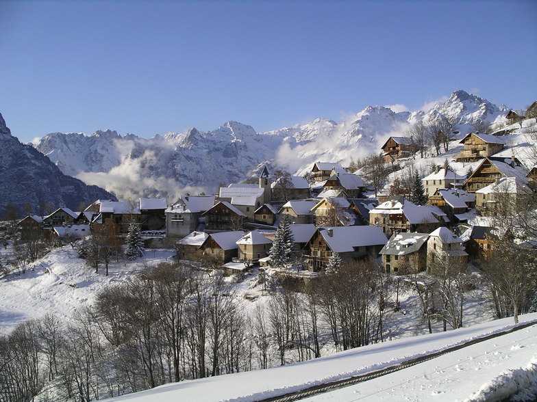
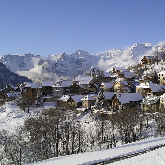
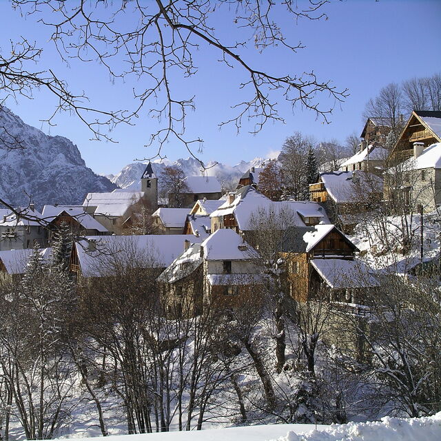
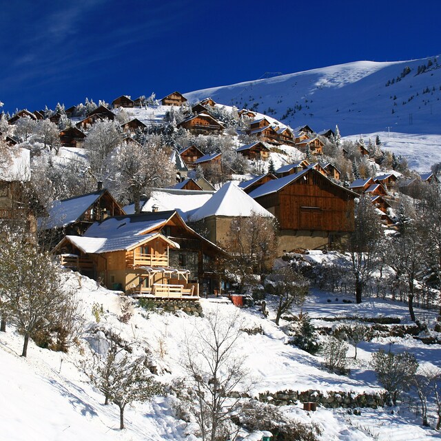
Villard Reculas (Villard-Reculas) is an unspoilt tiny picturesque old village with many original buildings made from local stone and wood scattered on a high shoulder above Bourge. It is a one hour drive from Grenoble, the last few kilometres up a steep hair-pinned alpine road. The setting is beautiful and the view of the mountains and down the ]valley is quite stunning. The ambiance is local and French with few foreign visitors. Accommodation is mostly in private houses and apartments although there is a small hotel and one catered Chalet run by an enthusiastic English ex pat. There are a couple of bars and restaurants serving simple meals in the village centre as well as the hotel. However there is no 'nightlife' to speak of. The slopes are Just 150 metres from the village centre which provide a high speed quad chairlift into the main Alpe D'Huez Ski circus as well a number of button lifts serving the beginners area. The village slopes themselves are all above the tree line offering a range of red blue and a few green runs. The run back down into the village from the top of the chairlift is a delightful and normally quiet end to a heavy day in the rest of Alpe D'Huez.. These slopes also offer wonderful off piste skiing in new snow. The local ski school is run by a young English speaking Frenchman called Alex and only operates in peak season offering private lessons out side these dates. Much of the accommodation is over 500 metres from the slopes but a free bus service is now available in peak season and the Chalet La Source provides transport for its guests. Overall Villard is a charming and quiet alternative to the noise and bustle of Alpe D'Huez whilst retaining quick access to one the Alps major ski areas. It must have something as we have returned every year with a mixed assortment of expert intermediates children and even walkers for the last 12 years staying in the La Source chalet.
Jonathan Poole from United Kingdom writes:
Villard Reculas (Villard-Reculas) is an unspoilt tiny picturesque old village with many original buildings made from local stone and wood scattered on a high shoulder above Bourge. It is a one hour drive from Grenoble, the last few kilometres up a steep hair-pinned alpine road. The setting is beautiful and the view of the mountains and down the ]valley is quite stunning.
The ambiance is local and French with few foreign visitors. Accommodation is mostly in private houses and apartments although there is a small hotel and one catered Chalet run by an enthusiastic English ex pat. There are a couple of bars and restaurants serving simple meals in the village centre as well as the hotel. However there is no 'nightlife' to speak of.
The slopes are Just 150 metres from the village centre which provide a high speed quad chairlift into the main Alpe D'Huez Ski circus as well a number of button lifts serving the beginners area. The village slopes themselves are all above the tree line offering a range of red blue and a few green runs. The run back down into the village from the top of the chairlift is a delightful and normally quiet end to a heavy day in the rest of Alpe D'Huez.. These slopes also offer wonderful off piste skiing in new snow.
The local ski school is run by a young English speaking Frenchman called Alex and only operates in peak season offering private lessons out side these dates.
Much of the accommodation is over 500 metres from the slopes but a free bus service is now available in peak season and the Chalet La Source provides transport for its guests.
Overall Villard is a charming and quiet alternative to the noise and bustle of Alpe D'Huez whilst retaining quick access to one the Alps major ski areas. It must have something as we have returned every year with a mixed assortment of expert intermediates children and even walkers for the last 12 years staying in the La Source chalet.
The Villard-Reculas skiing weather widget is available to embed on external websites free of charge. It provides a daily summary of our Villard-Reculas snow forecast and current weather conditions. Simply go to the feed configuration page and follow the 3 simple steps to grab the custom html code snippet and paste it into your own site. You can choose the snow forecast elevation (summit, mid-mountain or bottom lift) and metric/imperial units for the snow forecast feed to suit your own website…. Click here to get the code.
View detailed snow forecast for Villard-Reculas at:
snow-forecast.com


 Nearest