

Massive Snowfall in the Alps
A huge snowfall is underway in the Alps, by far the biggest of the 24-25 season.
Please sign in with your Snow-Forecast account details below.


Valdesqui Weather (Next 3 days): The snow forecast for Valdesqui is: A moderate fall of snow, heaviest on Sat morning. Becoming mild with drizzle, on Mon afternoon. Freeze-thaw conditions (max 3°C on Mon afternoon, min -6°C on Sat morning). Winds decreasing (strong winds from the WNW on Sat morning, light winds from the WSW by Mon afternoon).
Valdesqui Weather (Days 4-6): Some drizzle, heaviest during Thu night. Freeze-thaw conditions (max 9°C on Thu afternoon, min 0°C on Tue morning). Wind will be generally light.
| Resort | Snow Depth | Temp. (°C) | Wind (km/h) | Weather | ||
|---|---|---|---|---|---|---|
| Top Lift: | -6 | |||||
| Middle Lift: | -5 | |||||
| Bottom Lift: | -3 |
Latest snow reports near Valdesqui:
Moderate to heavy freezing rain reported from Navacerrada-Puerto at 1888 metres elevation one km WNW of Puerto de Navacerrada but it is forecast cold enough for snow at the ski area from Puerto de Navacerrada
Intermittent moderate snow reported from Navacerrada-Puerto at 1888 metres elevation one km WNW of Puerto de Navacerrada Ski Resort from Puerto de Navacerrada

Saturday 19 | Sunday 20 | Monday 21 | Tuesday 22 | Wednesday 23 | Thursday 24 | Friday 25 | |||||||||||||||
AM | PM | night | AM | PM | night | AM | PM | night | AM | PM | night | AM | PM | night | AM | PM | night | AM | PM | night | |
light snow | light snow | light snow | light snow | light snow | some clouds | some clouds | light rain | light snow | light snow | light snow | some clouds | clear | clear | clear | clear | some clouds | rain shwrs | rain shwrs | risk thun- der | rain shwrs | |
km/h | |||||||||||||||||||||
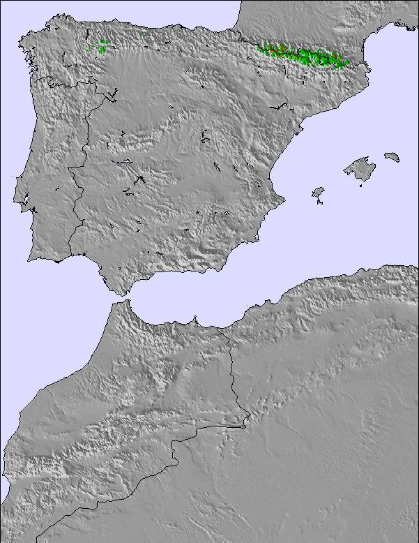
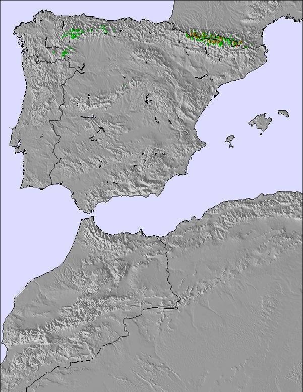
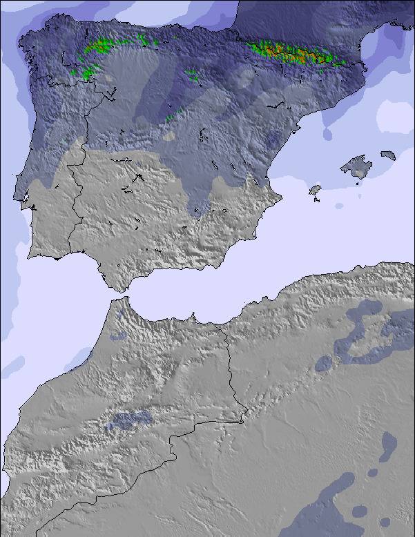
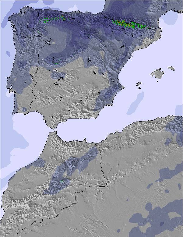
Snow map | 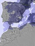 | 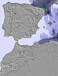 | 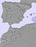 | 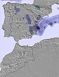 | 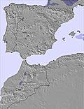 | 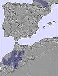 | 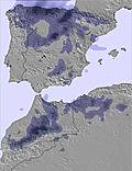 | ||||||||||||||
5 | 1.0 | 5 | 1.0 | — | — | — | — | 3 | — | — | — | — | — | — | — | — | — | — | — | — | |
— | — | — | — | — | — | — | 1.0 | — | — | — | — | — | — | — | — | — | 1.0 | 1.0 | 3 | 1.0 | |
max°C | -6 | -5 | -4 | -5 | -1 | 0 | 1 | 3 | 2 | 0 | 1 | 3 | 4 | 7 | 7 | 7 | 9 | 8 | 6 | 7 | 6 |
min°C | -6 | -5 | -6 | -5 | -2 | -1 | 0 | 2 | 0 | 0 | 1 | 1 | 3 | 6 | 7 | 6 | 8 | 6 | 6 | 7 | 3 |
-15 | -14 | -14 | -12 | -9 | -7 | -5 | -1 | -2 | -3 | -1 | -3 | 0 | 5 | 5 | 6 | 8 | 5 | 4 | 4 | -3 | |
80 | 81 | 99 | 82 | 68 | 54 | 82 | 78 | 96 | 77 | 65 | 55 | 50 | 55 | 54 | 52 | 67 | 65 | 66 | 64 | 60 | |
1400 | 1650 | 1450 | 1350 | 2150 | 2300 | 2400 | 2600 | 2300 | 2200 | 2500 | 2850 | 3250 | 3200 | 3400 | 3500 | 3300 | 3250 | 3150 | 3200 | 2900 | |
7:31 | — | — | 7:30 | — | — | 7:28 | — | — | 7:28 | — | — | 7:26 | — | — | 7:24 | — | — | 7:22 | — | — | |
— | — | 8:59 | — | — | 9:00 | — | — | 9:00 | — | — | 9:01 | — | — | 9:02 | — | — | 9:04 | — | — | 9:05 | |
A moderate fall of snow, heaviest on Sat morning. Becoming mild with drizzle, on Mon afternoon. Freeze-thaw conditions (max 3°C on Mon afternoon, min -6°C on Sat morning). Winds decreasing (strong winds from the WNW on Sat morning, light winds from the WSW by Mon afternoon).
Some drizzle, heaviest during Thu night. Freeze-thaw conditions (max 9°C on Thu afternoon, min 0°C on Tue morning). Wind will be generally light.
Latest snow reports near Valdesqui:
Moderate to heavy freezing rain reported from Navacerrada-Puerto at 1888 metres elevation one km WNW of Puerto de Navacerrada but it is forecast cold enough for snow at the ski area from Puerto de Navacerrada
Intermittent moderate snow reported from Navacerrada-Puerto at 1888 metres elevation one km WNW of Puerto de Navacerrada Ski Resort from Puerto de Navacerrada
| Top snow depth: | — |
|---|---|
| Bottom snow depth: | — |
| Fresh snowfall depth: | 1 cm |
| Last snowfall: | 18 Apr 2025 |
| Snow Alerts | Create Alert |
0.4 | Bluebird Powder days Fresh snow, mostly sunny, light wind. |
|---|---|
0.4 | Powder days Fresh snow, limited sun, any wind. |
0.2 | Bluebird days Average snow, mostly sunny, light wind. |
The above table gives the weather forecast for Valdesqui at the specific elevation of 2280 m. Our sophisticated weather models allow us to provide snow forecasts for the top, middle and bottom ski stations of Valdesqui. To access the weather forecasts for the other elevations, use the tab navigation above the table. For a wider view of the weather, check out the Weather Map of Spain.
Click here to read further information on freezing levels and how we forecast our temperatures.
Overall 2.1 Based on 42 votes and 12 reviews
Es la mejor estación de la zona centro porque tiene unas pistas anchas y homogéneas. En general muy bien cuidadas las pistas aprovechando la nieve todo lo posible. El personal de pista suele ser atento y hacerlo bien. Pero hay cosas muy malas: -precio alto aprovechando que están cerca de Madrid. -remontes lentisimos y no los mejoran! -pésima gestión de los alquileres. -la cafetería la cierran en el mismo minuto de la última subida, no esperan ni media hora, ni te dejan terminar la consumicion. -pésima informacion. -Ni 1 euro de descuento por familia numerosa.
Ramon Garcia from Spain writes:
Es la mejor estación de la zona centro porque tiene unas pistas anchas y homogéneas. En general muy bien cuidadas las pistas aprovechando la nieve todo lo posible. El personal de pista suele ser atento y hacerlo bien.
Pero hay cosas muy malas:
-precio alto aprovechando que están cerca de Madrid.
-remontes lentisimos y no los mejoran!
-pésima gestión de los alquileres.
-la cafetería la cierran en el mismo minuto de la última subida, no esperan ni media hora, ni te dejan terminar la consumicion.
-pésima informacion.
-Ni 1 euro de descuento por familia numerosa.
The Valdesqui skiing weather widget is available to embed on external websites free of charge. It provides a daily summary of our Valdesqui snow forecast and current weather conditions. Simply go to the feed configuration page and follow the 3 simple steps to grab the custom html code snippet and paste it into your own site. You can choose the snow forecast elevation (summit, mid-mountain or bottom lift) and metric/imperial units for the snow forecast feed to suit your own website…. Click here to get the code.
View detailed snow forecast for Valdesqui at:
snow-forecast.com

 Nearest