

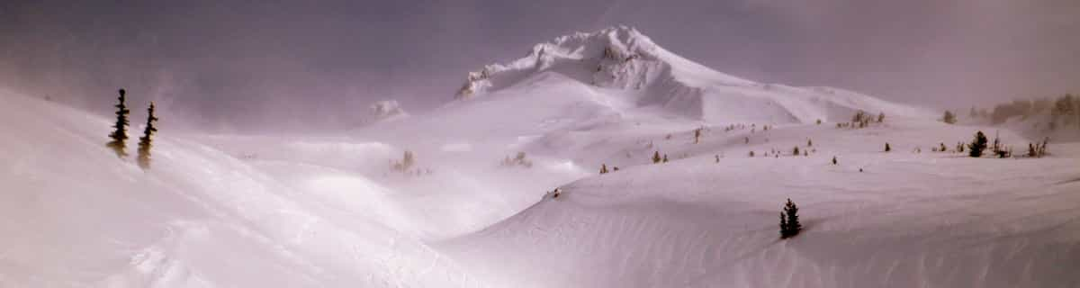
US Set To Be Home To World’s New Highest Ski Lift
The US looks set to become the new home of the world’s highest ski lift after Colorado’s Copper Mountain got the go ahead from the White River National Forest to expand its ski area.
Please sign in with your Snow-Forecast account details below.


Vail Weather (Next 3 days): The snow forecast for Vail is: A dusting of snow turning to light rain (total 4.0mm) on Sat afternoon. Freeze-thaw conditions (max 10°C on Mon afternoon, min -10°C on Fri night). Winds increasing (calm on Sat morning, fresh winds from the WSW by Mon afternoon).
Vail Weather (Days 4-6): Light rain (total 7.0mm), mostly falling on Thu afternoon. Freeze-thaw conditions (max 12°C on Thu morning, min 0°C on Mon night). Wind will be generally light.
| Resort | Snow Depth | Temp. (°C) | Wind (km/h) | Weather | ||
|---|---|---|---|---|---|---|
| Top Lift: | 1.2 m | -15 | ||||
| Middle Lift: | -12 | |||||
| Bottom Lift: | 0.3 m | -10 |
Latest snow reports near Vail:
Light snow reported from Leadville Airport at 9820 feet 5 miles S of Ski Cooper but it is probably falling as rain apart from near the top of the ski area from Ski Cooper
It is snowing steadily at Breckenridge. from Breckenridge

Saturday 19 | Sunday 20 | Monday 21 | Tuesday 22 | Wednesday 23 | Thursday 24 | ||||||||||||||
night | AM | PM | night | AM | PM | night | AM | PM | night | AM | PM | night | AM | PM | night | AM | PM | night | |
light snow | light snow | rain shwrs | light snow | cloudy | light rain | clear | clear | some clouds | rain shwrs | clear | rain shwrs | clear | some clouds | light rain | some clouds | some clouds | light rain | rain shwrs | |
km/h | |||||||||||||||||||
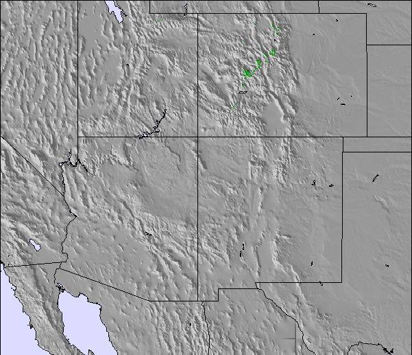
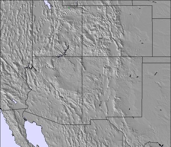
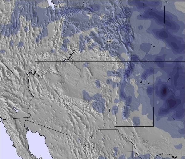
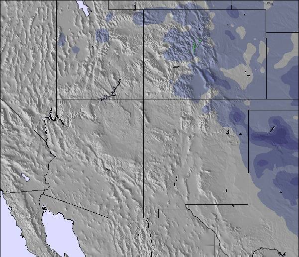
Snow map |  |  |  |  |  |  | 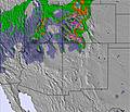 | ||||||||||||
4 | — | — | 1.0 | — | — | — | — | — | — | — | — | — | — | — | — | — | — | — | |
— | — | 2.0 | — | — | 2.0 | — | — | — | 1.0 | — | 1.0 | — | — | 2.0 | — | — | 3 | 2.0 | |
max°C | -4 | 1 | 3 | -3 | 2 | 5 | 0 | 9 | 10 | 2 | 9 | 11 | 3 | 11 | 8 | 4 | 12 | 11 | 5 |
min°C | -10 | -3 | 2 | -7 | 0 | 5 | -2 | 6 | 8 | 0 | 7 | 9 | 2 | 9 | 7 | 2 | 9 | 9 | 2 |
-14 | -3 | 0 | -10 | -2 | 2 | -5 | 3 | 4 | -2 | 5 | 8 | 0 | 7 | 7 | 0 | 9 | 8 | -1 | |
94 | 72 | 67 | 93 | 63 | 61 | 73 | 43 | 35 | 68 | 39 | 27 | 59 | 36 | 64 | 64 | 45 | 41 | 84 | |
1650 | 1950 | 2850 | 2050 | 2400 | 3100 | 2600 | 3350 | 3750 | 2950 | 3450 | 3800 | 3200 | 3700 | 3550 | 3250 | 3650 | 3950 | 3200 | |
— | 6:22 | — | — | 6:20 | — | — | 6:18 | — | — | 6:18 | — | — | 6:16 | — | — | 6:15 | — | — | |
— | — | 7:46 | — | — | 7:47 | — | — | 7:49 | — | — | 7:50 | — | — | 7:51 | — | — | 7:52 | — | |
A dusting of snow turning to light rain (total 4.0mm) on Sat afternoon. Freeze-thaw conditions (max 10°C on Mon afternoon, min -10°C on Fri night). Winds increasing (calm on Sat morning, fresh winds from the WSW by Mon afternoon).
Light rain (total 7.0mm), mostly falling on Thu afternoon. Freeze-thaw conditions (max 12°C on Thu morning, min 0°C on Mon night). Wind will be generally light.
Latest snow reports near Vail:
Light snow reported from Leadville Airport at 9820 feet 5 miles S of Ski Cooper but it is probably falling as rain apart from near the top of the ski area from Ski Cooper
It is snowing steadily at Breckenridge. from Breckenridge
| Top snow depth: | 121 cm |
|---|---|
| Bottom snow depth: | 30 cm |
| Fresh snowfall depth: | 4 cm |
| Last snowfall: | 17 Apr 2025 |
| Snow Alerts | Create Alert |
0.1 | Bluebird Powder days Fresh snow, mostly sunny, light wind. |
|---|---|
1.2 | Powder days Fresh snow, limited sun, any wind. |
0.1 | Bluebird days Average snow, mostly sunny, light wind. |


The above table gives the weather forecast for Vail at the specific elevation of 2474 m. Our sophisticated weather models allow us to provide snow forecasts for the top, middle and bottom ski stations of Vail. To access the weather forecasts for the other elevations, use the tab navigation above the table. For a wider view of the weather, check out the Weather Map of United States.
Click here to read further information on freezing levels and how we forecast our temperatures.
Overall 4.3 Based on 10 votes and 18 reviews
One reviewer states the following: "Europe is sick on its day, but the powder is not as light as the Rockies, and is much more avalanche prone if you go off-piste." --- This is a disservice to the community here and gravely understates the risk to off-piste skiers in the Vail area. Colorado and it's continental snowpack is one of the most dangerous in the world for avalanche risk. The Alps are much safer, as the snowpack stabilizes much faster after storms versus the long-term and deep instabilities found in the USA's Central Rcckies. Do not take out-of-bounds or off-piste skiing lightly at Vail or anywhere else in Colorado. To suggest that somehow the snowpack in Vail is "safe" is akin to saying that a revolver with only one bullet in the six chamber gun is is "safe" when playing Russian Roulette. For those that would ski Vail's off-piste (outside the controlled ski area boundary), you will need a beacon, shovel, probe and the ability to use these tools. The best source of snowpack and avalanche information for backcountry and off-piste travellers in the Vail area and the rest of Colorado is the Colorado Avalanche Information Center. Google it and check out the local and regional forecasts prior to leaving the resort boundaries.
heavy winter from United States writes:
One reviewer states the following: "Europe is sick on its day, but the powder is not as light as the Rockies, and is much more avalanche prone if you go off-piste." --- This is a disservice to the community here and gravely understates the risk to off-piste skiers in the Vail area. Colorado and it's continental snowpack is one of the most dangerous in the world for avalanche risk. The Alps are much safer, as the snowpack stabilizes much faster after storms versus the long-term and deep instabilities found in the USA's Central Rcckies. Do not take out-of-bounds or off-piste skiing lightly at Vail or anywhere else in Colorado. To suggest that somehow the snowpack in Vail is "safe" is akin to saying that a revolver with only one bullet in the six chamber gun is is "safe" when playing Russian Roulette. For those that would ski Vail's off-piste (outside the controlled ski area boundary), you will need a beacon, shovel, probe and the ability to use these tools. The best source of snowpack and avalanche information for backcountry and off-piste travellers in the Vail area and the rest of Colorado is the Colorado Avalanche Information Center. Google it and check out the local and regional forecasts prior to leaving the resort boundaries.
The Vail skiing weather widget is available to embed on external websites free of charge. It provides a daily summary of our Vail snow forecast and current weather conditions. Simply go to the feed configuration page and follow the 3 simple steps to grab the custom html code snippet and paste it into your own site. You can choose the snow forecast elevation (summit, mid-mountain or bottom lift) and metric/imperial units for the snow forecast feed to suit your own website…. Click here to get the code.
View detailed snow forecast for Vail at:
snow-forecast.com

 Nearest