Sugarloaf snow
Ski USA - Maine

Sugarloaf Snow Forecast

Weather Forecast for Sugarloaf at 1296 m
Issued: 1 am  27 Apr 2025 (local time)

New snow in Sugarloaf

9.0cm3.5in
Sun 27th (AM)
The snow forecast for Sugarloaf is: A light covering of new snow, mostly falling on Sun night. Becoming milder with light rain (total 2.0mm) on Tue night. Freeze-thaw conditions (max 12°C on Tue night, min -3°C on Sun afternoon). Winds decreasing (severe gales from the N on Sun night, light winds from the WNW by Mon night).

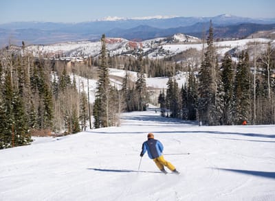
Sugarloaf Weather (Next 3 days): The snow forecast for Sugarloaf is: A light covering of new snow, mostly falling on Sun night. Becoming milder with light rain (total 2.0mm) on Tue night. Freeze-thaw conditions (max 12°C on Tue night, min -3°C on Sun afternoon). Winds decreasing (severe gales from the N on Sun night, light winds from the WNW by Mon night).

Sugarloaf Weather (Days 4-6): Moderate rain (total 13.0mm), heaviest on Fri night. Freeze-thaw conditions (max 10°C on Fri night, min -5°C on Wed morning). Winds decreasing (severe gales from the NW on Wed morning, calm by Thu afternoon).


Sugarloaf Live Weather

ResortSnow DepthTemp. (°C)Wind (km/h)Weather
Top Lift: 0.6m
6
5
light rain
Middle Lift: 
7
5
light rain
Bottom Lift: 0.3m
8
5
light rain
Powered by Snow-Forecast.comSnow-Forecast.com
6 Day Forecast
Issued: 1 am 27 Apr 2025 / Updates in ::
Change Forecast Height
Choose Forecast
Last 6 daysScroll left for last 6 daysNow
Sunday
27
Monday
28
Tuesday
29
Wednesday
30
Thursday
1
Friday
2
Saturday
3
AM
PM
night
AM
PM
night
AM
PM
night
AM
PM
night
AM
PM
night
AM
PM
night
AM
PM
night
light snow
light snow
snow showers
clear
clear
clear
part cloud
part cloud
rain showers
part cloud
clear
part cloud
part cloud
part cloud
cloud
light rain
cloud
rain showers
mod rain
light snow
light snow
light snow
light snow
snow shwrs
clear
clear
clear
some clouds
some clouds
rain shwrs
some clouds
clear
some clouds
some clouds
some clouds
cloudy
light rain
cloudy
rain shwrs
mod. rain
light snow
light snow
 km/h
30
NNE
70
N
70
N
35
NNW
30
NW
20
W
35
WSW
45
SW
70
W
60
NW
50
NW
50
NNW
20
NNW
5
W
40
S
55
SW
45
WSW
45
S
20
NNW
25
NNW
35
WNW
Snow map
 cm 
1.0
3
3
1.0
 mm 
2.0
3
10
8
6
max°C
1
-2
2
3
5
6
9
11
12
-3
0
2
3
7
6
9
9
10
7
4
0
min°C
0
-3
-2
2
3
5
8
10
1
-5
-1
-1
3
5
5
6
8
7
5
2
-3
chill°C 
-7
-14
-13
-5
-2
1
3
7
-8
-16
-10
-10
-3
4
0
0
3
2
1
-4
-11
Humid% 
99
98
76
63
49
44
44
59
96
78
53
22
17
33
45
96
92
99
98
97
81
Freezing level (m
1200
800
1650
1850
2300
2550
3400
3400
3350
700
1300
1350
2450
2950
3200
3150
3500
3150
2850
1800
900
topliftbotliftSea lvl1000m2000m3000m4000m5000m
1-303469117-4-1136689963-242381261319113938157699873
Sunrise
5:35
5:35
5:33
5:31
5:30
5:28
5:26
Sunset
7:39
7:42
7:43
7:44
7:45
7:46
7:47

Snow Radar

Latest snow reports near Sugarloaf:

No recent snow reports

No recent snow reports

Sugarloaf Snow Conditions

Top snow depth:61cm
Bottom snow depth:30cm
Fresh snowfall depth:
Last snowfall:15 Apr 2025
Snow AlertsCreate Alert
Other resorts in USA - Maine are reporting: powder (0) / good piste (0)

Snow-Forecast Partner Offers

Snow History

Week 4 of April has on average:
0.2
Bluebird Powder days
Fresh snow, mostly sunny, light wind.
0.6
Powder days
Fresh snow, limited sun, any wind.
0.7
Bluebird days
Average snow, mostly sunny, light wind.