
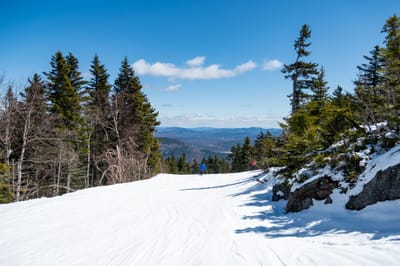
Whistler leads North America with 90% terrain open after fresh snowfall
Updated April 16, 2025: Big late-season dumps hit the Northeast and Canada, while Rockies brace for Easter snow—some resorts still skiing into May.
Please sign in with your Snow-Forecast account details below.

Sugarbush Weather (Next 3 days): The snow forecast for Sugarbush is: Light rain (total 9.0mm), mostly falling on Sat morning. Freeze-thaw conditions (max 11°C on Fri night, min -7°C on Thu morning). Winds increasing (moderate winds from the WSW on Fri morning, gales from the W by Sat afternoon).
Sugarbush Weather (Days 4-6): Moderate rain (total 14.0mm) heaviest on Mon night, then becoming colder with a dusting of snow on Tue morning. Freeze-thaw conditions (max 7°C on Mon night, min -6°C on Sun morning). Winds decreasing (near gales from the NW on Sun morning, calm by Mon morning).
| Resort | Snow Depth | Temp. (°C) | Wind (km/h) | Weather | ||
|---|---|---|---|---|---|---|
| Top Lift: | 1.2 m | -7 | ||||
| Middle Lift: | -4 | |||||
| Bottom Lift: | 0.7 m | -2 |
Latest snow reports near Sugarbush:

Thursday 17 | Friday 18 | Saturday 19 | Sunday 20 | Monday 21 | Tuesday 22 | Wednesday 23 | |||||||||||||||
AM | PM | night | AM | PM | night | AM | PM | night | AM | PM | night | AM | PM | night | AM | PM | night | AM | PM | night | |
snow shwrs | clear | some clouds | clear | light rain | light rain | light rain | light rain | light snow | snow shwrs | some clouds | clear | some clouds | light rain | mod. rain | light snow | light snow | light snow | light snow | some clouds | heavy rain | |
km/h | |||||||||||||||||||||
Snow map |  |  |  |  |  |  |  | ||||||||||||||
— | — | — | — | — | — | — | — | — | — | — | — | — | — | — | 1.0 | 1.0 | 1.0 | — | — | — | |
— | — | — | — | 1.0 | 3 | 4 | 1.0 | — | — | — | — | — | 3 | 10 | 1.0 | — | — | — | — | 13 | |
max°C | -7 | -3 | 0 | 6 | 8 | 11 | 11 | 11 | 8 | -5 | -2 | 1 | 5 | 4 | 7 | 4 | 0 | -2 | 0 | 6 | 8 |
min°C | -7 | -4 | -3 | 3 | 5 | 7 | 11 | 10 | -2 | -6 | -3 | -2 | 4 | 3 | 4 | 1 | -1 | -3 | -2 | 3 | 7 |
-17 | -13 | -12 | -2 | -2 | 0 | 8 | 5 | -11 | -17 | -12 | -11 | 4 | -3 | -3 | -5 | -7 | -11 | -9 | -2 | 2 | |
76 | 58 | 43 | 23 | 83 | 95 | 90 | 86 | 78 | 78 | 65 | 32 | 15 | 98 | 99 | 99 | 97 | 100 | 90 | 73 | 96 | |
500 | 900 | 0 | 2700 | 2700 | 3550 | 3350 | 3450 | 1750 | 700 | 1050 | 1500 | 2800 | 3000 | 2800 | 1400 | 1050 | 900 | 1250 | 3150 | 2850 | |
6:05 | — | — | 6:03 | — | — | 6:01 | — | — | 6:00 | — | — | 5:58 | — | — | 5:56 | — | — | 5:54 | — | — | |
— | 7:37 | — | — | 7:37 | — | — | 7:39 | — | — | 7:40 | — | — | 7:42 | — | — | 7:43 | — | — | 7:45 | — | |
Light rain (total 9.0mm), mostly falling on Sat morning. Freeze-thaw conditions (max 11°C on Fri night, min -7°C on Thu morning). Winds increasing (moderate winds from the WSW on Fri morning, gales from the W by Sat afternoon).
Moderate rain (total 14.0mm) heaviest on Mon night, then becoming colder with a dusting of snow on Tue morning. Freeze-thaw conditions (max 7°C on Mon night, min -6°C on Sun morning). Winds decreasing (near gales from the NW on Sun morning, calm by Mon morning).
Latest snow reports near Sugarbush:
| Top snow depth: | 122 cm |
|---|---|
| Bottom snow depth: | 71 cm |
| Fresh snowfall depth: | 5 cm |
| Last snowfall: | 16 Apr 2025 |
| Snow Alerts | Create Alert |
0.2 | Bluebird Powder days Fresh snow, mostly sunny, light wind. |
|---|---|
1.0 | Powder days Fresh snow, limited sun, any wind. |
0.6 | Bluebird days Average snow, mostly sunny, light wind. |
The above table gives the weather forecast for Sugarbush at the specific elevation of 1260 m. Our sophisticated weather models allow us to provide snow forecasts for the top, middle and bottom ski stations of Sugarbush. To access the weather forecasts for the other elevations, use the tab navigation above the table. For a wider view of the weather, check out the Weather Map of United States.
Click here to read further information on freezing levels and how we forecast our temperatures.
Overall 4.1 Based on 10 votes and 10 reviews
Sugarbush is arguably the best "Skier's Mountain" in the Northeast. I first came here about 25 years ago and was struck by how the operation was geared around the skier. While they've grown, they have stayed close to their roots. When one says they have "something for everyone", here we're not talking about one run for this, one run for that. How about an entire mountain just for natural snow lovers? How about Mt. Ellen which offers reasonably priced tickets, with a smaller, somewhat remote, laid back atmosphere? How about a lodge where they actually have a storage area and very large eating area all at ground level? Skiers that come here know what they are, and Sugarbush does not make an attempt to change you. You can still find a lot of "Old School" trails - if you know what I mean, I don't have to tell you. Sure, Sugarbush has many of the accoutrements of a large area: shopping, dining and real estate, but in an appropriate scale. Sorry, no "Guest services" staff lurking about to direct you to the Bogner store. Safe? You bet. No pimpleheads stealing skis from the racks. The development has been steady but slow. They manage their finances well and don't dream big with money they don't have. They have an extremely friendly and helpful relationship with Mad River Glen right down the road. I believe they also give back to the community in large ways such as donating an old lift. The nearby town of Waitsfield is not your shopper's mecca, but it has everything a skier could want, with plenty of dining options. New England the way it was. The trails are a dream. Plenty of groomers at all levels, plenty of natural. Relax or engaged, it's your choice. Stowe used to be an annual stop for me, but no longer. It's too predictable, and become far more corporate. I now spend several days a year at Sugarbush and Mad River. It's a delight to have three peaks, plus Middlebury all nearby.
Bill Tarkulich from United States writes:
Sugarbush is arguably the best "Skier's Mountain" in the Northeast. I first came here about 25 years ago and was struck by how the operation was geared around the skier. While they've grown, they have stayed close to their roots. When one says they have "something for everyone", here we're not talking about one run for this, one run for that. How about an entire mountain just for natural snow lovers? How about Mt. Ellen which offers reasonably priced tickets, with a smaller, somewhat remote, laid back atmosphere? How about a lodge where they actually have a storage area and very large eating area all at ground level? Skiers that come here know what they are, and Sugarbush does not make an attempt to change you. You can still find a lot of "Old School" trails - if you know what I mean, I don't have to tell you. Sure, Sugarbush has many of the accoutrements of a large area: shopping, dining and real estate, but in an appropriate scale. Sorry, no "Guest services" staff lurking about to direct you to the Bogner store. Safe? You bet. No pimpleheads stealing skis from the racks. The development has been steady but slow. They manage their finances well and don't dream big with money they don't have. They have an extremely friendly and helpful relationship with Mad River Glen right down the road. I believe they also give back to the community in large ways such as donating an old lift. The nearby town of Waitsfield is not your shopper's mecca, but it has everything a skier could want, with plenty of dining options. New England the way it was. The trails are a dream. Plenty of groomers at all levels, plenty of natural. Relax or engaged, it's your choice. Stowe used to be an annual stop for me, but no longer. It's too predictable, and become far more corporate. I now spend several days a year at Sugarbush and Mad River. It's a delight to have three peaks, plus Middlebury all nearby.
The Sugarbush skiing weather widget is available to embed on external websites free of charge. It provides a daily summary of our Sugarbush snow forecast and current weather conditions. Simply go to the feed configuration page and follow the 3 simple steps to grab the custom html code snippet and paste it into your own site. You can choose the snow forecast elevation (summit, mid-mountain or bottom lift) and metric/imperial units for the snow forecast feed to suit your own website…. Click here to get the code.
View detailed snow forecast for Sugarbush at:
snow-forecast.com


 Nearest