
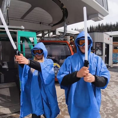
Ski Areas Ready for Star Wars Day
Several North American ski areas that are still open plan to celebrate the unofficial Star Wars Day tomorrow, May the Fourth (be with you).
Please sign in with your Snow-Forecast account details below.

Stuhleck Weather (Next 3 days): The snow forecast for Stuhleck is: A dusting of new snow. Freeze-thaw conditions (max 1°C on Tue morning, min -1°C on Wed morning). Wind will be generally light.
Stuhleck Weather (Days 4-6): Light rain (total 3.0mm), mostly falling on Sun afternoon. Freeze-thaw conditions (max 3°C on Sat afternoon, min -2°C on Fri morning). Wind will be generally light.
| Resort | Snow Depth | Temp. (°F) | Wind (mph) | Weather | ||
|---|---|---|---|---|---|---|
| Top Lift: | 0 ft | 34 | ||||
| Middle Lift: | 36 | |||||
| Bottom Lift: | 0 ft | 39 |
Latest snow reports near Stuhleck:
Intermittent moderate snow reported from Rax Seilbahn Bergstation at 1558 metres elevation N of Reichenau an der Rax/Raxalpe but it is probably falling as rain apart from near the top of the ski area from Reichenau an der Rax/Raxalpe
Light rain showers reported from Sankt Sebastian/Mariazell at 865 metres elevation only 3 kms NW of Mariazeller Land but it is forecast cold enough for snow at the ski area from Mariazeller Land
Rain reported from Rax Seilbahn Bergstation at 1558 metres elevation N of Reichenau an der Rax/Raxalpe but it is forecast cold enough for snow at higher elevations in the ski area from Reichenau an der Rax/Raxalpe

Tuesday 6 | Wednesday 7 | Thursday 8 | Friday 9 | Saturday 10 | Sunday 11 | Monday 12 | |||||||||||||||
AM | PM | night | AM | PM | night | AM | PM | night | AM | PM | night | AM | PM | night | AM | PM | night | AM | PM | night | |
light snow | light snow | cloudy | cloudy | cloudy | light snow | light snow | light snow | light snow | cloudy | cloudy | clear | some clouds | cloudy | some clouds | light snow | rain shwrs | rain shwrs | some clouds | cloudy | some clouds | |
mph | |||||||||||||||||||||
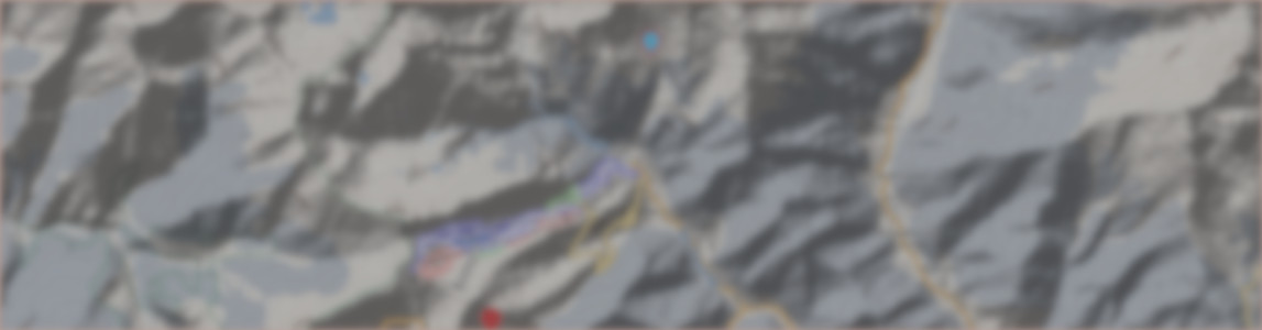
Snow map |  |  | 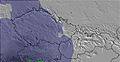 | 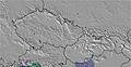 | 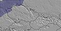 | 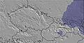 |  | ||||||||||||||
— | — | — | — | — | 0.4 | 0.4 | — | — | — | — | — | — | — | — | — | — | — | — | — | — | |
— | — | — | — | — | — | — | — | — | — | — | — | — | — | — | — | 0.08 | 0.04 | — | — | — | |
max°F | 34 | 32 | 32 | 34 | 34 | 32 | 30 | 30 | 30 | 30 | 34 | 34 | 36 | 37 | 36 | 36 | 37 | 37 | 37 | 39 | 37 |
min°F | 32 | 32 | 32 | 30 | 34 | 30 | 30 | 30 | 30 | 28 | 34 | 32 | 32 | 36 | 34 | 32 | 36 | 36 | 34 | 36 | 28 |
28 | 28 | 27 | 25 | 32 | 30 | 25 | 30 | 25 | 25 | 32 | 27 | 27 | 32 | 30 | 28 | 30 | 32 | 28 | 32 | 18 | |
98 | 98 | 88 | 80 | 84 | 99 | 98 | 99 | 69 | 85 | 71 | 54 | 54 | 76 | 88 | 85 | 76 | 78 | 69 | 58 | 68 | |
5900 | 5900 | 6100 | 6400 | 6600 | 5600 | 4900 | 5100 | 5200 | 5200 | 6200 | 5900 | 6700 | 6900 | 6400 | 6600 | 7100 | 7200 | 7200 | 7400 | 4900 | |
5:33 | — | — | 5:31 | — | — | 5:30 | — | — | 5:28 | — | — | 5:26 | — | — | 5:24 | — | — | 5:24 | — | — | |
— | — | 8:14 | — | — | 8:15 | — | — | 8:16 | — | — | 8:17 | — | — | 8:20 | — | — | 8:21 | — | — | 8:22 | |
A dusting of new snow. Freeze-thaw conditions (max 1°C on Tue morning, min -1°C on Wed morning). Wind will be generally light.
Light rain (total 3.0mm), mostly falling on Sun afternoon. Freeze-thaw conditions (max 3°C on Sat afternoon, min -2°C on Fri morning). Wind will be generally light.
Latest snow reports near Stuhleck:
Intermittent moderate snow reported from Rax Seilbahn Bergstation at 1558 metres elevation N of Reichenau an der Rax/Raxalpe but it is probably falling as rain apart from near the top of the ski area from Reichenau an der Rax/Raxalpe
Light rain showers reported from Sankt Sebastian/Mariazell at 865 metres elevation only 3 kms NW of Mariazeller Land but it is forecast cold enough for snow at the ski area from Mariazeller Land
Rain reported from Rax Seilbahn Bergstation at 1558 metres elevation N of Reichenau an der Rax/Raxalpe but it is forecast cold enough for snow at higher elevations in the ski area from Reichenau an der Rax/Raxalpe
| Top snow depth: | 0 in |
|---|---|
| Bottom snow depth: | 0 in |
| Fresh snowfall depth: | — |
| Last snowfall: | 10 Apr 2025 |
| Snow Alerts | Create Alert |
0.1 | Bluebird Powder days Fresh snow, mostly sunny, light wind. |
|---|---|
0.0 | Powder days Fresh snow, limited sun, any wind. |
0.0 | Bluebird days Average snow, mostly sunny, light wind. |
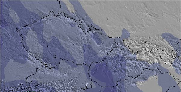
The above table gives the weather forecast for Stuhleck at the specific elevation of 1774 m. Our sophisticated weather models allow us to provide snow forecasts for the top, middle and bottom ski stations of Stuhleck. To access the weather forecasts for the other elevations, use the tab navigation above the table. For a wider view of the weather, check out the Weather Map of Austria.
Click here to read further information on freezing levels and how we forecast our temperatures.
Overall 3.2 Based on 9 votes and 2 reviews
Stuhleck is very good for skiing. Good pistes, most of the peoples are very very friendly and the workers are also very friendly! This year I´ll be back!
Skimaster2009 from Austria writes:
Stuhleck is very good for skiing. Good pistes, most of the peoples are very very friendly and the workers are also very friendly!
This year I´ll be back!
The Stuhleck skiing weather widget is available to embed on external websites free of charge. It provides a daily summary of our Stuhleck snow forecast and current weather conditions. Simply go to the feed configuration page and follow the 3 simple steps to grab the custom html code snippet and paste it into your own site. You can choose the snow forecast elevation (summit, mid-mountain or bottom lift) and metric/imperial units for the snow forecast feed to suit your own website…. Click here to get the code.
View detailed snow forecast for Stuhleck at:
snow-forecast.com

 Nearest