Sainte Anne La Condamine snow
Ski France

Sainte Anne La Condamine Snow Forecast

Weather Forecast for Sainte Anne La Condamine at 2116 m
Issued: 12 pm  14 Mar 2025 (local time)

Popular Sainte Anne La Condamine Pages

New snow in Sainte Anne La Condamine

5.0cm2.0in
Fri 14th (PM)
The snow forecast for Sainte Anne La Condamine is: A heavy fall of snow, heaviest during Sat afternoon. Temperatures will be below freezing (max -1°C on Fri afternoon, min -7°C on Sat night). Wind will be generally light.

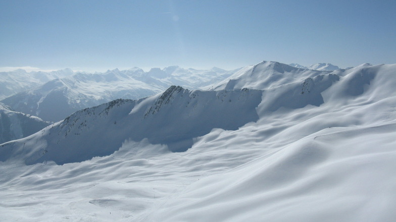
Sainte Anne La Condamine Weather (Next 3 days): The snow forecast for Sainte Anne La Condamine is: A heavy fall of snow, heaviest during Sat afternoon. Temperatures will be below freezing (max -1°C on Fri afternoon, min -7°C on Sat night). Wind will be generally light.

Sainte Anne La Condamine Weather (Days 4-6): Mostly dry. Temperatures will be below freezing (max 0°C on Wed morning, min -6°C on Tue night). Wind will be generally light.


Sainte Anne La Condamine Live Weather

ResortSnow DepthTemp. (°C)Wind (km/h)Weather
Top Lift: 
-3
10
mod snow
Middle Lift: 
-2
10
light snow
Bottom Lift: 
0
5
light snow
Powered by Snow-Forecast.comSnow-Forecast.com
6 Day Forecast
Issued: 12 pm 14 Mar 2025 / Updates in ::
Change Forecast Height
Choose Forecast
Last 6 daysScroll left for last 6 daysNow
Friday
14
Saturday
15
Sunday
16
Monday
17
Tuesday
18
Wednesday
19
Thursday
20
AM
PM
night
AM
PM
night
AM
PM
night
AM
PM
night
AM
PM
night
AM
PM
night
AM
PM
night
light snow
light snow
light snow
light snow
heavy snow
light snow
light snow
light snow
snow showers
clear
part cloud
part cloud
part cloud
snow showers
part cloud
clear
clear
clear
part cloud
cloud
cloud
light snow
light snow
light snow
light snow
heavy snow
light snow
light snow
light snow
snow shwrs
clear
some clouds
some clouds
some clouds
snow shwrs
some clouds
clear
clear
clear
some clouds
cloudy
cloudy
 km/h
5
S
10
SSE
5
S
5
SE
5
SSE
5
WNW
5
WNW
5
WSW
5
ESE
0
WNW
0
S
5
ESE
5
ESE
0
ESE
5
ESE
5
S
5
SSW
0
SE
5
S
5
S
10
ESE
Snow map
 cm 
3
5
2.0
11
2.0
 mm 
max°C
-2
-1
-2
-1
-2
-5
-4
-4
-6
-1
-1
-3
-1
-2
-5
0
0
-3
0
1
-1
min°C
-2
-2
-3
-2
-3
-7
-4
-5
-7
-2
-2
-5
-2
-3
-6
-1
-2
-4
0
-1
-2
chill°C 
-5
-5
-6
-5
-6
-7
-4
-5
-10
-2
-2
-9
-4
-3
-8
-1
-2
-4
-2
-3
-6
Humid% 
84
97
97
96
97
95
83
86
78
62
67
68
75
82
73
46
60
69
83
76
84
Freezing level (m
1800
1900
1650
1850
1800
1150
1300
1500
600
1750
2050
1100
1850
1850
750
1950
2050
1050
2200
2250
1850
topliftbotliftSea lvl1000m2000m3000m4000m5000m
-4-3-4-4-5-7-6-6-7-4-3-5-3-4-6-2-3-4-1-2-300-20-1-7-3-4-10-1-3-60-2-91-2-621-3
Sunrise
6:48
6:46
6:43
6:41
6:39
6:37
6:37
Sunset
6:37
6:37
6:38
6:40
6:42
6:43
6:45
Popular Sainte Anne La Condamine Pages

Snow Radar

Submit a report Eyeball Reporter

Latest snow reports near Sainte Anne La Condamine:

  • 17 km away from Sainte Anne La Condamine

    12 hours ago
    Is it snowing?

    There is heavy snow falling in Vars. from Vars

  • 49 km away from Sainte Anne La Condamine

    22 hours ago
    Is it snowing?

    There is heavy snow falling in Briancon. from Briancon

Sainte Anne La Condamine Snow Conditions

Top snow depth:
Bottom snow depth:
Fresh snowfall depth:21cm
Last snowfall:13 Mar 2025
Snow AlertsCreate Alert
Other resorts in France are reporting: powder (22) / good piste (22)

Snow-Forecast Partner Offers

Snow History

Week 2 of March has on average:
0.6
Bluebird Powder days
Fresh snow, mostly sunny, light wind.
0.5
Powder days
Fresh snow, limited sun, any wind.
1.6
Bluebird days
Average snow, mostly sunny, light wind.


Snow-Forecast Partner Offers