

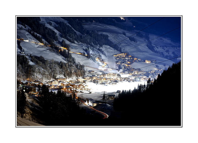
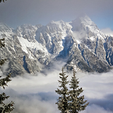
Massive Snowfall in the Alps
A huge snowfall is underway in the Alps, by far the biggest of the 24-25 season.
Please sign in with your Snow-Forecast account details below.


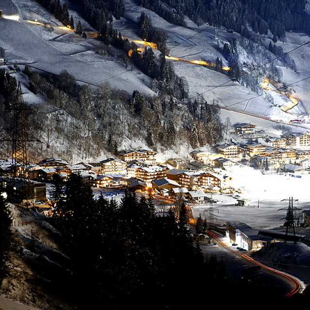
Saalbach Hinterglemm Weather (Next 3 days): The snow forecast for Saalbach Hinterglemm is: Mild with moderate rain (total 18.0mm) on Tue night, Becoming colder with a light covering of snow, mostly falling on Wed night. Freeze-thaw conditions (max 6°C on Wed afternoon, min -2°C on Wed night). Wind will be generally light.
Saalbach Hinterglemm Weather (Days 4-6): A light covering of new snow, mostly falling on Thu night. Freeze-thaw conditions (max 6°C on Sat afternoon, min -3°C on Thu night). Wind will be generally light.
| Resort | Snow Depth | Temp. (°C) | Wind (km/h) | Weather | ||
|---|---|---|---|---|---|---|
| Top Lift: | 3 | |||||
| Middle Lift: | 6 | |||||
| Bottom Lift: | 9 |
Latest snow reports near Saalbach Hinterglemm:

Monday 21 | Tuesday 22 | Wednesday 23 | Thursday 24 | Friday 25 | Saturday 26 | Sunday 27 | |||||||||||||||
AM | PM | night | AM | PM | night | AM | PM | night | AM | PM | night | AM | PM | night | AM | PM | night | AM | PM | night | |
some clouds | light rain | light snow | light snow | light rain | mod. rain | some clouds | risk thun- der | mod. snow | light snow | light snow | light snow | light snow | light snow | snow shwrs | clear | some clouds | some clouds | rain shwrs | rain shwrs | rain shwrs | |
km/h | |||||||||||||||||||||
Snow map |  |  |  |  |  |  |  | ||||||||||||||
— | — | 1.0 | — | — | — | — | — | 8 | 1.0 | 1.0 | 2.0 | 1.0 | 1.0 | — | — | — | — | — | — | — | |
— | 2.0 | 1.0 | — | 1.0 | 6 | — | 3 | 5 | — | — | — | — | — | — | — | — | — | 1.0 | 2.0 | 1.0 | |
max°C | 4 | 5 | 3 | 1 | 3 | 3 | 4 | 6 | 4 | -2 | 0 | -1 | -2 | 0 | 0 | 4 | 6 | 4 | 4 | 5 | 3 |
min°C | 3 | 4 | 1 | 1 | 2 | 2 | 2 | 5 | -2 | -2 | 0 | -3 | -3 | 0 | -1 | 1 | 6 | 2 | 2 | 4 | 1 |
1 | 3 | 1 | 1 | 2 | 2 | 2 | 5 | -7 | -6 | -4 | -8 | -7 | -4 | -4 | 1 | 6 | 2 | 2 | 2 | -1 | |
77 | 91 | 97 | 94 | 93 | 92 | 76 | 90 | 98 | 93 | 88 | 96 | 96 | 88 | 79 | 57 | 64 | 75 | 69 | 72 | 84 | |
2650 | 2750 | 2400 | 2350 | 2600 | 2500 | 2700 | 2800 | 2050 | 1900 | 2050 | 1800 | 1750 | 2050 | 2000 | 2750 | 2800 | 2500 | 2500 | 2600 | 2300 | |
6:11 | — | — | 6:09 | — | — | 6:07 | — | — | 6:05 | — | — | 6:03 | — | — | 6:01 | — | — | 6:00 | — | — | |
— | — | 8:06 | — | — | 8:07 | — | — | 8:08 | — | — | 8:09 | — | — | 8:10 | — | — | 8:13 | — | — | 8:14 | |
Mild with moderate rain (total 18.0mm) on Tue night, Becoming colder with a light covering of snow, mostly falling on Wed night. Freeze-thaw conditions (max 6°C on Wed afternoon, min -2°C on Wed night). Wind will be generally light.
A light covering of new snow, mostly falling on Thu night. Freeze-thaw conditions (max 6°C on Sat afternoon, min -3°C on Thu night). Wind will be generally light.
Latest snow reports near Saalbach Hinterglemm:
| Top snow depth: | — |
|---|---|
| Bottom snow depth: | — |
| Fresh snowfall depth: | — |
| Last snowfall: | 18 Apr 2025 |
| Snow Alerts | Create Alert |
0.3 | Bluebird Powder days Fresh snow, mostly sunny, light wind. |
|---|---|
1.7 | Powder days Fresh snow, limited sun, any wind. |
0.4 | Bluebird days Average snow, mostly sunny, light wind. |


The above table gives the weather forecast for Saalbach Hinterglemm at the specific elevation of 2100 m. Our sophisticated weather models allow us to provide snow forecasts for the top, middle and bottom ski stations of Saalbach Hinterglemm. To access the weather forecasts for the other elevations, use the tab navigation above the table. For a wider view of the weather, check out the Weather Map of Austria.
Click here to read further information on freezing levels and how we forecast our temperatures.
Overall 4.3 Based on 37 votes and 47 reviews
It’s epic on a powder day - other than that it’s a total Jerry circus.
Ranger_dad from Germany writes:
It’s epic on a powder day - other than that it’s a total Jerry circus.
Read 46 more reviews of Saalbach Hinterglemm or submit your own
The Saalbach Hinterglemm skiing weather widget is available to embed on external websites free of charge. It provides a daily summary of our Saalbach Hinterglemm snow forecast and current weather conditions. Simply go to the feed configuration page and follow the 3 simple steps to grab the custom html code snippet and paste it into your own site. You can choose the snow forecast elevation (summit, mid-mountain or bottom lift) and metric/imperial units for the snow forecast feed to suit your own website…. Click here to get the code.
View detailed snow forecast for Saalbach Hinterglemm at:
snow-forecast.com


 Nearest