

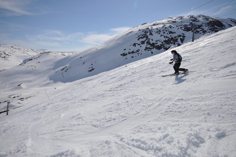
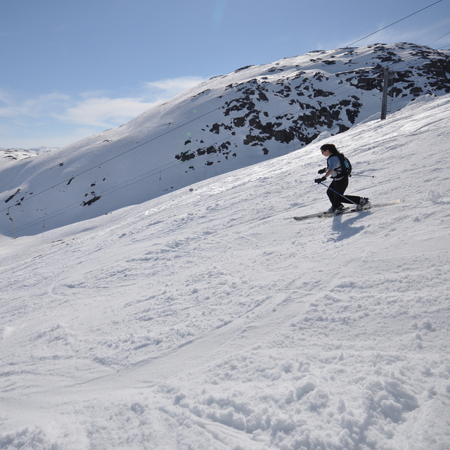
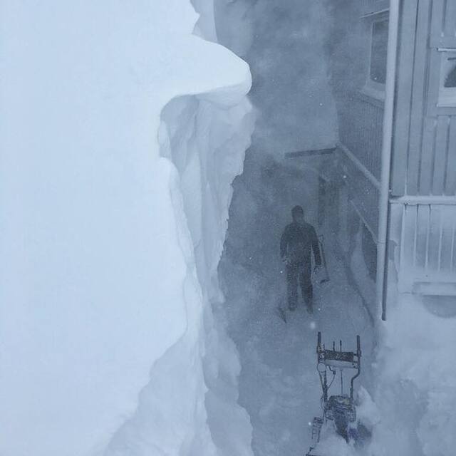
Massive Snowfall in the Alps
A huge snowfall is underway in the Alps, by far the biggest of the 24-25 season.
Please sign in with your Snow-Forecast account details below.


Riksgränsen Weather (Next 3 days): The snow forecast for Riksgränsen is: A light covering of new snow, mostly falling on Sat morning. Freeze-thaw conditions (max 1°C on Fri night, min -16°C on Sun night). Wind will be generally light.
Riksgränsen Weather (Days 4-6): A dusting of new snow. Temperatures will be below freezing (max -2°C on Tue afternoon, min -13°C on Wed night). Wind will be generally light.
| Resort | Snow Depth | Temp. (°C) | Wind (km/h) | Weather | ||
|---|---|---|---|---|---|---|
| Top Lift: | 1.9 m | -2 | ||||
| Middle Lift: | 0 | |||||
| Bottom Lift: | 0.8 m | 0 |
Latest snow reports near Riksgränsen:

Saturday 19 | Sunday 20 | Monday 21 | Tuesday 22 | Wednesday 23 | Thursday 24 | ||||||||||||||
night | AM | PM | night | AM | PM | night | AM | PM | night | AM | PM | night | AM | PM | night | AM | PM | night | |
light snow | light snow | light snow | light snow | snow shwrs | some clouds | clear | snow shwrs | some clouds | cloudy | light snow | light snow | light snow | light snow | light snow | light snow | clear | clear | clear | |
km/h | |||||||||||||||||||
Snow map | 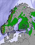 | 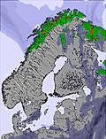 | 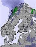 | 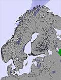 | 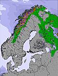 | 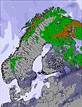 | 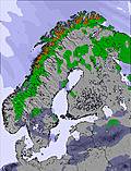 | ||||||||||||
1.0 | 3 | 1.0 | 2.0 | — | — | — | — | — | — | — | — | — | — | 1.0 | 1.0 | — | — | — | |
— | — | — | — | — | — | — | — | — | — | — | — | — | — | — | — | — | — | — | |
max°C | 1 | 0 | -1 | -5 | -4 | -3 | -9 | -6 | -4 | -9 | -4 | -2 | -5 | -4 | -3 | -4 | -6 | -4 | -10 |
min°C | -1 | 0 | -2 | -11 | -8 | -3 | -16 | -10 | -4 | -12 | -7 | -3 | -11 | -7 | -3 | -13 | -10 | -4 | -17 |
-3 | -2 | -5 | -14 | -8 | -6 | -16 | -10 | -6 | -17 | -10 | -3 | -15 | -10 | -3 | -18 | -14 | -4 | -17 | |
97 | 96 | 84 | 96 | 87 | 78 | 83 | 88 | 82 | 86 | 88 | 90 | 95 | 87 | 92 | 77 | 61 | 71 | 86 | |
600 | 400 | 150 | 0 | 0 | 0 | 0 | 0 | 0 | 0 | 0 | 0 | 0 | 0 | 0 | 0 | 0 | 0 | 0 | |
— | 4:37 | — | — | 4:33 | — | — | 4:28 | — | — | 4:24 | — | — | 4:20 | — | — | 4:15 | — | — | |
— | — | — | 8:57 | — | — | 9:00 | — | — | 9:05 | — | — | 9:09 | — | — | 9:14 | — | — | 9:17 | |
A light covering of new snow, mostly falling on Sat morning. Freeze-thaw conditions (max 1°C on Fri night, min -16°C on Sun night). Wind will be generally light.
A dusting of new snow. Temperatures will be below freezing (max -2°C on Tue afternoon, min -13°C on Wed night). Wind will be generally light.
Latest snow reports near Riksgränsen:
| Top snow depth: | 186 cm |
|---|---|
| Bottom snow depth: | 75 cm |
| Fresh snowfall depth: | 5 cm |
| Last snowfall: | 15 Apr 2025 |
| Snow Alerts | Create Alert |
0.5 | Bluebird Powder days Fresh snow, mostly sunny, light wind. |
|---|---|
1.8 | Powder days Fresh snow, limited sun, any wind. |
0.4 | Bluebird days Average snow, mostly sunny, light wind. |
The above table gives the weather forecast for Riksgränsen at the specific elevation of 500 m. Our sophisticated weather models allow us to provide snow forecasts for the top, middle and bottom ski stations of Riksgränsen. To access the weather forecasts for the other elevations, use the tab navigation above the table. For a wider view of the weather, check out the Weather Map of Sweden.
Click here to read further information on freezing levels and how we forecast our temperatures.
Resort name is also written as Riksgransen.
Overall 3.5 Based on 2 votes and 6 reviews
Riksgränsen is by far the best resort in Sweden for free riding, both on skis and snowboard. I would say that the resort profile on this page is severely wrong when stating that the mountain wouldn't appeal to an expert skier. Sure there 'aint much steep groomers but the inbounds off-piste terrain on the front side of the mountain is sick, steep and littered with cliffs. The backside is more mellow with longer and more open runs. There is also seriuos hike-to terrain on Nordalsfjäll, the venue of the Scandinavian Free skiing Championships, with steep (up to 55 degrees,long runs and cliffs up to 60 feet. Riksgränsen is also one of the resorts, in Sweden, that receives the most snow. [Editors note: Thank you for your comments. I have now altered the text in the notes to provide a more honest profile.]
D from Sweden writes:
Riksgränsen is by far the best resort in Sweden for free riding, both on skis and snowboard. I would say that the resort profile on this page is severely wrong when stating that the mountain wouldn't appeal to an expert skier. Sure there 'aint much steep groomers but the inbounds off-piste terrain on the front side of the mountain is sick, steep and littered with cliffs. The backside is more mellow with longer and more open runs. There is also seriuos hike-to terrain on Nordalsfjäll, the venue of the Scandinavian Free skiing Championships, with steep (up to 55 degrees,long runs and cliffs up to 60 feet. Riksgränsen is also one of the resorts, in Sweden, that receives the most snow.
[Editors note: Thank you for your comments. I have now altered the text in the notes to provide a more honest profile.]
The Riksgränsen skiing weather widget is available to embed on external websites free of charge. It provides a daily summary of our Riksgränsen snow forecast and current weather conditions. Simply go to the feed configuration page and follow the 3 simple steps to grab the custom html code snippet and paste it into your own site. You can choose the snow forecast elevation (summit, mid-mountain or bottom lift) and metric/imperial units for the snow forecast feed to suit your own website…. Click here to get the code.
View detailed snow forecast for Riksgränsen at:
snow-forecast.com


 Nearest