North America Weekly Snow Roundup #308
Weekly Snow News for North America, updated 2 April 2026: US resorts close early amid +20°C warmth, while Canada sees up to 64cm (26") snowfall and strong coverage.

Pakenham Weather (Next 3 days): The snow forecast for Pakenham is: Heavy rain (total 29.0mm), heaviest during Sat night. Later becoming colder with a dusting of snow on Mon night. Freeze-thaw conditions (max 13°C on Sat night, min -6°C on Mon night). Winds decreasing (fresh winds from the SSW on Sat night, calm by Mon night).
Pakenham Weather (Days 4-6): A dusting of snow turning to light rain (total 8.0mm) on Thu afternoon. Freeze-thaw conditions (max 10°C on Thu afternoon, min -9°C on Tue morning). Winds increasing (light winds from the SW on Wed morning, fresh winds from the SSW by Wed night).
| Resort | Snow Depth | Temp. (°C) | Wind (km/h) | Weather | ||
|---|---|---|---|---|---|---|
| Top Lift: | -1 | |||||
| Bottom Lift: | -1 |

Saturday 4 | Sunday 5 | Monday 6 | Tuesday 7 | Wednesday 8 | Thursday 9 | |||||||||||||
AM | PM | night | AM | PM | night | AM | PM | night | AM | PM | night | AM | PM | night | AM | PM | night | |
some clouds | light rain | heavy rain | light rain | light rain | snow shwrs | cloudy | cloudy | light snow | snow shwrs | cloudy | clear | some clouds | cloudy | cloudy | light rain | mod. rain | rain shwrs | |
km/h | ||||||||||||||||||
Snow map |  |  |  |  |  | 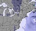 | ||||||||||||
— | — | — | — | — | — | — | — | 2 | 1 | — | — | — | — | — | — | — | — | |
— | 3 | 24 | 1 | 1 | — | — | — | — | — | — | — | — | — | — | 1 | 6 | 1 | |
max °C | 2 | 4 | 13 | 6 | 6 | 2 | -1 | 2 | 0 | -7 | -3 | -4 | -1 | 4 | 5 | 9 | 10 | 8 |
min °C | -1 | 3 | 5 | 6 | 5 | -2 | -2 | 1 | -6 | -9 | -4 | -6 | -5 | 3 | 3 | 6 | 9 | -4 |
-6 | -1 | 2 | 2 | 1 | -7 | -7 | -3 | -12 | -18 | -11 | -12 | -9 | -2 | -2 | 2 | 6 | -11 | |
65 | 89 | 92 | 67 | 65 | 82 | 66 | 50 | 89 | 40 | 32 | 56 | 42 | 34 | 58 | 76 | 88 | 84 | |
3150 | 3350 | 3050 | 850 | 750 | 100 | 0 | 400 | 0 | 0 | 0 | 0 | 0 | 800 | 2300 | 2150 | 1700 | 300 | |
6:39 | — | — | 6:37 | — | — | 6:37 | — | — | 6:35 | — | — | 6:33 | — | — | 6:31 | — | — | |
— | 7:36 | — | — | 7:37 | — | — | 7:38 | — | — | 7:39 | — | — | 7:40 | — | — | 7:42 | — | |
Heavy rain (total 29.0mm), heaviest during Sat night. Later becoming colder with a dusting of snow on Mon night. Freeze-thaw conditions (max 13°C on Sat night, min -6°C on Mon night). Winds decreasing (fresh winds from the SSW on Sat night, calm by Mon night).
A dusting of snow turning to light rain (total 8.0mm) on Thu afternoon. Freeze-thaw conditions (max 10°C on Thu afternoon, min -9°C on Tue morning). Winds increasing (light winds from the SW on Wed morning, fresh winds from the SSW by Wed night).
Latest snow reports near Pakenham:
| Top snow depth: | — |
|---|---|
| Bottom snow depth: | — |
| Fresh snowfall depth: | 1 cm |
| Last snowfall: | 2 Apr 2026 |
| Snow Alerts | Create Alert |
0.1 | Bluebird Powder days Fresh snow, mostly sunny, light wind. |
|---|---|
0.1 | Powder days Fresh snow, limited sun, any wind. |
0.8 | Bluebird days Average snow, mostly sunny, light wind. |
The above table gives the weather forecast for Pakenham at the specific elevation of 180 m. Our sophisticated weather models allow us to provide snow forecasts for the top, middle and bottom ski stations of Pakenham. To access the weather forecasts for the other elevations, use the tab navigation above the table. For a wider view of the weather, check out the Weather Map of Canada.
Click here to read further information on freezing levels and how we forecast our temperatures.
A great beginner hill and very nicely run Group Lessons for kids. But if you want to sign up for privates (much more expensive, of course), then you should ask for an experienced instructor in order to maximize your learning.
Happy Tails from Afghanistan writes:
A great beginner hill and very nicely run Group Lessons for kids. But if you want to sign up for privates (much more expensive, of course), then you should ask for an experienced instructor in order to maximize your learning.


 Nearest