

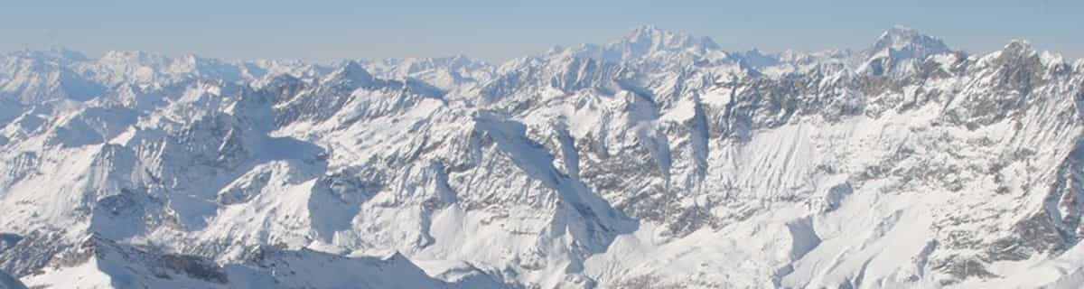
Massive Snowfall in the Alps
A huge snowfall is underway in the Alps, by far the biggest of the 24-25 season.
Please sign in with your Snow-Forecast account details below.

Ovindoli Weather (Next 3 days): The snow forecast for Ovindoli is: Moderate rain (total 12.0mm), heaviest on Mon afternoon. Mild temperatures (max 7°C on Sun afternoon, min 4°C on Sat night). Wind will be generally light.
Ovindoli Weather (Days 4-6): Heavy rain (total 31.0mm), heaviest during Wed afternoon. Later becoming colder with a dusting of snow on Fri afternoon. Mild temperatures (max 6°C on Tue night, min 1°C on Fri morning). Wind will be generally light.
| Resort | Snow Depth | Temp. (°C) | Wind (km/h) | Weather | ||
|---|---|---|---|---|---|---|
| Top Lift: | 5 | |||||
| Middle Lift: | 7 | |||||
| Bottom Lift: | 7 |
Latest snow reports near Ovindoli:

Sunday 20 | Monday 21 | Tuesday 22 | Wednesday 23 | Thursday 24 | Friday 25 | ||||||||||||||
night | AM | PM | night | AM | PM | night | AM | PM | night | AM | PM | night | AM | PM | night | AM | PM | night | |
some clouds | some clouds | some clouds | rain shwrs | risk thun- der | risk thun- der | rain shwrs | clear | risk thun- der | mod. rain | light rain | mod. rain | light rain | light rain | light rain | rain shwrs | clear | snow shwrs | snow shwrs | |
km/h | |||||||||||||||||||
Snow map | 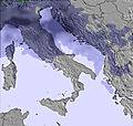 | 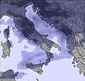 | 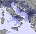 | 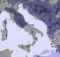 | 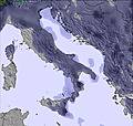 | 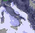 | 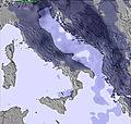 | ||||||||||||
— | — | — | — | — | — | — | — | — | — | — | — | — | — | — | — | — | 1.0 | 1.0 | |
— | — | — | 3 | 2.0 | 4 | 2.0 | — | 1.0 | 6 | 5 | 8 | 3 | 2.0 | 5 | 2.0 | — | — | — | |
max°C | 5 | 5 | 7 | 6 | 5 | 6 | 5 | 5 | 6 | 6 | 4 | 3 | 3 | 3 | 3 | 3 | 1 | 2 | 0 |
min°C | 4 | 5 | 7 | 5 | 5 | 6 | 5 | 5 | 6 | 4 | 4 | 3 | 2 | 2 | 3 | 2 | 1 | 1 | -1 |
0 | 2 | 5 | 3 | 3 | 4 | 3 | 4 | 6 | 4 | 4 | 3 | 2 | 2 | 2 | 2 | -2 | -4 | -5 | |
61 | 67 | 68 | 70 | 69 | 70 | 45 | 47 | 70 | 80 | 80 | 82 | 77 | 81 | 87 | 90 | 67 | 61 | 80 | |
2950 | 2900 | 3000 | 3050 | 3000 | 2950 | 3000 | 2950 | 2900 | 2850 | 2750 | 2700 | 2650 | 2600 | 2700 | 2600 | 2450 | 2350 | 2100 | |
— | 6:18 | — | — | 6:16 | — | — | 6:15 | — | — | 6:13 | — | — | 6:11 | — | — | 6:11 | — | — | |
— | — | 7:52 | — | — | 7:52 | — | — | 7:53 | — | — | 7:54 | — | — | 7:55 | — | — | 7:57 | — | |
Moderate rain (total 12.0mm), heaviest on Mon afternoon. Mild temperatures (max 7°C on Sun afternoon, min 4°C on Sat night). Wind will be generally light.
Heavy rain (total 31.0mm), heaviest during Wed afternoon. Later becoming colder with a dusting of snow on Fri afternoon. Mild temperatures (max 6°C on Tue night, min 1°C on Fri morning). Wind will be generally light.
Latest snow reports near Ovindoli:
| Top snow depth: | — |
|---|---|
| Bottom snow depth: | — |
| Fresh snowfall depth: | — |
| Last snowfall: | 1 Apr 2025 |
| Snow Alerts | Create Alert |
0.1 | Bluebird Powder days Fresh snow, mostly sunny, light wind. |
|---|---|
1.0 | Powder days Fresh snow, limited sun, any wind. |
0.1 | Bluebird days Average snow, mostly sunny, light wind. |
The above table gives the weather forecast for Ovindoli at the specific elevation of 2223 m. Our sophisticated weather models allow us to provide snow forecasts for the top, middle and bottom ski stations of Ovindoli. To access the weather forecasts for the other elevations, use the tab navigation above the table. For a wider view of the weather, check out the Weather Map of Italy.
Click here to read further information on freezing levels and how we forecast our temperatures.
Overall 4.2 Based on 8 votes and 3 reviews
Spent a few days boarding here in the second week of March. I was dubious about how good this place (which I had never heard of) was going to be. It was absolutely brilliant. We wanted a cheap holiday with great snow and that was exactly what we got. If you want to drink wine and play cards (on a limited budget) in the evening then happy days otherwise very little going on. It is very cheap compared to other places that I have been around Europe. We were pretty much the only foreigners around. Great piste, great off-piste. Snow was fresh (March 9-14). Only negative was the weather with a lot of low cloud and snow but that's the risk you take. Would definitely come back for a few days - a week may be a little long.
Bob from Ireland writes:
Spent a few days boarding here in the second week of March. I was dubious about how good this place (which I had never heard of) was going to be. It was absolutely brilliant. We wanted a cheap holiday with great snow and that was exactly what we got. If you want to drink wine and play cards (on a limited budget) in the evening then happy days otherwise very little going on. It is very cheap compared to other places that I have been around Europe. We were pretty much the only foreigners around. Great piste, great off-piste. Snow was fresh (March 9-14). Only negative was the weather with a lot of low cloud and snow but that's the risk you take. Would definitely come back for a few days - a week may be a little long.
The Ovindoli skiing weather widget is available to embed on external websites free of charge. It provides a daily summary of our Ovindoli snow forecast and current weather conditions. Simply go to the feed configuration page and follow the 3 simple steps to grab the custom html code snippet and paste it into your own site. You can choose the snow forecast elevation (summit, mid-mountain or bottom lift) and metric/imperial units for the snow forecast feed to suit your own website…. Click here to get the code.
View detailed snow forecast for Ovindoli at:
snow-forecast.com


 Nearest