

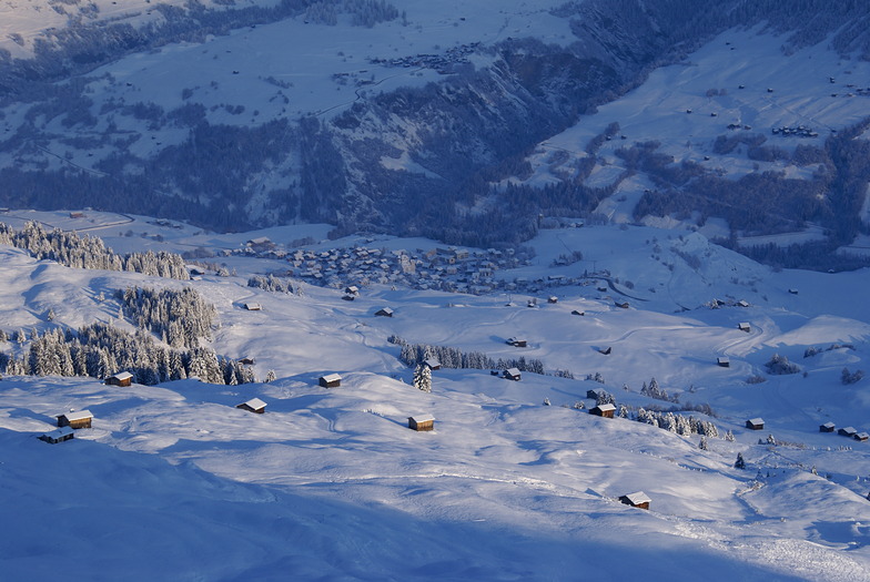
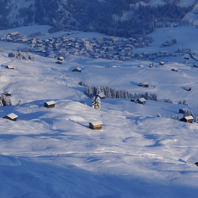
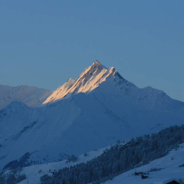
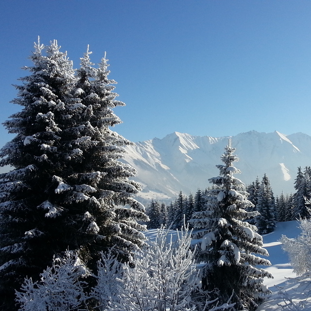
Massive Snowfall in the Alps
A huge snowfall is underway in the Alps, by far the biggest of the 24-25 season.
Please sign in with your Snow-Forecast account details below.

Obersaxen - Mundaun - Val Lumnezia Weather (Next 3 days): The snow forecast for Obersaxen - Mundaun - Val Lumnezia is: Heavy rain (total 25.0mm), heaviest during Mon afternoon. Later becoming colder with a dusting of snow on Mon night. Mild temperatures (max 6°C on Sat afternoon, min 1°C on Mon night). Wind will be generally light.
Obersaxen - Mundaun - Val Lumnezia Weather (Days 4-6): A dusting of snow giving way to moderate rain (total 15.0mm) heaviest on Wed afternoon. Freeze-thaw conditions (max 8°C on Wed afternoon, min 0°C on Thu night). Wind will be generally light.
| Resort | Snow Depth | Temp. (°C) | Wind (km/h) | Weather | ||
|---|---|---|---|---|---|---|
| Top Lift: | 0.0 m | 1 | ||||
| Middle Lift: | 3 | |||||
| Bottom Lift: | 0.0 m | 5 |
Latest snow reports near Obersaxen - Mundaun - Val Lumnezia:

Saturday 19 | Sunday 20 | Monday 21 | Tuesday 22 | Wednesday 23 | Thursday 24 | Friday 25 | |||||||||||||||
AM | PM | night | AM | PM | night | AM | PM | night | AM | PM | night | AM | PM | night | AM | PM | night | AM | PM | night | |
some clouds | cloudy | light rain | rain shwrs | light rain | rain shwrs | light rain | mod. rain | light snow | light snow | rain shwrs | light rain | cloudy | rain shwrs | light rain | light rain | rain shwrs | light snow | light snow | light rain | light snow | |
km/h | |||||||||||||||||||||
Snow map |  |  |  |  |  |  |  | ||||||||||||||
— | — | — | — | — | — | — | — | 1.0 | — | — | — | — | — | — | — | — | 1.0 | — | — | — | |
— | — | 1.0 | 1.0 | 2.0 | 2.0 | 4 | 7 | 8 | — | 1.0 | 2.0 | — | 3 | 2.0 | 2.0 | 3 | 2.0 | — | 2.0 | — | |
max°C | 5 | 6 | 3 | 4 | 5 | 4 | 4 | 4 | 3 | 3 | 6 | 4 | 6 | 8 | 6 | 4 | 6 | 3 | 1 | 3 | 1 |
min°C | 4 | 5 | 3 | 4 | 4 | 2 | 3 | 3 | 1 | 2 | 6 | 3 | 3 | 7 | 4 | 4 | 5 | 0 | 0 | 2 | -1 |
2 | 2 | 0 | 1 | 1 | 0 | 1 | 2 | 1 | 2 | 6 | 3 | 3 | 7 | 4 | 4 | 3 | -2 | -2 | 1 | -3 | |
74 | 82 | 91 | 86 | 90 | 95 | 96 | 97 | 99 | 93 | 81 | 95 | 79 | 75 | 95 | 88 | 78 | 98 | 89 | 81 | 92 | |
2500 | 2400 | 2250 | 2450 | 2400 | 2200 | 2350 | 2400 | 2200 | 2350 | 2650 | 2350 | 2550 | 2750 | 2500 | 2400 | 2450 | 1900 | 1900 | 2150 | 1600 | |
6:28 | — | — | 6:28 | — | — | 6:26 | — | — | 6:24 | — | — | 6:22 | — | — | 6:20 | — | — | 6:18 | — | — | |
— | — | 8:15 | — | — | 8:16 | — | — | 8:17 | — | — | 8:20 | — | — | 8:21 | — | — | 8:22 | — | — | 8:23 | |
Heavy rain (total 25.0mm), heaviest during Mon afternoon. Later becoming colder with a dusting of snow on Mon night. Mild temperatures (max 6°C on Sat afternoon, min 1°C on Mon night). Wind will be generally light.
A dusting of snow giving way to moderate rain (total 15.0mm) heaviest on Wed afternoon. Freeze-thaw conditions (max 8°C on Wed afternoon, min 0°C on Thu night). Wind will be generally light.
Latest snow reports near Obersaxen - Mundaun - Val Lumnezia:
| Top snow depth: | 0 cm |
|---|---|
| Bottom snow depth: | 0 cm |
| Fresh snowfall depth: | 1 cm |
| Last snowfall: | 17 Apr 2025 |
| Snow Alerts | Create Alert |
0.1 | Bluebird Powder days Fresh snow, mostly sunny, light wind. |
|---|---|
0.8 | Powder days Fresh snow, limited sun, any wind. |
0.2 | Bluebird days Average snow, mostly sunny, light wind. |
The above table gives the weather forecast for Obersaxen - Mundaun - Val Lumnezia at the specific elevation of 1750 m. Our sophisticated weather models allow us to provide snow forecasts for the top, middle and bottom ski stations of Obersaxen - Mundaun - Val Lumnezia. To access the weather forecasts for the other elevations, use the tab navigation above the table. For a wider view of the weather, check out the Weather Map of Switzerland.
Click here to read further information on freezing levels and how we forecast our temperatures.
Overall 3.5 Based on 15 votes and 5 reviews
Das Klo der Seilbahn in Valata sagt alles über Zustand der Anlagen und wohl auch der Geschäftslei(s)tung. Absolut veraltet, unsauber und alles andere als einladend. Seit ca. 36 Jahren wurde dort kaum was verändert, so ein Einheimischer. Möchte nicht wissen wie lange diese Bahn nicht mehr gewartet wurde...Selbst die Klotür lässt sich nicht schliessen.
Walter from Austria writes:
Das Klo der Seilbahn in Valata sagt alles über Zustand der Anlagen und wohl auch der Geschäftslei(s)tung. Absolut veraltet, unsauber und alles andere als einladend. Seit ca. 36 Jahren wurde dort kaum was verändert, so ein Einheimischer. Möchte nicht wissen wie lange diese Bahn nicht mehr gewartet wurde...Selbst die Klotür lässt sich nicht schliessen.
Read 4 more reviews of Obersaxen - Mundaun - Val Lumnezia or submit your own
The Obersaxen - Mundaun - Val Lumnezia skiing weather widget is available to embed on external websites free of charge. It provides a daily summary of our Obersaxen - Mundaun - Val Lumnezia snow forecast and current weather conditions. Simply go to the feed configuration page and follow the 3 simple steps to grab the custom html code snippet and paste it into your own site. You can choose the snow forecast elevation (summit, mid-mountain or bottom lift) and metric/imperial units for the snow forecast feed to suit your own website…. Click here to get the code.
View detailed snow forecast for Obersaxen - Mundaun - Val Lumnezia at:
snow-forecast.com


 Nearest