
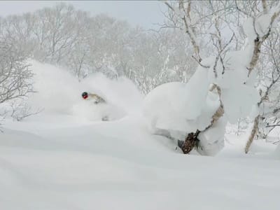
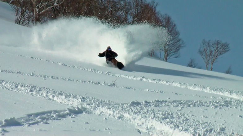
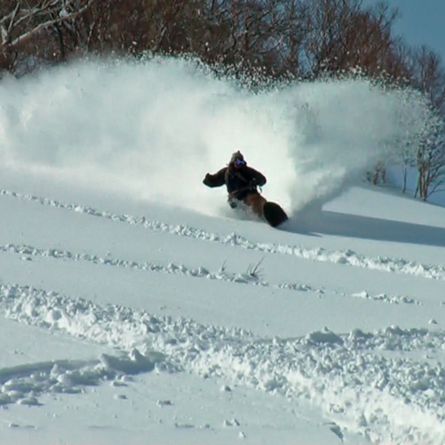
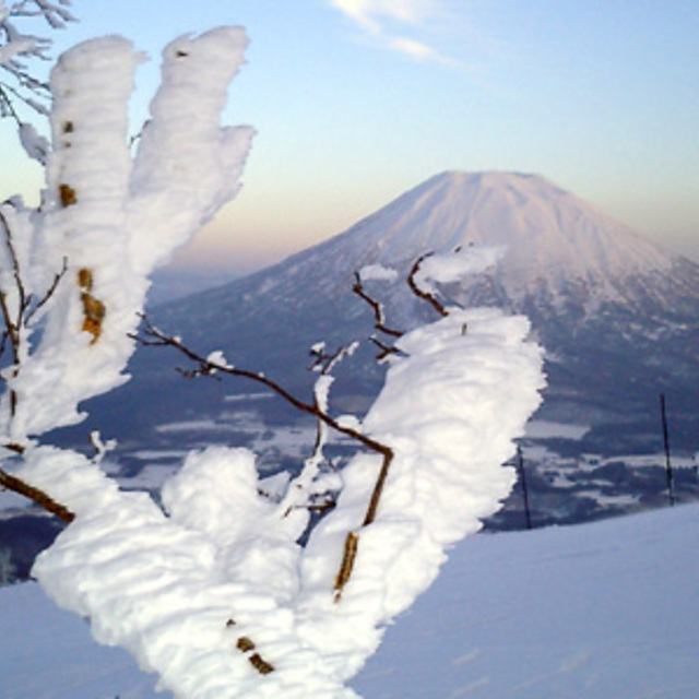
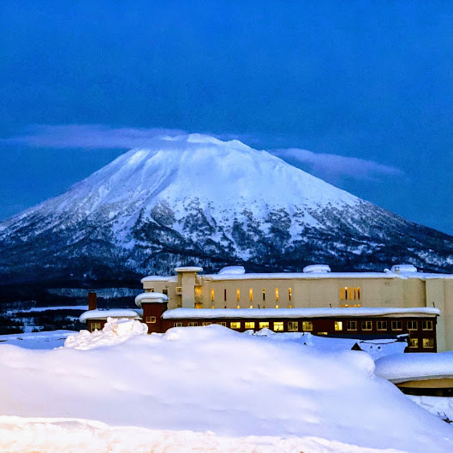
Deepest Snow In Japan Passes 7 Metres (23 Feet)
The deepest snow stat being reported from Japan has now passed 7 metres (23 feet), the deepest reported by a ski area anywhere in the world for several years.
Please sign in with your Snow-Forecast account details below.


Niseko Grand Hirafu Weather (Next 3 days): The snow forecast for Niseko Grand Hirafu is: Moderate rain (total 11.0mm), heaviest on Sat night. Freeze-thaw conditions (max 7°C on Sat night, min -1°C on Sun night). Winds decreasing (near gales from the SSW on Sat night, calm by Mon night).
Niseko Grand Hirafu Weather (Days 4-6): Light rain (total 2.0mm) at first, then becoming colder with a dusting of snow on Tue night. Freeze-thaw conditions (max 9°C on Wed night, min 0°C on Thu night). Wind will be generally light.
| Resort | Snow Depth | Temp. (°C) | Wind (km/h) | Weather | ||
|---|---|---|---|---|---|---|
| Top Lift: | 1.8 m | 4 | ||||
| Middle Lift: | 5 | |||||
| Bottom Lift: | 0.5 m | 6 |
Latest snow reports near Niseko Grand Hirafu:

Saturday 19 | Sunday 20 | Monday 21 | Tuesday 22 | Wednesday 23 | Thursday 24 | Friday 25 | |||||||||||||||
AM | PM | night | AM | PM | night | AM | PM | night | AM | PM | night | AM | PM | night | AM | PM | night | AM | PM | night | |
light snow | light snow | mod. rain | light rain | light snow | light snow | some clouds | some clouds | some clouds | cloudy | cloudy | light snow | some clouds | clear | some clouds | some clouds | some clouds | clear | light snow | snow shwrs | light snow | |
km/h | |||||||||||||||||||||
Snow map | 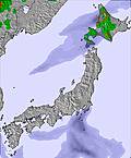 | 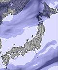 |  |  |  |  |  | ||||||||||||||
— | — | — | — | — | — | — | — | — | — | — | 4 | — | — | — | — | — | — | 2.0 | — | 1.0 | |
1.0 | — | 6 | 3 | 1.0 | — | — | — | — | — | — | 2.0 | — | — | — | — | — | — | — | — | — | |
max°C | 3 | 4 | 7 | 5 | 2 | 0 | 0 | 1 | 4 | 7 | 7 | 5 | 4 | 6 | 9 | 5 | 3 | 1 | -1 | -1 | 0 |
min°C | 2 | 2 | 4 | 5 | 0 | -1 | 0 | -1 | 3 | 6 | 7 | 1 | 3 | 6 | 5 | 4 | 2 | 0 | -1 | -1 | -1 |
-5 | -4 | -1 | -1 | -8 | -8 | -7 | -8 | -2 | 5 | 5 | -5 | 1 | 4 | 1 | -1 | -3 | -5 | -7 | -8 | -10 | |
98 | 87 | 73 | 99 | 98 | 98 | 91 | 85 | 55 | 42 | 36 | 79 | 90 | 67 | 35 | 78 | 95 | 68 | 94 | 84 | 80 | |
1850 | 1650 | 2750 | 2400 | 1600 | 1050 | 1100 | 1050 | 2500 | 2650 | 2750 | 1950 | 2550 | 2900 | 2800 | 2450 | 1650 | 1200 | 1050 | 1000 | 1050 | |
4:50 | — | — | 4:48 | — | — | 4:47 | — | — | 4:45 | — | — | 4:43 | — | — | 4:41 | — | — | 4:41 | — | — | |
— | 6:22 | — | — | 6:23 | — | — | 6:24 | — | — | 6:25 | — | — | 6:27 | — | — | 6:28 | — | — | 6:30 | — | |
Moderate rain (total 11.0mm), heaviest on Sat night. Freeze-thaw conditions (max 7°C on Sat night, min -1°C on Sun night). Winds decreasing (near gales from the SSW on Sat night, calm by Mon night).
Light rain (total 2.0mm) at first, then becoming colder with a dusting of snow on Tue night. Freeze-thaw conditions (max 9°C on Wed night, min 0°C on Thu night). Wind will be generally light.
Latest snow reports near Niseko Grand Hirafu:
| Top snow depth: | 180 cm |
|---|---|
| Bottom snow depth: | 50 cm |
| Fresh snowfall depth: | — |
| Last snowfall: | 16 Apr 2025 |
| Snow Alerts | Create Alert |
0.4 | Bluebird Powder days Fresh snow, mostly sunny, light wind. |
|---|---|
0.8 | Powder days Fresh snow, limited sun, any wind. |
0.9 | Bluebird days Average snow, mostly sunny, light wind. |
The above table gives the weather forecast for Niseko Grand Hirafu at the specific elevation of 1156 m. Our sophisticated weather models allow us to provide snow forecasts for the top, middle and bottom ski stations of Niseko Grand Hirafu. To access the weather forecasts for the other elevations, use the tab navigation above the table. For a wider view of the weather, check out the Weather Map of Japan.
Click here to read further information on freezing levels and how we forecast our temperatures.
Resort name is also written as Niseko Hirafu.
Overall 3.9 Based on 71 votes and 120 reviews
Niseko Feb 19 2024. Poor snow conditions with rain. Long queues for every thing. This Powder Paradise is a myth.
Mark from Japan writes:
Niseko Feb 19 2024. Poor snow conditions with rain. Long queues for every thing. This Powder Paradise is a myth.
Read 119 more reviews of Niseko Grand Hirafu or submit your own
The Niseko Grand Hirafu skiing weather widget is available to embed on external websites free of charge. It provides a daily summary of our Niseko Grand Hirafu snow forecast and current weather conditions. Simply go to the feed configuration page and follow the 3 simple steps to grab the custom html code snippet and paste it into your own site. You can choose the snow forecast elevation (summit, mid-mountain or bottom lift) and metric/imperial units for the snow forecast feed to suit your own website…. Click here to get the code.
View detailed snow forecast for Niseko Grand Hirafu at:
snow-forecast.com


 Nearest