
Pre-2025-Season Snowfall in Southern Hemisphere
Ski areas on three continents across the southern hemisphere have been reporting fresh snowfall ahead of the 2025 season, which is now only a month away.
Please sign in with your Snow-Forecast account details below.

Mount Snow Weather (Next 3 days): The snow forecast for Mount Snow is: Moderate rain (total 12.0mm), heaviest on Tue night. Very mild (max 16°C on Tue afternoon, min 3°C on Wed morning). Winds decreasing (gales from the WNW on Tue night, light winds from the W by Wed night).
Mount Snow Weather (Days 4-6): Heavy rain (total 32.0mm), heaviest during Sat afternoon. Freeze-thaw conditions (max 14°C on Fri morning, min -1°C on Sat night). Winds decreasing (near gales from the SW on Fri afternoon, light winds from the S by Sat morning).
| Resort | Snow Depth | Temp. (°C) | Wind (km/h) | Weather | ||
|---|---|---|---|---|---|---|
| Top Lift: | 0.0 m | 10 | ||||
| Middle Lift: | 11 | |||||
| Bottom Lift: | 0.0 m | 8 |
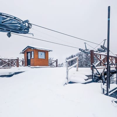
Latest snow reports near Mount Snow:

Tuesday 29 | Wednesday 30 | Thursday 1 | Friday 2 | Saturday 3 | Sunday 4 | Monday 5 | |||||||||||||||
AM | PM | night | AM | PM | night | AM | PM | night | AM | PM | night | AM | PM | night | AM | PM | night | AM | PM | night | |
clear | some clouds | heavy rain | clear | some clouds | some clouds | some clouds | cloudy | light rain | light rain | risk thun- der | rain shwrs | rain shwrs | heavy rain | snow shwrs | clear | some clouds | some clouds | some clouds | some clouds | clear | |
km/h | |||||||||||||||||||||
Snow map |  |  |  |  |  |  |  | ||||||||||||||
— | — | — | — | — | — | — | — | — | — | — | — | — | — | — | — | — | — | — | — | — | |
— | — | 11 | — | — | — | — | — | 1.0 | 3 | 1.0 | 2.0 | 1.0 | 25 | — | — | — | — | — | — | — | |
max°C | 15 | 16 | 14 | 3 | 6 | 5 | 8 | 10 | 11 | 14 | 14 | 12 | 10 | 6 | 3 | 2 | 4 | 3 | 5 | 11 | 10 |
min°C | 12 | 15 | 7 | 3 | 5 | 5 | 6 | 10 | 10 | 12 | 14 | 9 | 10 | 5 | -1 | 1 | 3 | 1 | 3 | 7 | 9 |
9 | 13 | 1 | -4 | 0 | 0 | 4 | 8 | 7 | 9 | 11 | 5 | 8 | 0 | -9 | -6 | -4 | -6 | -3 | 3 | 6 | |
47 | 71 | 96 | 52 | 43 | 26 | 22 | 38 | 84 | 79 | 88 | 79 | 91 | 87 | 87 | 63 | 65 | 54 | 54 | 69 | 73 | |
3700 | 3900 | 3500 | 3400 | 3300 | 3300 | 3250 | 3300 | 3400 | 3400 | 3500 | 3100 | 2950 | 2350 | 1000 | 1250 | 1500 | 1500 | 2150 | 2900 | 3100 | |
5:48 | — | — | 5:47 | — | — | 5:46 | — | — | 5:43 | — | — | 5:43 | — | — | 5:41 | — | — | 5:39 | — | — | |
— | 7:49 | — | — | 7:50 | — | — | 7:52 | — | — | 7:52 | — | — | 7:53 | — | — | 7:54 | — | — | 7:55 | — | |
Moderate rain (total 12.0mm), heaviest on Tue night. Very mild (max 16°C on Tue afternoon, min 3°C on Wed morning). Winds decreasing (gales from the WNW on Tue night, light winds from the W by Wed night).
Heavy rain (total 32.0mm), heaviest during Sat afternoon. Freeze-thaw conditions (max 14°C on Fri morning, min -1°C on Sat night). Winds decreasing (near gales from the SW on Fri afternoon, light winds from the S by Sat morning).
Latest snow reports near Mount Snow:
| Top snow depth: | 0 cm |
|---|---|
| Bottom snow depth: | 0 cm |
| Fresh snowfall depth: | — |
| Last snowfall: | 16 Apr 2025 |
| Snow Alerts | Create Alert |
0.0 | Bluebird Powder days Fresh snow, mostly sunny, light wind. |
|---|---|
0.8 | Powder days Fresh snow, limited sun, any wind. |
0.6 | Bluebird days Average snow, mostly sunny, light wind. |
The above table gives the weather forecast for Mount Snow at the specific elevation of 1097 m. Our sophisticated weather models allow us to provide snow forecasts for the top, middle and bottom ski stations of Mount Snow. To access the weather forecasts for the other elevations, use the tab navigation above the table. For a wider view of the weather, check out the Weather Map of United States.
Click here to read further information on freezing levels and how we forecast our temperatures.
Overall 3.8 Based on 5 votes and 6 reviews
My home hill. Middle-of-the-plate pitch for a New England resort with one caveat: If you're a park-rat (grom to shred; I'm not) Carinthia is the best terrain park in the East, walking away, with a whole face dedicated to jibbers. As a whole, resort favours the intermediate skier with primarily groomed terrain. However, they have a boundary-to-boundary policy in place for when the snow flies. There are a variety of tree runs for all ability levels when there's snow. Trail style runs the gamut from wide-open (Snowdance) to old-school Northeastern trails (Uncles). The "North Face" has decent incline; "Jaws" can be a real treat with good coverage. When there's no natural snow (and when there is) I think recent improvements put it in the top rank for snowmaking, nation-wide, actually. All that said, this is an intermediate hill. A good place to progress your skiing but not an advance/expert playground-for-days. What sets it apart from other Vermont resorts (*cough* Stratton *cough*) is the laid-back, unpretentious vibe. People come here to ski and be with their family and friends, and that's it. Most of them will be happy to see you, too.
Uphill Edge from United States writes:
My home hill.
Middle-of-the-plate pitch for a New England resort with one caveat: If you're a park-rat (grom to shred; I'm not) Carinthia is the best terrain park in the East, walking away, with a whole face dedicated to jibbers.
As a whole, resort favours the intermediate skier with primarily groomed terrain. However, they have a boundary-to-boundary policy in place for when the snow flies. There are a variety of tree runs for all ability levels when there's snow.
Trail style runs the gamut from wide-open (Snowdance) to old-school Northeastern trails (Uncles). The "North Face" has decent incline; "Jaws" can be a real treat with good coverage. When there's no natural snow (and when there is) I think recent improvements put it in the top rank for snowmaking, nation-wide, actually.
All that said, this is an intermediate hill. A good place to progress your skiing but not an advance/expert playground-for-days. What sets it apart from other Vermont resorts (*cough* Stratton *cough*) is the laid-back, unpretentious vibe. People come here to ski and be with their family and friends, and that's it. Most of them will be happy to see you, too.
The Mount Snow skiing weather widget is available to embed on external websites free of charge. It provides a daily summary of our Mount Snow snow forecast and current weather conditions. Simply go to the feed configuration page and follow the 3 simple steps to grab the custom html code snippet and paste it into your own site. You can choose the snow forecast elevation (summit, mid-mountain or bottom lift) and metric/imperial units for the snow forecast feed to suit your own website…. Click here to get the code.
View detailed snow forecast for Mount Snow at:
snow-forecast.com


 Nearest