
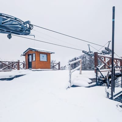
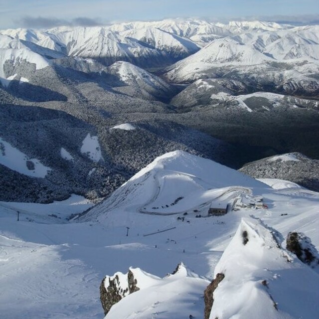
Pre-2025-Season Snowfall in Southern Hemisphere
Ski areas on three continents across the southern hemisphere have been reporting fresh snowfall ahead of the 2025 season, which is now only a month away.
Please sign in with your Snow-Forecast account details below.


Mount Cheeseman Weather (Next 3 days): The snow forecast for Mount Cheeseman is: Heavy rain (total 29.0mm) on Tue night. Becoming colder with heavy fall of snow, heaviest during Wed afternoon. Freeze-thaw conditions (max 6°C on Tue afternoon, min -3°C on Wed night). Winds increasing (calm on Tue night, strong winds from the SSE by Thu afternoon).
Mount Cheeseman Weather (Days 4-6): A dusting of new snow. Freeze-thaw conditions (max 8°C on Sun morning, min -3°C on Thu night). Winds decreasing (fresh winds from the SSE on Thu night, calm by Sun morning).
| Resort | Snow Depth | Temp. (°C) | Wind (km/h) | Weather | ||
|---|---|---|---|---|---|---|
| Top Lift: | 4 | |||||
| Bottom Lift: | 4 |
Latest snow reports near Mount Cheeseman:

Tuesday 29 | Wednesday 30 | Thursday 1 | Friday 2 | Saturday 3 | Sunday 4 | ||||||||||||||
night | AM | PM | night | AM | PM | night | AM | PM | night | AM | PM | night | AM | PM | night | AM | PM | night | |
light rain | light rain | mod. rain | light snow | mod. snow | heavy snow | heavy snow | mod. snow | mod. snow | light snow | cloudy | some clouds | clear | clear | clear | clear | clear | clear | clear | |
km/h | |||||||||||||||||||
Snow map |  |  |  |  |  |  |  | ||||||||||||
— | — | — | 4 | 6 | 11 | 19 | 7 | 6 | 1.0 | — | — | — | — | — | — | — | — | — | |
3 | 5 | 7 | 14 | — | — | — | — | — | — | — | — | — | — | — | — | — | — | — | |
max°C | 4 | 5 | 6 | 6 | 0 | -2 | -3 | -3 | -3 | -3 | -2 | 1 | 4 | 5 | 5 | 7 | 8 | 8 | 9 |
min°C | 3 | 4 | 6 | 1 | -1 | -2 | -3 | -3 | -3 | -3 | -2 | -1 | 2 | 4 | 5 | 5 | 7 | 7 | 8 |
1 | 0 | 3 | -3 | -6 | -8 | -10 | -11 | -11 | -11 | -8 | -6 | -2 | 3 | 3 | 2 | 7 | 7 | 8 | |
83 | 96 | 94 | 100 | 99 | 99 | 98 | 97 | 97 | 88 | 86 | 67 | 63 | 64 | 54 | 51 | 29 | 31 | 26 | |
3100 | 2950 | 3000 | 2800 | 1800 | 1400 | 1050 | 1050 | 1100 | 1200 | 1200 | 1450 | 2400 | 2650 | 2750 | 2900 | 3050 | 3200 | 3450 | |
— | 7:20 | — | — | 7:20 | — | — | 7:22 | — | — | 7:24 | — | — | 7:24 | — | — | 7:26 | — | — | |
— | — | 5:39 | — | — | 5:37 | — | — | 5:37 | — | — | 5:36 | — | — | 5:34 | — | — | 5:32 | — | |
Heavy rain (total 29.0mm) on Tue night. Becoming colder with heavy fall of snow, heaviest during Wed afternoon. Freeze-thaw conditions (max 6°C on Tue afternoon, min -3°C on Wed night). Winds increasing (calm on Tue night, strong winds from the SSE by Thu afternoon).
A dusting of new snow. Freeze-thaw conditions (max 8°C on Sun morning, min -3°C on Thu night). Winds decreasing (fresh winds from the SSE on Thu night, calm by Sun morning).
Latest snow reports near Mount Cheeseman:
| Top snow depth: | — |
|---|---|
| Bottom snow depth: | — |
| Fresh snowfall depth: | — |
| Last snowfall: | 23 Apr 2025 |
| Snow Alerts | Create Alert |
0.1 | Bluebird Powder days Fresh snow, mostly sunny, light wind. |
|---|---|
0.3 | Powder days Fresh snow, limited sun, any wind. |
0.0 | Bluebird days Average snow, mostly sunny, light wind. |
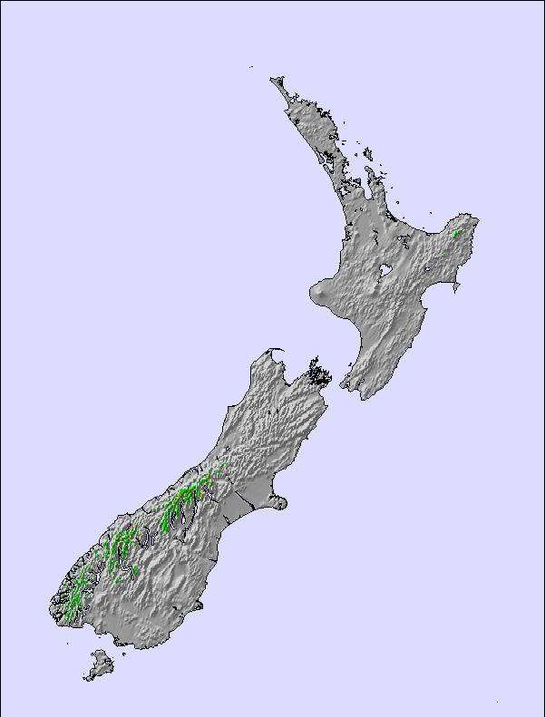
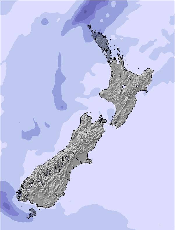
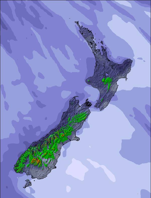
The above table gives the weather forecast for Mount Cheeseman at the specific elevation of 1845 m. Our sophisticated weather models allow us to provide snow forecasts for the top, middle and bottom ski stations of Mount Cheeseman. To access the weather forecasts for the other elevations, use the tab navigation above the table. For a wider view of the weather, check out the Weather Map of New Zealand.
Click here to read further information on freezing levels and how we forecast our temperatures.
Overall 3.8 Based on 11 votes and 9 reviews
I have called myself a skier pretty much since I was able to walk, and I have found Mt Cheeseman a great ski hill to ski at throughout all my years on skis. The ski hill is a big bowl with lots of variation throughout it so even though it does not boast the most vertical of any ski hill, every run is different. After 25 years skiing there I am still finding new lines to excite me. And for some reason it often gets much better quality snow than other fields in the surrounding ranges, so that is an extra bonus. The people are super friendly and I find at Cheesean I feel I am more than a guest, kind of part of a family. And that feeling of being at home is half the reason why I keep coming back. I know I can turn up there on my own but always find someone I know or don't to ski with. I have skiied at some of the biggest name ski hills in the world but I still find Cheeseman a great place to ski. It offers a relaxed, friendly skiing experience, regardless of your ability, and I will be coming back for more skiing as long as I am able.
Catherine Kircher from New Zealand writes:
I have called myself a skier pretty much since I was able to walk, and I have found Mt Cheeseman a great ski hill to ski at throughout all my years on skis. The ski hill is a big bowl with lots of variation throughout it so even though it does not boast the most vertical of any ski hill, every run is different. After 25 years skiing there I am still finding new lines to excite me. And for some reason it often gets much better quality snow than other fields in the surrounding ranges, so that is an extra bonus.
The people are super friendly and I find at Cheesean I feel I am more than a guest, kind of part of a family. And that feeling of being at home is half the reason why I keep coming back. I know I can turn up there on my own but always find someone I know or don't to ski with.
I have skiied at some of the biggest name ski hills in the world but I still find Cheeseman a great place to ski. It offers a relaxed, friendly skiing experience, regardless of your ability, and I will be coming back for more skiing as long as I am able.
The Mount Cheeseman skiing weather widget is available to embed on external websites free of charge. It provides a daily summary of our Mount Cheeseman snow forecast and current weather conditions. Simply go to the feed configuration page and follow the 3 simple steps to grab the custom html code snippet and paste it into your own site. You can choose the snow forecast elevation (summit, mid-mountain or bottom lift) and metric/imperial units for the snow forecast feed to suit your own website…. Click here to get the code.
View detailed snow forecast for Mount Cheeseman at:
snow-forecast.com

 Nearest