

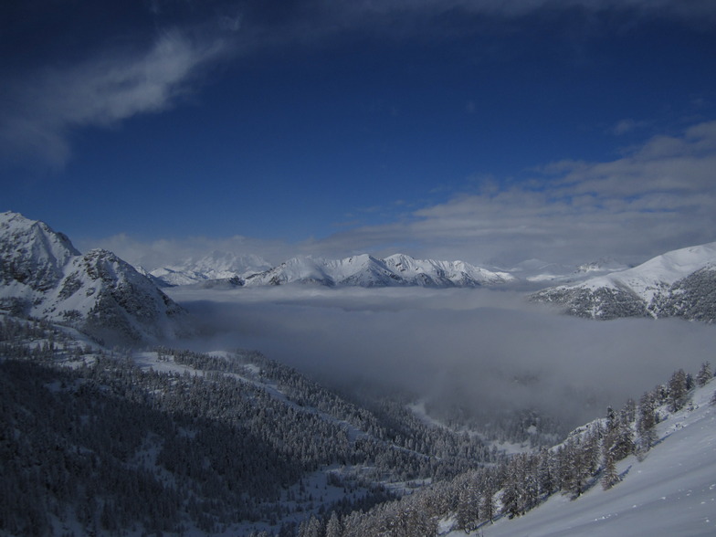
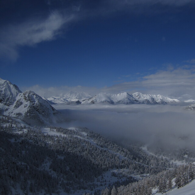
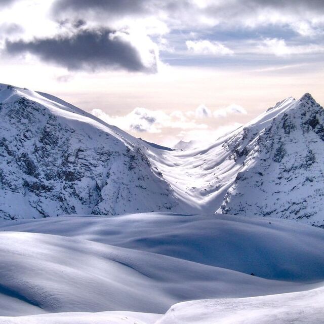
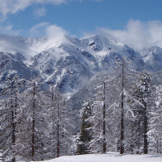
Massive Snowfall in the Alps
A huge snowfall is underway in the Alps, by far the biggest of the 24-25 season.
Please sign in with your Snow-Forecast account details below.


Montgenèvre (Vialattea) Weather (Next 3 days): The snow forecast for Montgenèvre (Vialattea) is: A moderate fall of snow, heaviest on Thu afternoon. Freeze-thaw conditions (max 1°C on Fri afternoon, min -4°C on Thu night). Wind will be generally light.
Montgenèvre (Vialattea) Weather (Days 4-6): A dusting of new snow. Temperatures will be below freezing (max 0°C on Tue morning, min -4°C on Sun night). Wind will be generally light.
| Resort | Snow Depth | Temp. (°C) | Wind (km/h) | Weather | ||
|---|---|---|---|---|---|---|
| Top Lift: | -3 | |||||
| Middle Lift: | 1 | |||||
| Bottom Lift: | 4 |
Latest snow reports near Montgenèvre (Vialattea):
Snowing heavily at Val Thorens. from Val Thorens
Powder day!. Heavy snow just keeps on falling. from Val Thorens
Heavy snow is falling at Val Thorens. from Val Thorens
It is snowing heavily at Val Thorens. from Val Thorens

Thu 17 | Friday 18 | Saturday 19 | Sunday 20 | Monday 21 | Tuesday 22 | Wednesday 23 | ||||||||||||||
PM | night | AM | PM | night | AM | PM | night | AM | PM | night | AM | PM | night | AM | PM | night | AM | PM | night | |
mod. snow | light snow | some clouds | clear | some clouds | some clouds | cloudy | light snow | light snow | light snow | light snow | light snow | light snow | cloudy | some clouds | some clouds | some clouds | clear | clear | clear | |
km/h | ||||||||||||||||||||
Snow map |  |  |  |  |  |  |  | |||||||||||||
9 | — | — | — | — | — | — | 1.0 | 1.0 | 1.0 | 1.0 | — | — | — | — | — | — | — | — | — | |
— | — | — | — | — | — | — | — | — | — | — | — | — | — | — | — | — | — | — | — | |
max°C | -3 | -3 | -1 | 1 | 0 | -2 | -2 | -2 | -3 | -2 | -3 | -2 | -1 | -1 | 0 | 0 | 0 | 0 | 1 | 1 |
min°C | -3 | -4 | -3 | 0 | -2 | -2 | -2 | -3 | -3 | -2 | -4 | -2 | -1 | -2 | -1 | 0 | -1 | -1 | 0 | 0 |
-7 | -7 | -7 | -2 | -6 | -6 | -6 | -8 | -8 | -6 | -6 | -5 | -1 | -2 | -1 | 0 | -1 | -1 | -2 | -3 | |
97 | 85 | 42 | 37 | 51 | 83 | 95 | 96 | 94 | 90 | 92 | 95 | 93 | 89 | 82 | 83 | 82 | 82 | 79 | 42 | |
2150 | 1000 | 2500 | 2850 | 2350 | 2400 | 2400 | 2150 | 2250 | 2300 | 2050 | 2300 | 2550 | 2200 | 2650 | 2750 | 2300 | 2600 | 2800 | 2950 | |
— | — | 6:43 | — | — | 6:41 | — | — | 6:41 | — | — | 6:39 | — | — | 6:37 | — | — | 6:35 | — | — | |
— | 8:20 | — | — | 8:21 | — | — | 8:22 | — | — | 8:22 | — | — | 8:24 | — | — | 8:25 | — | — | 8:27 | |
A moderate fall of snow, heaviest on Thu afternoon. Freeze-thaw conditions (max 1°C on Fri afternoon, min -4°C on Thu night). Wind will be generally light.
A dusting of new snow. Temperatures will be below freezing (max 0°C on Tue morning, min -4°C on Sun night). Wind will be generally light.
Latest snow reports near Montgenèvre (Vialattea):
Snowing heavily at Val Thorens. from Val Thorens
Powder day!. Heavy snow just keeps on falling. from Val Thorens
Heavy snow is falling at Val Thorens. from Val Thorens
It is snowing heavily at Val Thorens. from Val Thorens
| Top snow depth: | — |
|---|---|
| Bottom snow depth: | — |
| Fresh snowfall depth: | 66 cm |
| Last snowfall: | 16 Apr 2025 |
| Snow Alerts | Create Alert |
1.0 | Bluebird Powder days Fresh snow, mostly sunny, light wind. |
|---|---|
1.9 | Powder days Fresh snow, limited sun, any wind. |
1.0 | Bluebird days Average snow, mostly sunny, light wind. |
The above table gives the weather forecast for Montgenèvre (Vialattea) at the specific elevation of 2680 m. Our sophisticated weather models allow us to provide snow forecasts for the top, middle and bottom ski stations of Montgenèvre (Vialattea). To access the weather forecasts for the other elevations, use the tab navigation above the table. For a wider view of the weather, check out the Weather Map of France.
Click here to read further information on freezing levels and how we forecast our temperatures.
Resort name is also written as Montgenevre (Via Lattea).
Overall 4.1 Based on 17 votes and 34 reviews
Station découverte il y a 10 ans et dont j'ai fait désormais mon fief. Les plus : facilement accessible depuis Paris en TGV (5h de TGV gare italienne à 15 km), Enneigement important en raison des fameux retours d'est et de l'altitude. Domaine varié sur 2 versants + liaison avec l'Italie. Station à l'architecture agréable toutes commodités. Projets d'extension qui se concrétisent avec à terme des pistes à 3000 mètres. Pas d'attente au remontées mécaniques. Progrès à faire : Quelques telesièges un peu lent.
Florent from France writes:
Station découverte il y a 10 ans et dont j'ai fait désormais mon fief.
Les plus : facilement accessible depuis Paris en TGV (5h de TGV gare italienne à 15 km), Enneigement important en raison des fameux retours d'est et de l'altitude. Domaine varié sur 2 versants + liaison avec l'Italie. Station à l'architecture agréable toutes commodités. Projets d'extension qui se concrétisent avec à terme des pistes à 3000 mètres. Pas d'attente au remontées mécaniques.
Progrès à faire : Quelques telesièges un peu lent.
Read 33 more reviews of Montgenèvre (Vialattea) or submit your own
The Montgenèvre (Vialattea) skiing weather widget is available to embed on external websites free of charge. It provides a daily summary of our Montgenèvre (Vialattea) snow forecast and current weather conditions. Simply go to the feed configuration page and follow the 3 simple steps to grab the custom html code snippet and paste it into your own site. You can choose the snow forecast elevation (summit, mid-mountain or bottom lift) and metric/imperial units for the snow forecast feed to suit your own website…. Click here to get the code.
View detailed snow forecast for Montgenèvre (Vialattea) at:
snow-forecast.com


 Nearest