
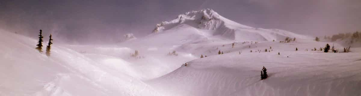
Future Of Saudi Arabia's Ski Resort Development Unclear
The status of a planned year-round outdoor ski area in Saudi Arabia is currently uncertain, and not just because of the current war in the region.

Mont Edouard Weather (Next 3 days): The snow forecast for Mont Edouard is: A heavy fall of snow, heaviest during Sat night. Becoming milder with drizzle, on Sun afternoon. Freeze-thaw conditions (max 2°C on Sun morning, min -15°C on Mon night). Winds increasing (light winds from the NNE on Sat morning, fresh winds from the WNW by Mon morning).
Mont Edouard Weather (Days 4-6): Mild with light rain (total 3.0mm) on Thu afternoon Becoming colder with a light covering of snow, mostly falling on Thu night. Freeze-thaw conditions (max 5°C on Thu morning, min -18°C on Tue night). Winds increasing (light winds from the SW on Wed night, strong winds from the SW by Thu afternoon).
| Resort | Snow Depth | Temp. (°C) | Wind (km/h) | Weather | ||
|---|---|---|---|---|---|---|
| Top Lift: | -4 | |||||
| Middle Lift: | -3 | |||||
| Bottom Lift: | -1 |

Saturday 4 | Sunday 5 | Monday 6 | Tuesday 7 | Wednesday 8 | Thursday 9 | |||||||||||||
AM | PM | night | AM | PM | night | AM | PM | night | AM | PM | night | AM | PM | night | AM | PM | night | |
some clouds | cloudy | heavy snow | mod. snow | light snow | light snow | light snow | light snow | light snow | light snow | light snow | snow shwrs | light snow | light snow | snow shwrs | cloudy | light rain | light snow | |
km/h | ||||||||||||||||||
Snow map |  |  |  |  |  | 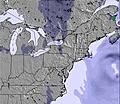 | ||||||||||||
— | — | 14 | 6 | — | 2 | 1 | 1 | 1 | — | — | — | — | — | — | — | — | 4 | |
— | — | — | — | 1 | — | — | — | — | — | — | — | — | — | — | — | 2 | 1 | |
max °C | -3 | -2 | -2 | 2 | 2 | 1 | -7 | -5 | -7 | -15 | -12 | -15 | -6 | -1 | -1 | 5 | 5 | 4 |
min °C | -7 | -2 | -5 | 0 | 1 | -5 | -7 | -5 | -15 | -16 | -13 | -18 | -11 | -3 | -5 | 3 | 5 | -14 |
-10 | -6 | -10 | -6 | -4 | -13 | -16 | -13 | -24 | -25 | -22 | -25 | -17 | -8 | -10 | -2 | 0 | -25 | |
72 | 69 | 95 | 98 | 94 | 93 | 92 | 84 | 94 | 82 | 84 | 94 | 80 | 80 | 89 | 90 | 88 | 89 | |
0 | 0 | 0 | 1500 | 650 | 50 | 0 | 0 | 0 | 0 | 0 | 0 | 0 | 250 | 0 | 2050 | 1350 | 0 | |
6:13 | — | — | 6:11 | — | — | 6:09 | — | — | 6:07 | — | — | 6:05 | — | — | 6:03 | — | — | |
— | 7:15 | — | — | 7:15 | — | — | 7:17 | — | — | 7:19 | — | — | 7:20 | — | — | 7:22 | — | |
A heavy fall of snow, heaviest during Sat night. Becoming milder with drizzle, on Sun afternoon. Freeze-thaw conditions (max 2°C on Sun morning, min -15°C on Mon night). Winds increasing (light winds from the NNE on Sat morning, fresh winds from the WNW by Mon morning).
Mild with light rain (total 3.0mm) on Thu afternoon Becoming colder with a light covering of snow, mostly falling on Thu night. Freeze-thaw conditions (max 5°C on Thu morning, min -18°C on Tue night). Winds increasing (light winds from the SW on Wed night, strong winds from the SW by Thu afternoon).
Latest snow reports near Mont Edouard:
| Top snow depth: | — |
|---|---|
| Bottom snow depth: | — |
| Fresh snowfall depth: | 45 cm |
| Last snowfall: | 3 Apr 2026 |
| Snow Alerts | Create Alert |
0.7 | Bluebird Powder days Fresh snow, mostly sunny, light wind. |
|---|---|
1.4 | Powder days Fresh snow, limited sun, any wind. |
0.8 | Bluebird days Average snow, mostly sunny, light wind. |
The above table gives the weather forecast for Mont Edouard at the specific elevation of 408 m. Our sophisticated weather models allow us to provide snow forecasts for the top, middle and bottom ski stations of Mont Edouard. To access the weather forecasts for the other elevations, use the tab navigation above the table. For a wider view of the weather, check out the Weather Map of Canada.
Click here to read further information on freezing levels and how we forecast our temperatures.
Resort name is also written as Mont-Edouard.


 Nearest