

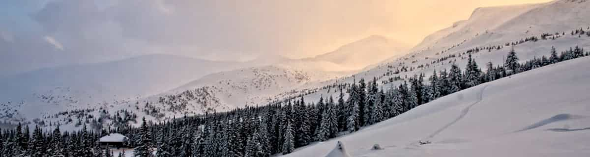
Massive Snowfall in the Alps
A huge snowfall is underway in the Alps, by far the biggest of the 24-25 season.
Please sign in with your Snow-Forecast account details below.

Mandarfen/Rifflsee Weather (Next 3 days): The snow forecast for Mandarfen/Rifflsee is: A moderate fall of snow, heaviest on Wed night. Temperatures will be below freezing (max 0°C on Tue afternoon, min -5°C on Thu night). Wind will be generally light.
Mandarfen/Rifflsee Weather (Days 4-6): A moderate fall of snow, heaviest on Sat night. Freeze-thaw conditions (max 2°C on Sat afternoon, min -4°C on Fri morning). Wind will be generally light.
| Resort | Snow Depth | Temp. (°C) | Wind (km/h) | Weather | ||
|---|---|---|---|---|---|---|
| Top Lift: | 0.0 m | -3 | ||||
| Middle Lift: | 0 | |||||
| Bottom Lift: | 0.0 m | 3 |
Latest snow reports near Mandarfen/Rifflsee:
Rain reported from Galtür at 1577 metres elevation 9 kms SW of Ischgl but it is forecast cold enough for snow at higher elevations in the ski area from Ischgl
Intermittent light rain reported from Galzig Mountain at 2090 metres elevation only 3 kms WSW of St. Anton but it is forecast cold enough for snow at higher elevations in the ski area from St. Anton

Tuesday 22 | Wednesday 23 | Thursday 24 | Friday 25 | Saturday 26 | Sunday 27 | Monday 28 | |||||||||||||||
AM | PM | night | AM | PM | night | AM | PM | night | AM | PM | night | AM | PM | night | AM | PM | night | AM | PM | night | |
some clouds | light snow | light snow | light snow | light snow | light snow | light snow | light snow | light snow | light snow | light snow | clear | some clouds | light snow | heavy snow | light snow | some clouds | clear | cloudy | cloudy | some clouds | |
km/h | |||||||||||||||||||||
Snow map |  |  |  |  |  |  |  | ||||||||||||||
— | 1.0 | 1.0 | — | 2.0 | 5 | 2.0 | — | — | — | — | — | — | — | 17 | — | — | — | — | — | — | |
— | — | — | — | — | — | — | — | — | — | — | — | — | — | — | — | — | — | — | — | — | |
max°C | -2 | 0 | -1 | -1 | 0 | -1 | -4 | -3 | -3 | -4 | -2 | 1 | 1 | 2 | -1 | -4 | -2 | 1 | 3 | 3 | 3 |
min°C | -3 | 0 | -2 | -2 | 0 | -3 | -4 | -3 | -5 | -4 | -3 | -1 | 1 | 1 | -4 | -4 | -3 | -1 | 2 | 2 | 2 |
-5 | 0 | -4 | -4 | -2 | -7 | -8 | -6 | -9 | -7 | -3 | -3 | 0 | 0 | -9 | -8 | -6 | -3 | 2 | 2 | 0 | |
87 | 92 | 98 | 92 | 95 | 98 | 95 | 98 | 98 | 96 | 92 | 29 | 50 | 81 | 94 | 79 | 72 | 26 | 27 | 64 | 65 | |
2500 | 2750 | 2550 | 2650 | 2750 | 2450 | 2250 | 2350 | 2150 | 2300 | 2550 | 2850 | 2900 | 2950 | 2250 | 2150 | 2550 | 2850 | 3200 | 3200 | 3200 | |
6:16 | — | — | 6:15 | — | — | 6:13 | — | — | 6:11 | — | — | 6:09 | — | — | 6:07 | — | — | 6:07 | — | — | |
— | — | 8:13 | — | — | 8:15 | — | — | 8:15 | — | — | 8:17 | — | — | 8:19 | — | — | 8:20 | — | — | 8:22 | |
A moderate fall of snow, heaviest on Wed night. Temperatures will be below freezing (max 0°C on Tue afternoon, min -5°C on Thu night). Wind will be generally light.
A moderate fall of snow, heaviest on Sat night. Freeze-thaw conditions (max 2°C on Sat afternoon, min -4°C on Fri morning). Wind will be generally light.
Latest snow reports near Mandarfen/Rifflsee:
Rain reported from Galtür at 1577 metres elevation 9 kms SW of Ischgl but it is forecast cold enough for snow at higher elevations in the ski area from Ischgl
Intermittent light rain reported from Galzig Mountain at 2090 metres elevation only 3 kms WSW of St. Anton but it is forecast cold enough for snow at higher elevations in the ski area from St. Anton
| Top snow depth: | 0 cm |
|---|---|
| Bottom snow depth: | 0 cm |
| Fresh snowfall depth: | — |
| Last snowfall: | 18 Apr 2025 |
| Snow Alerts | Create Alert |
0.1 | Bluebird Powder days Fresh snow, mostly sunny, light wind. |
|---|---|
1.9 | Powder days Fresh snow, limited sun, any wind. |
0.2 | Bluebird days Average snow, mostly sunny, light wind. |
The above table gives the weather forecast for Mandarfen/Rifflsee at the specific elevation of 2800 m. Our sophisticated weather models allow us to provide snow forecasts for the top, middle and bottom ski stations of Mandarfen/Rifflsee. To access the weather forecasts for the other elevations, use the tab navigation above the table. For a wider view of the weather, check out the Weather Map of Austria.
Click here to read further information on freezing levels and how we forecast our temperatures.
Resort name is also written as Mandarfen-Rifflsee.
Overall 3.7 Based on 1 vote and 1 review
For information, the village Mandarfen is only 2 km from the lift to Pitztal glacier and you can ski from Riffelsee to the lift, mountain railway (the railway takes 10 min to the glacier). The bus takes 5 min between Mandarfen and Pitztal glacier. You enter the cabin directly from Mandarfen village to Riffelsee ski area. Mandarfen have a lot of hotels, mostly 4 stars, within 25 to 500 meters to the lift/cabin, or take the bus 5 min to the glacier. It's a small, nice quiet and lovely place with good skiing. Have been there four times and will soon be back.
Stefan Ohman from Sweden writes:
For information, the village Mandarfen is only 2 km from the lift to Pitztal glacier and you can ski from Riffelsee to the lift, mountain railway (the railway takes 10 min to the glacier). The bus takes 5 min between Mandarfen and Pitztal glacier. You enter the cabin directly from Mandarfen village to Riffelsee ski area.
Mandarfen have a lot of hotels, mostly 4 stars, within 25 to 500 meters to the lift/cabin, or take the bus 5 min to the glacier.
It's a small, nice quiet and lovely place with good skiing.
Have been there four times and will soon be back.
The Mandarfen/Rifflsee skiing weather widget is available to embed on external websites free of charge. It provides a daily summary of our Mandarfen/Rifflsee snow forecast and current weather conditions. Simply go to the feed configuration page and follow the 3 simple steps to grab the custom html code snippet and paste it into your own site. You can choose the snow forecast elevation (summit, mid-mountain or bottom lift) and metric/imperial units for the snow forecast feed to suit your own website…. Click here to get the code.
View detailed snow forecast for Mandarfen/Rifflsee at:
snow-forecast.com


 Nearest