

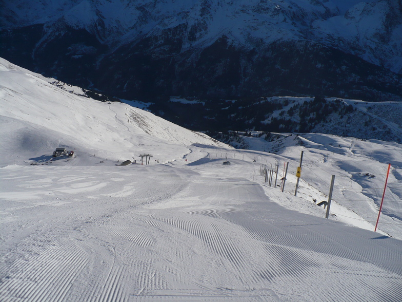
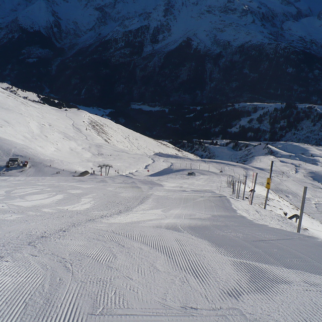
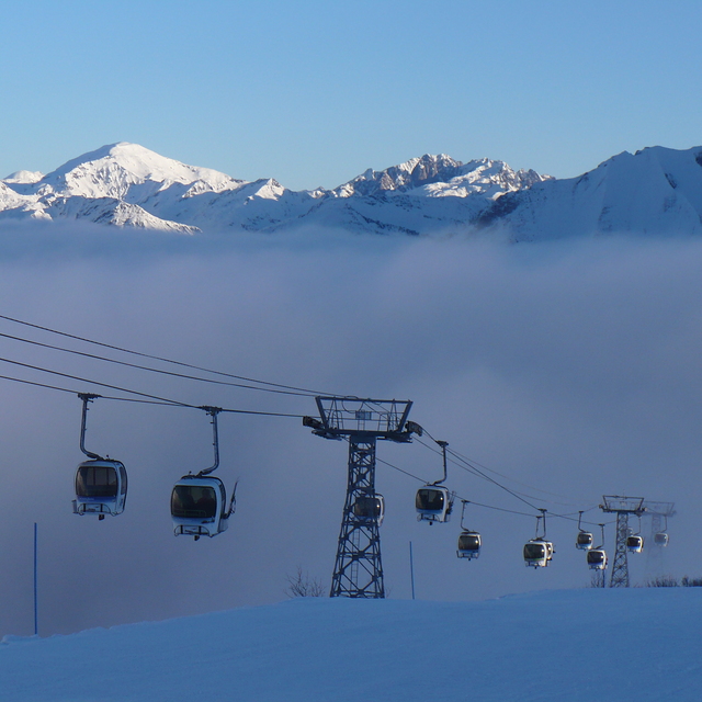
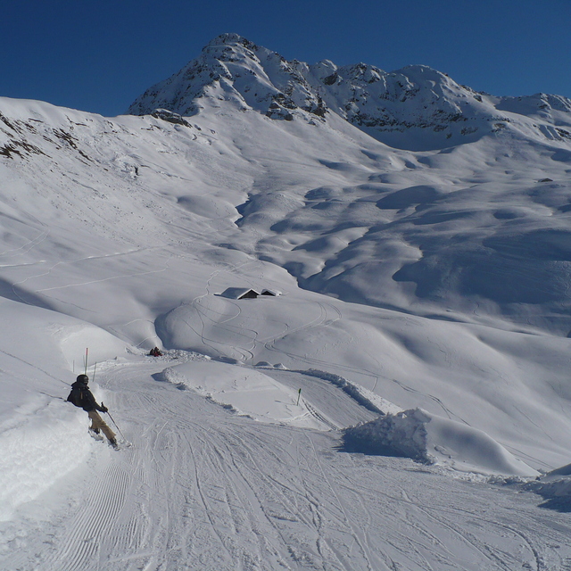
Massive Snowfall in the Alps
A huge snowfall is underway in the Alps, by far the biggest of the 24-25 season.
Please sign in with your Snow-Forecast account details below.


Les Contamines Weather (Next 3 days): The snow forecast for Les Contamines is: Moderate rain (total 12.0mm), heaviest on Sun morning. Freeze-thaw conditions (max 10°C on Mon afternoon, min 0°C on Fri night). Wind will be generally light.
Les Contamines Weather (Days 4-6): Heavy rain (total 27.0mm), heaviest during Wed night. Very mild (max 13°C on Wed afternoon, min 4°C on Thu morning). Wind will be generally light.
| Resort | Snow Depth | Temp. (°C) | Wind (km/h) | Weather | ||
|---|---|---|---|---|---|---|
| Top Lift: | 0.0 m | 0 | ||||
| Middle Lift: | 1 | |||||
| Bottom Lift: | 0.0 m | 0 |
Latest snow reports near Les Contamines:
Snow is falling at La Thuile. from La Thuile
Snowing at a moderate rate at La Rosière. from La Rosière
Snow is falling in Verbier. from Verbier
Snowing heavily at Avoriaz. from Avoriaz
It is snowing steadily at Tignes. Calm. Temperatures are around freezing. The new snow is waist deep! There are no lifts running. The pistes are closed. It's an off-piste powder day! from Tignes

Saturday 19 | Sunday 20 | Monday 21 | Tuesday 22 | Wednesday 23 | Thursday 24 | ||||||||||||||
night | AM | PM | night | AM | PM | night | AM | PM | night | AM | PM | night | AM | PM | night | AM | PM | night | |
some clouds | cloudy | cloudy | some clouds | light rain | light rain | light rain | rain shwrs | some clouds | light rain | cloudy | light rain | light rain | some clouds | rain shwrs | mod. rain | light rain | rain shwrs | light snow | |
km/h | |||||||||||||||||||
Snow map |  |  |  |  |  |  |  | ||||||||||||
— | — | — | — | — | — | — | — | — | — | — | — | — | — | — | — | — | — | 2.0 | |
— | — | — | — | 5 | 4 | 2.0 | 1.0 | — | 3 | — | 2.0 | 4 | — | 2.0 | 10 | 3 | 3 | 14 | |
max°C | 4 | 7 | 9 | 6 | 6 | 7 | 6 | 7 | 10 | 8 | 8 | 9 | 7 | 10 | 13 | 9 | 4 | 6 | 5 |
min°C | 0 | 3 | 8 | 4 | 4 | 7 | 3 | 3 | 9 | 6 | 6 | 8 | 7 | 7 | 12 | 5 | 4 | 5 | 1 |
-2 | 0 | 6 | 2 | 3 | 7 | 3 | 3 | 9 | 6 | 6 | 7 | 6 | 7 | 12 | 3 | 3 | 4 | -1 | |
78 | 90 | 84 | 89 | 97 | 94 | 90 | 84 | 71 | 97 | 81 | 92 | 98 | 74 | 68 | 95 | 98 | 77 | 99 | |
3050 | 2700 | 2600 | 2400 | 2200 | 2300 | 1850 | 2250 | 2450 | 2200 | 2400 | 2450 | 2350 | 2600 | 2750 | 2200 | 1800 | 2000 | 1600 | |
— | 6:41 | — | — | 6:39 | — | — | 6:37 | — | — | 6:35 | — | — | 6:33 | — | — | 6:31 | — | — | |
— | — | — | 8:23 | — | — | 8:24 | — | — | 8:25 | — | — | 8:28 | — | — | 8:29 | — | — | 8:30 | |
Moderate rain (total 12.0mm), heaviest on Sun morning. Freeze-thaw conditions (max 10°C on Mon afternoon, min 0°C on Fri night). Wind will be generally light.
Heavy rain (total 27.0mm), heaviest during Wed night. Very mild (max 13°C on Wed afternoon, min 4°C on Thu morning). Wind will be generally light.
Latest snow reports near Les Contamines:
Snow is falling at La Thuile. from La Thuile
Snowing at a moderate rate at La Rosière. from La Rosière
Snow is falling in Verbier. from Verbier
Snowing heavily at Avoriaz. from Avoriaz
It is snowing steadily at Tignes. Calm. Temperatures are around freezing. The new snow is waist deep! There are no lifts running. The pistes are closed. It's an off-piste powder day! from Tignes
| Top snow depth: | 0 cm |
|---|---|
| Bottom snow depth: | 0 cm |
| Fresh snowfall depth: | 52 cm |
| Last snowfall: | 17 Apr 2025 |
| Snow Alerts | Create Alert |
0.0 | Bluebird Powder days Fresh snow, mostly sunny, light wind. |
|---|---|
0.2 | Powder days Fresh snow, limited sun, any wind. |
0.0 | Bluebird days Average snow, mostly sunny, light wind. |
The above table gives the weather forecast for Les Contamines at the specific elevation of 1176 m. Our sophisticated weather models allow us to provide snow forecasts for the top, middle and bottom ski stations of Les Contamines. To access the weather forecasts for the other elevations, use the tab navigation above the table. For a wider view of the weather, check out the Weather Map of France.
Click here to read further information on freezing levels and how we forecast our temperatures.
Overall 4.2 Based on 23 votes and 21 reviews
Spent the last 14 years going to Les Contamines on and off. Last 3 years with a family (2 adults 2 boys ages 10 - 13 now). We love it. Quiet resort and easily accessible. Half-term holidays: very short queues. Virtually snow sure too. Add to that, from St Gervais (10 minute drive) you can get the little train up the mountain to Les Houche in the Chamonix valley and ski there too (125euro for a family of four including the skiing). Wide open skiing on mainly reds. Enough easy slopes for beginners; not a huge amount of blacks but a lot of off-piste/open bowl fun can be had if you know where to go. I was finding powder with none there 6 days after the last fall of snow! Accommodation is cheap/reasonable (it is a ski holiday!). We love going back year after year. Some nice bars and eateries. 3 supermarkets in town for self catering. We drive from Lancashire each year; well worth the trip. Driving also gives you options for going to Chamonix valley or Les Gets/Morzine/Avoriaz; all about 1hr ish away. Add to that free night skiing on Tuesday and Wednesday and for your intermediate/family skiers its all great!
Roger F from United Kingdom writes:
Spent the last 14 years going to Les Contamines on and off. Last 3 years with a family (2 adults 2 boys ages 10 - 13 now). We love it. Quiet resort and easily accessible. Half-term holidays: very short queues. Virtually snow sure too. Add to that, from St Gervais (10 minute drive) you can get the little train up the mountain to Les Houche in the Chamonix valley and ski there too (125euro for a family of four including the skiing).
Wide open skiing on mainly reds. Enough easy slopes for beginners; not a huge amount of blacks but a lot of off-piste/open bowl fun can be had if you know where to go. I was finding powder with none there 6 days after the last fall of snow!
Accommodation is cheap/reasonable (it is a ski holiday!). We love going back year after year. Some nice bars and eateries. 3 supermarkets in town for self catering.
We drive from Lancashire each year; well worth the trip. Driving also gives you options for going to Chamonix valley or Les Gets/Morzine/Avoriaz; all about 1hr ish away.
Add to that free night skiing on Tuesday and Wednesday and for your intermediate/family skiers its all great!
The Les Contamines skiing weather widget is available to embed on external websites free of charge. It provides a daily summary of our Les Contamines snow forecast and current weather conditions. Simply go to the feed configuration page and follow the 3 simple steps to grab the custom html code snippet and paste it into your own site. You can choose the snow forecast elevation (summit, mid-mountain or bottom lift) and metric/imperial units for the snow forecast feed to suit your own website…. Click here to get the code.
View detailed snow forecast for Les Contamines at:
snow-forecast.com


 Nearest