

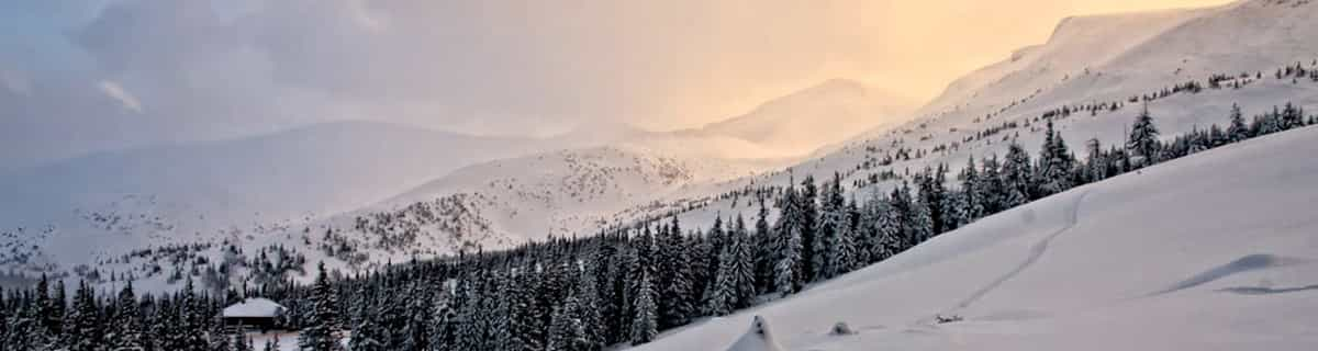
Massive Snowfall in the Alps
A huge snowfall is underway in the Alps, by far the biggest of the 24-25 season.
Please sign in with your Snow-Forecast account details below.

Lauchernalp - Lötschental Weather (Next 3 days): The snow forecast for Lauchernalp - Lötschental is: A light covering of new snow, mostly falling on Sun afternoon. Becoming milder with light rain (total 3.0mm) on Mon afternoon. Freeze-thaw conditions (max 3°C on Tue afternoon, min -1°C on Sun night). Wind will be generally light.
Lauchernalp - Lötschental Weather (Days 4-6): Mild with light rain (total 3.0mm) on Tue night Becoming colder with a light covering of snow, mostly falling on Wed night. Freeze-thaw conditions (max 3°C on Wed afternoon, min -2°C on Thu night). Wind will be generally light.
| Resort | Snow Depth | Temp. (°C) | Wind (km/h) | Weather | ||
|---|---|---|---|---|---|---|
| Top Lift: | 2.7 m | -4 | ||||
| Middle Lift: | 1 | |||||
| Bottom Lift: | 0.9 m | 6 |
Latest snow reports near Lauchernalp - Lötschental:
Snowing in St-Luc. from St-Luc

Sunday 20 | Monday 21 | Tuesday 22 | Wednesday 23 | Thursday 24 | Friday 25 | ||||||||||||||
night | AM | PM | night | AM | PM | night | AM | PM | night | AM | PM | night | AM | PM | night | AM | PM | night | |
snow shwrs | snow shwrs | light snow | light snow | some clouds | snow shwrs | light snow | cloudy | light rain | light snow | light rain | light snow | light snow | light snow | light snow | light snow | light snow | light snow | light snow | |
km/h | |||||||||||||||||||
Snow map |  |  |  |  |  |  |  | ||||||||||||
— | 1.0 | 2.0 | 2.0 | — | — | — | — | — | — | — | 1.0 | 2.0 | 1.0 | 1.0 | 2.0 | 1.0 | 1.0 | — | |
— | — | — | — | — | 1.0 | — | — | 2.0 | 1.0 | 1.0 | 1.0 | — | — | — | — | — | — | — | |
max°C | 1 | 1 | 1 | 0 | 1 | 2 | 2 | 2 | 3 | 2 | 2 | 3 | 1 | 0 | 0 | 0 | -1 | -1 | 0 |
min°C | 0 | 1 | 1 | -1 | -1 | 2 | 0 | 0 | 3 | 1 | 1 | 2 | 0 | 0 | 0 | -2 | -2 | -1 | -1 |
-4 | -2 | -2 | -4 | -1 | 2 | 0 | 0 | 3 | 1 | 1 | 1 | 0 | 0 | -2 | -5 | -5 | -4 | -4 | |
86 | 96 | 97 | 93 | 82 | 88 | 94 | 85 | 86 | 91 | 87 | 98 | 98 | 98 | 98 | 97 | 96 | 95 | 84 | |
2250 | 2300 | 2250 | 1950 | 2250 | 2450 | 2200 | 2350 | 2550 | 2300 | 2400 | 2400 | 2150 | 2150 | 2150 | 1900 | 1900 | 1950 | 1850 | |
— | 6:33 | — | — | 6:31 | — | — | 6:30 | — | — | 6:28 | — | — | 6:26 | — | — | 6:24 | — | — | |
— | — | — | 8:22 | — | — | 8:22 | — | — | 8:23 | — | — | 8:25 | — | — | 8:27 | — | — | 8:28 | |
A light covering of new snow, mostly falling on Sun afternoon. Becoming milder with light rain (total 3.0mm) on Mon afternoon. Freeze-thaw conditions (max 3°C on Tue afternoon, min -1°C on Sun night). Wind will be generally light.
Mild with light rain (total 3.0mm) on Tue night Becoming colder with a light covering of snow, mostly falling on Wed night. Freeze-thaw conditions (max 3°C on Wed afternoon, min -2°C on Thu night). Wind will be generally light.
Latest snow reports near Lauchernalp - Lötschental:
Snowing in St-Luc. from St-Luc
| Top snow depth: | 270 cm |
|---|---|
| Bottom snow depth: | 85 cm |
| Fresh snowfall depth: | 101 cm |
| Last snowfall: | 17 Apr 2025 |
| Snow Alerts | Create Alert |
0.3 | Bluebird Powder days Fresh snow, mostly sunny, light wind. |
|---|---|
1.5 | Powder days Fresh snow, limited sun, any wind. |
0.5 | Bluebird days Average snow, mostly sunny, light wind. |
The above table gives the weather forecast for Lauchernalp - Lötschental at the specific elevation of 2126 m. Our sophisticated weather models allow us to provide snow forecasts for the top, middle and bottom ski stations of Lauchernalp - Lötschental. To access the weather forecasts for the other elevations, use the tab navigation above the table. For a wider view of the weather, check out the Weather Map of Switzerland.
Click here to read further information on freezing levels and how we forecast our temperatures.
Resort name is also written as Lauchernalp - Lotschental.
Overall 4.0 Based on 10 votes and 2 reviews
The area is not that big. Skiing is nice. The slopes are long and some are very technical. Large off-pise area. Mostly is skiing to the village of Wiler (bottom station) not possible. The views are very nice. The valley is beautiful. Large tracks for langlaufen and hiking. In the evening you can see the mountain goats east of Eisden (small village near Blatten). The buses are free with a skipass. Buses drive between the station of Goppenstein and Blatten and they stop, of course, at the bottom station of the cable car. The restaurants are ok, the food also. Only a few hotels which are not big hotels. Much possiblllity to rent chalet in every village. Reaching the valley from the south is possible by car. From the north you have to go with the car on the train at the station of Kandersteg. The airfield of Zurich is, I think, 2 hours by train. Never done that.
Jacco from Netherlands writes:
The area is not that big. Skiing is nice. The slopes are long and some are very technical. Large off-pise area. Mostly is skiing to the village of Wiler (bottom station) not possible. The views are very nice. The valley is beautiful. Large tracks for langlaufen and hiking. In the evening you can see the mountain goats east of Eisden (small village near Blatten).
The buses are free with a skipass. Buses drive between the station of Goppenstein and Blatten and they stop, of course, at the bottom station of the cable car. The restaurants are ok, the food also. Only a few hotels which are not big hotels. Much possiblllity to rent chalet in every village.
Reaching the valley from the south is possible by car. From the north you have to go with the car on the train at the station of Kandersteg.
The airfield of Zurich is, I think, 2 hours by train. Never done that.
Read 1 more reviews of Lauchernalp - Lötschental or submit your own
The Lauchernalp - Lötschental skiing weather widget is available to embed on external websites free of charge. It provides a daily summary of our Lauchernalp - Lötschental snow forecast and current weather conditions. Simply go to the feed configuration page and follow the 3 simple steps to grab the custom html code snippet and paste it into your own site. You can choose the snow forecast elevation (summit, mid-mountain or bottom lift) and metric/imperial units for the snow forecast feed to suit your own website…. Click here to get the code.
View detailed snow forecast for Lauchernalp - Lötschental at:
snow-forecast.com


 Nearest