The snow forecast for Kühtai is: A light covering of new snow, mostly falling on Thu night. Temperatures will be below freezing (max -1°C on Wed afternoon, min -4°C on Wed night). Wind will be generally light.
Kühtai Weather (Next 3 days): The snow forecast for Kühtai is: A light covering of new snow, mostly falling on Thu night. Temperatures will be below freezing (max -1°C on Wed afternoon, min -4°C on Wed night). Wind will be generally light.
Kühtai Weather (Days 4-6): A dusting of snow turning to light rain (total 3.0mm) on Sun afternoon. Freeze-thaw conditions (max 4°C on Sun afternoon, min -2°C on Fri night). Wind will be generally light.
Kühtai Live Weather
Resort
Snow Depth
Temp. (°F)
Wind (mph)
Weather
Top Lift:
0ft
28
Middle Lift:
30
Bottom Lift:
0ft
32
Powered by Snow-Forecast.com
Kühtai Weather
(Next 3 days):
The snow forecast for Kühtai is: A light covering of new snow, mostly falling on Thu night. Temperatures will be below freezing (max 30°F on Wed afternoon, min 25°F on Wed night). Wind will be generally light.
Kühtai Weather (Days 4-6):
A dusting of snow turning to light rain (total 0.1in) on Sun afternoon. Freeze-thaw conditions (max 39°F on Sun afternoon, min 28°F on Fri night). Wind will be generally light.
Rain reported from Patscherkofel at 2252 metres elevation ENE of Patscherkofel but it is forecast cold enough for snow at the ski area from Patscherkofel
A light covering of new snow, mostly falling on Thu night. Temperatures will be below freezing (max -1°C on Wed afternoon, min -4°C on Wed night). Wind will be generally light.
Next 4-6 days weather summary:
A dusting of snow turning to light rain (total 3.0mm) on Sun afternoon. Freeze-thaw conditions (max 4°C on Sun afternoon, min -2°C on Fri night). Wind will be generally light.
Rain reported from Patscherkofel at 2252 metres elevation ENE of Patscherkofel but it is forecast cold enough for snow at the ski area from Patscherkofel
The above table gives the weather forecast for Kühtai at the specific elevation of 2520 m. Our sophisticated weather models allow us to provide snow forecasts for the top, middle and bottom ski stations of Kühtai. To access the weather forecasts for the other elevations, use the tab navigation above the table. For a wider view of the weather, check out the Weather Map of Austria.
Click here to read further information on freezing levels and how we forecast our temperatures.
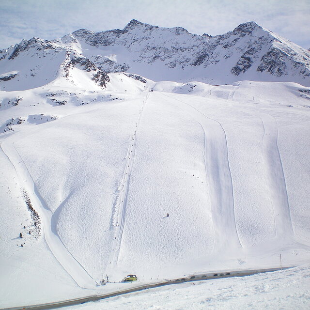
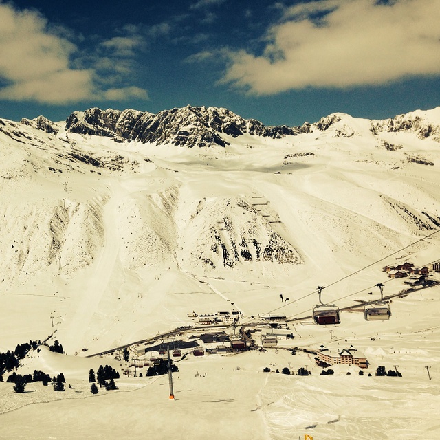
Kuhtai is a small steep resort with limited blue run skiing. There are a couple of blues higher up the mountain but you have to ski down quite a steep red run to get back to base. There is no lift back option unless you're prepared to walk back up the slope to the gondola. Of course this is no problem for most skiers but learners and people lacking in confidence beware. I, on the other hand, am an experienced skier with a 6 year old lad that happens to be fearless so it's great. Hotel Elisabeth is great, on the slope, next to the lift. Kuhtai also has night skiing which is a great experience. It's only 40 mins from Innsbruck Airport, much cheaper than other resorts for ski pass, accommodation etc and is big enough for a small family and the less experienced. If you wish to venture further then you can catch a free bus to a resort down the road. The lift pass covers both resorts. The snow conditions are always good due to it being the highest resort in Austria and the slopes are always well groomed and quite. If you like off-piste then there's a great damm wall you can ski down plus other bits and pieces. There's also a fantastic toboggan run that's about 2 miles long where you can hire a sledge and get a lift. If you want value and quality but can live with a small resort and can ski then it's great. Let's face it, if you find a nice ski run in a large resort then sometimes it's better to ski the one you like rather than traipse from resort to resort and plan to get back on time or you can find yourself stuck in another valley facing a very expensive taxi back. All the ski runs are good and lead back to the main village. Throw the lift pass away and enjoy the slopes!
Kuhtai is a small steep resort with limited blue run skiing. There are a couple of blues higher up the mountain but you have to ski down quite a steep red run to get back to base. There is no lift back option unless you're prepared to walk back up the slope to the gondola. Of course this is no problem for most skiers but learners and people lacking in confidence beware. I, on the other hand, am an experienced skier with a 6 year old lad that happens to be fearless so it's great. Hotel Elisabeth is great, on the slope, next to the lift. Kuhtai also has night skiing which is a great experience. It's only 40 mins from Innsbruck Airport, much cheaper than other resorts for ski pass, accommodation etc and is big enough for a small family and the less experienced. If you wish to venture further then you can catch a free bus to a resort down the road. The lift pass covers both resorts. The snow conditions are always good due to it being the highest resort in Austria and the slopes are always well groomed and quite. If you like off-piste then there's a great damm wall you can ski down plus other bits and pieces. There's also a fantastic toboggan run that's about 2 miles long where you can hire a sledge and get a lift. If you want value and quality but can live with a small resort and can ski then it's great. Let's face it, if you find a nice ski run in a large resort then sometimes it's better to ski the one you like rather than traipse from resort to resort and plan to get back on time or you can find yourself stuck in another valley facing a very expensive taxi back. All the ski runs are good and lead back to the main village. Throw the lift pass away and enjoy the slopes!
Free Snow-Forecast.com weather widget for your website
The Kühtai skiing weather widget is available to embed on external websites free of charge. It provides a daily summary of our Kühtai snow forecast and current weather conditions. Simply go to the feed configuration page and follow the 3 simple steps to grab the custom html code snippet and paste it into your own site. You can choose the snow forecast elevation (summit, mid-mountain or bottom lift) and metric/imperial units for the snow forecast feed to suit your own website…. Click here to get the code.


 Nearest