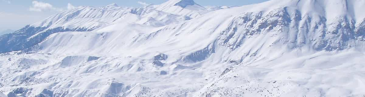
The snow forecast for Königsleiten is: A moderate fall of snow, heaviest on Thu night. Temperatures will be below freezing (max 0°C on Sat afternoon, min -5°C on Thu night). Wind will be generally light.
Königsleiten Weather (Next 3 days): The snow forecast for Königsleiten is: A moderate fall of snow, heaviest on Thu night. Temperatures will be below freezing (max 0°C on Sat afternoon, min -5°C on Thu night). Wind will be generally light.
Königsleiten Weather (Days 4-6): Light rain (total 5.0mm) at first, then becoming colder with a dusting of snow on Mon night. Freeze-thaw conditions (max 3°C on Sun afternoon, min -2°C on Tue night). Wind will be generally light.
Königsleiten Live Weather
Resort
Snow Depth
Temp. (°C)
Wind (km/h)
Weather
Top Lift:
-3
Middle Lift:
1
Bottom Lift:
5
Powered by Snow-Forecast.com
Königsleiten Weather
(Next 3 days):
The snow forecast for Königsleiten is: A moderate fall of snow, heaviest on Thu night. Temperatures will be below freezing (max 0°C on Sat afternoon, min -5°C on Thu night). Wind will be generally light.
Königsleiten Weather (Days 4-6):
Light rain (total 5.0mm) at first, then becoming colder with a dusting of snow on Mon night. Freeze-thaw conditions (max 3°C on Sun afternoon, min -2°C on Tue night). Wind will be generally light.
Continuous light snow reported from Rudolfshuette-Alpinzentrum at 2320 metres elevation only 2 kms S of Uttendorf/Weißsee but it is probably falling as rain at the bottom of the ski area from Uttendorf/Weißsee
43km away from Königsleiten
6 hours ago
Light rain showers reported from Rudolfshuette-Alpinzentrum at 2320 metres elevation only 2 kms S of Uttendorf/Weißsee but it is forecast cold enough for snow at the ski area from Uttendorf/Weißsee
A moderate fall of snow, heaviest on Thu night. Temperatures will be below freezing (max 0°C on Sat afternoon, min -5°C on Thu night). Wind will be generally light.
Next 4-6 days weather summary:
Light rain (total 5.0mm) at first, then becoming colder with a dusting of snow on Mon night. Freeze-thaw conditions (max 3°C on Sun afternoon, min -2°C on Tue night). Wind will be generally light.
Continuous light snow reported from Rudolfshuette-Alpinzentrum at 2320 metres elevation only 2 kms S of Uttendorf/Weißsee but it is probably falling as rain at the bottom of the ski area from Uttendorf/Weißsee
43km away from Königsleiten
6 hours ago
Light rain showers reported from Rudolfshuette-Alpinzentrum at 2320 metres elevation only 2 kms S of Uttendorf/Weißsee but it is forecast cold enough for snow at the ski area from Uttendorf/Weißsee
The above table gives the weather forecast for Königsleiten at the specific elevation of 2499 m. Our sophisticated weather models allow us to provide snow forecasts for the top, middle and bottom ski stations of Königsleiten. To access the weather forecasts for the other elevations, use the tab navigation above the table. For a wider view of the weather, check out the Weather Map of Austria.
Click here to read further information on freezing levels and how we forecast our temperatures.
At the far end of the magnificent Zillertal Arena you'll find this fantastic ski resort. Although it's purpose built, it stil breathes the typical Austrian "gemütlichkeit"! If you want a less crowdy and noisy village (compared to party town Gerlos, for instance), but still well facilitated, this is the place to be. Après-ski is still possible, with the very cosy Schirmbar (party every night!) and several bars and a discotheque. And if you want to have a nice evening in Gerlos, it is just a 20 minute drive.
It's very suitable for families with kids as well, with the piste in the middle of the village and several ski schools for the youngsters.
Because the village itself is set at 1600m above sea level, snow is assured up until the end of March. From most appartments you can just click on your ski's and glide to the Sonnwendkopfbahn to enter the Zillertal Arena, or the Plattenkogel X-press to the Gerlosplatte (this is a very good option late season, it's on the north side and no direct sun on the slopes). Once in the Z'tal Arena you can make wonderful tours to the Gerlos and Zell am Ziller areas. I've been there twice now and it's a great place to spend your holiday. I will return there for sure!!
Free Snow-Forecast.com weather widget for your website
The Königsleiten skiing weather widget is available to embed on external websites free of charge. It provides a daily summary of our Königsleiten snow forecast and current weather conditions. Simply go to the feed configuration page and follow the 3 simple steps to grab the custom html code snippet and paste it into your own site. You can choose the snow forecast elevation (summit, mid-mountain or bottom lift) and metric/imperial units for the snow forecast feed to suit your own website…. Click here to get the code.


 Nearest