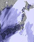
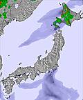
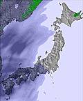
Kamui Ski Links Weather (Next 3 days): The snow forecast for Kamui Ski Links is: A light fall of snow, heaviest on Wed morning. Turning milder with light rain (total 4.0mm) on Fri night. Freeze-thaw conditions (max 11°C on Fri afternoon, min -1°C on Wed night). Winds decreasing (near gales from the NW on Wed afternoon, calm by Thu night).
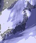
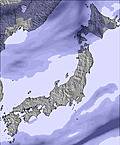
Kamui Ski Links Weather (Days 4-6): Moderate rain (total 15.0mm), heaviest on Sun morning. Mild temperatures (max 9°C on Mon afternoon, min 2°C on Sun afternoon). Winds increasing (calm on Sat afternoon, fresh winds from the S by Mon night).


 Nearest