
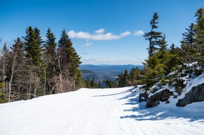
Whistler leads North America with 90% terrain open after fresh snowfall
Updated April 16, 2025: Big late-season dumps hit the Northeast and Canada, while Rockies brace for Easter snow—some resorts still skiing into May.
Please sign in with your Snow-Forecast account details below.


Hintertux Weather (Next 3 days): The snow forecast for Hintertux is: Drizzle on Thu afternoon turning to light snow on Thu night. Freeze-thaw conditions (max 3°C on Thu afternoon, min -3°C on Fri morning). Wind will be generally light.
Hintertux Weather (Days 4-6): A dusting of new snow. Freeze-thaw conditions (max 3°C on Sun afternoon, min 0°C on Sun night). Wind will be generally light.
| Resort | Snow Depth | Temp. (°C) | Wind (km/h) | Weather | ||
|---|---|---|---|---|---|---|
| Top Lift: | 2.2 m | -3 | ||||
| Middle Lift: | 2 | |||||
| Bottom Lift: | 6 |
Latest snow reports near Hintertux:

Thursday 17 | Friday 18 | Saturday 19 | Sunday 20 | Monday 21 | Tuesday 22 | Wednesday 23 | |||||||||||||||
AM | PM | night | AM | PM | night | AM | PM | night | AM | PM | night | AM | PM | night | AM | PM | night | AM | PM | night | |
light snow | light snow | light snow | light snow | light snow | light snow | cloudy | cloudy | cloudy | cloudy | some clouds | light snow | light snow | light snow | light snow | light snow | light snow | light snow | cloudy | light snow | light snow | |
km/h | |||||||||||||||||||||
Snow map |  |  |  |  |  |  |  | ||||||||||||||
— | 2.0 | 3 | — | — | — | — | — | — | — | — | — | — | — | — | — | 1.0 | 1.0 | — | 1.0 | 2.0 | |
— | 1.0 | — | — | — | — | — | — | — | — | — | — | — | — | — | — | — | — | — | — | — | |
max°C | 2 | 3 | -1 | -2 | -1 | 0 | 2 | 1 | 1 | 2 | 3 | 1 | 1 | 1 | 0 | 0 | 1 | 0 | 1 | 2 | 1 |
min°C | 2 | 1 | -2 | -3 | -2 | -1 | 1 | 1 | 0 | 1 | 2 | 0 | 0 | 1 | 0 | 0 | 1 | 0 | 0 | 1 | 1 |
-3 | -3 | -2 | -3 | -4 | -4 | -1 | -2 | -4 | -4 | -2 | -2 | -4 | -3 | -3 | 0 | 0 | 0 | 0 | -1 | 1 | |
80 | 94 | 88 | 97 | 89 | 79 | 57 | 81 | 72 | 78 | 80 | 91 | 96 | 97 | 85 | 96 | 96 | 98 | 95 | 98 | 89 | |
2650 | 2500 | 2100 | 2000 | 2300 | 2200 | 2750 | 2550 | 2450 | 2650 | 2700 | 2400 | 2450 | 2500 | 2450 | 2350 | 2500 | 2400 | 2500 | 2650 | 2650 | |
6:22 | — | — | 6:20 | — | — | 6:18 | — | — | 6:16 | — | — | 6:15 | — | — | 6:13 | — | — | 6:11 | — | — | |
— | — | 8:02 | — | — | 8:05 | — | — | 8:06 | — | — | 8:07 | — | — | 8:08 | — | — | 8:09 | — | — | 8:10 | |
Drizzle on Thu afternoon turning to light snow on Thu night. Freeze-thaw conditions (max 3°C on Thu afternoon, min -3°C on Fri morning). Wind will be generally light.
A dusting of new snow. Freeze-thaw conditions (max 3°C on Sun afternoon, min 0°C on Sun night). Wind will be generally light.
Latest snow reports near Hintertux:
| Top snow depth: | 220 cm |
|---|---|
| Bottom snow depth: | — |
| Fresh snowfall depth: | — |
| Last snowfall: | 9 Apr 2025 |
| Snow Alerts | Create Alert |
1.0 | Bluebird Powder days Fresh snow, mostly sunny, light wind. |
|---|---|
1.3 | Powder days Fresh snow, limited sun, any wind. |
1.3 | Bluebird days Average snow, mostly sunny, light wind. |
The above table gives the weather forecast for Hintertux at the specific elevation of 2375 m. Our sophisticated weather models allow us to provide snow forecasts for the top, middle and bottom ski stations of Hintertux. To access the weather forecasts for the other elevations, use the tab navigation above the table. For a wider view of the weather, check out the Weather Map of Austria.
Click here to read further information on freezing levels and how we forecast our temperatures.
Overall 4.2 Based on 19 votes and 11 reviews
After many years, back in Hintertux for summer skiing! Fantastic snow and magnificent scenery, can only recommend to ski in June, particularly this year 2020. It is amazing to feel again the skis under your feet and enjoy the slopes from 3200 down to 2600m...
Massimo Anselmi from Italy writes:
After many years, back in Hintertux for summer skiing! Fantastic snow and magnificent scenery, can only recommend to ski in June, particularly this year 2020. It is amazing to feel again the skis under your feet and enjoy the slopes from 3200 down to 2600m...
The Hintertux skiing weather widget is available to embed on external websites free of charge. It provides a daily summary of our Hintertux snow forecast and current weather conditions. Simply go to the feed configuration page and follow the 3 simple steps to grab the custom html code snippet and paste it into your own site. You can choose the snow forecast elevation (summit, mid-mountain or bottom lift) and metric/imperial units for the snow forecast feed to suit your own website…. Click here to get the code.
View detailed snow forecast for Hintertux at:
snow-forecast.com


 Nearest